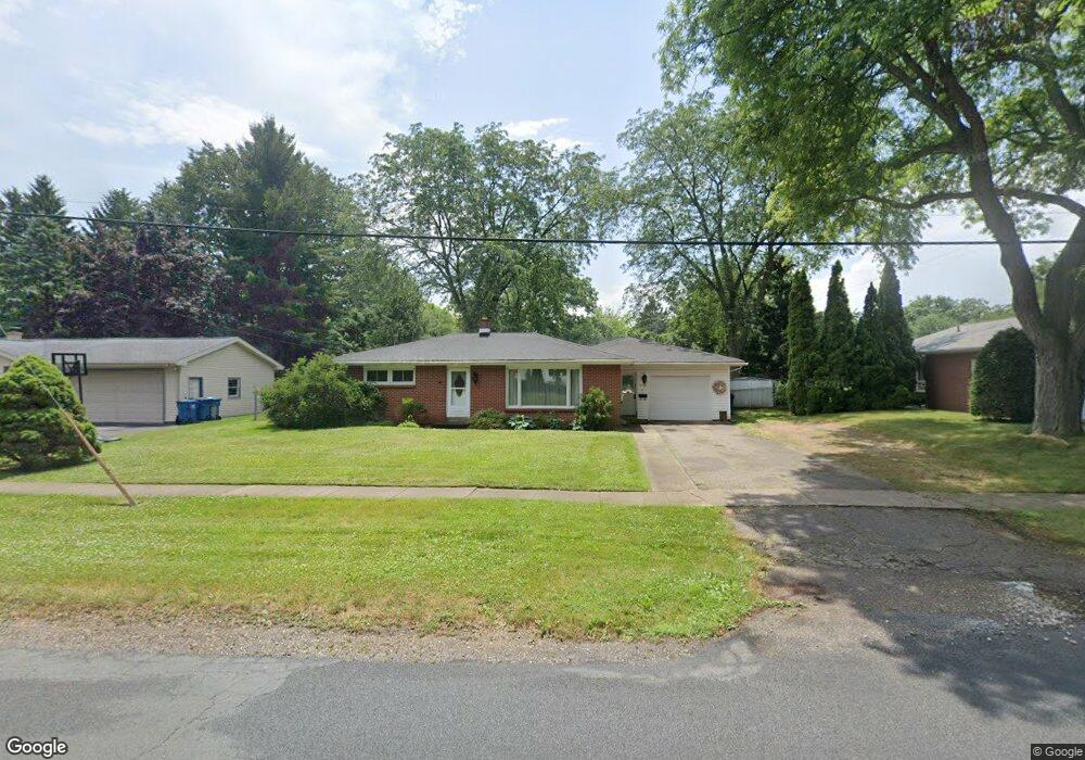
3113 Haskell St Kalamazoo, MI 49006
Westwood NeighborhoodEstimated Value: $244,494 - $277,000
3
Beds
2
Baths
1,562
Sq Ft
$169/Sq Ft
Est. Value
About This Home
This home is located at 3113 Haskell St, Kalamazoo, MI 49006 and is currently estimated at $263,374, approximately $168 per square foot. 3113 Haskell St is a home located in Kalamazoo County with nearby schools including King-Westwood Elementary School, Hillside Middle School, and Kalamazoo Central High School.
Ownership History
Date
Name
Owned For
Owner Type
Purchase Details
Closed on
Feb 16, 2010
Sold by
Gillen Michael and Gillen Beth
Bought by
Fosness Kathryn
Current Estimated Value
Home Financials for this Owner
Home Financials are based on the most recent Mortgage that was taken out on this home.
Original Mortgage
$122,735
Outstanding Balance
$81,554
Interest Rate
5.11%
Mortgage Type
FHA
Estimated Equity
$181,820
Purchase Details
Closed on
Apr 30, 2009
Sold by
Vanderklay James D and Vanderklay Susan L
Bought by
Us Bank National Association Nd
Create a Home Valuation Report for This Property
The Home Valuation Report is an in-depth analysis detailing your home's value as well as a comparison with similar homes in the area
Home Values in the Area
Average Home Value in this Area
Purchase History
| Date | Buyer | Sale Price | Title Company |
|---|---|---|---|
| Fosness Kathryn | $125,000 | Devon Title | |
| Us Bank National Association Nd | $129,900 | None Available |
Source: Public Records
Mortgage History
| Date | Status | Borrower | Loan Amount |
|---|---|---|---|
| Open | Fosness Kathryn | $122,735 |
Source: Public Records
Tax History
| Year | Tax Paid | Tax Assessment Tax Assessment Total Assessment is a certain percentage of the fair market value that is determined by local assessors to be the total taxable value of land and additions on the property. | Land | Improvement |
|---|---|---|---|---|
| 2025 | $714 | $125,000 | $0 | $0 |
| 2024 | $693 | $112,300 | $0 | $0 |
| 2023 | $661 | $104,900 | $0 | $0 |
| 2022 | $3,241 | $89,800 | $0 | $0 |
| 2021 | $3,038 | $78,000 | $0 | $0 |
| 2020 | $2,991 | $73,700 | $0 | $0 |
| 2019 | $2,859 | $70,700 | $0 | $0 |
| 2018 | $2,789 | $61,700 | $0 | $0 |
| 2017 | $0 | $61,700 | $0 | $0 |
| 2016 | -- | $60,400 | $0 | $0 |
| 2015 | -- | $57,600 | $0 | $0 |
| 2014 | -- | $53,300 | $0 | $0 |
Source: Public Records
Map
Nearby Homes
- 1113 Nichols Rd
- 1335 Calhoun St
- 902 Coolidge Ave
- 1361 Cherokee St
- 605 Coolidge Ave
- 1725 Nichols Rd
- V/L Ferndale Ave
- 2720 W Main St
- 243 Ballantrae Ct Unit 142
- 238 Falkirk Ct
- 213 Paisley Ct Unit B
- 209 Paisley Ct
- 141 Selkirk Ct Unit 103
- 156 Carberry Hill Ct Unit 42
- 160 Carberry Hill Ct Unit 40
- 125 Balmoral Ct
- 0 Ravine Rd
- 1904 W North St
- 2010 Commonwealth Ave
- 2424 Nichols Rd
- 3111 Haskell St
- 1210 Nichols Rd
- 1126 Nichols Rd
- 3027 Haskell St
- 3114 Haskell St
- 3110 Haskell St
- 3024 Haskell St
- 1201 Nichols Rd
- 3019 Haskell St
- 1209 Nichols Rd
- 1125 Nichols Rd
- 1303 Calhoun St
- 1225 Nichols Rd
- 3011 Haskell St
- 1115 Nichols Rd
- 1310 Nichols Rd
- 1309 Calhoun St
- 1224 Calhoun St
- 3220 Croyden Ave
- 1303 Nichols Rd
Your Personal Tour Guide
Ask me questions while you tour the home.