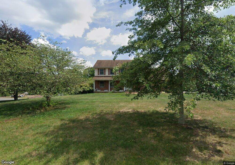
3115 Adams Dr Hampstead, MD 21074
Estimated Value: $512,000 - $619,000
3
Beds
4
Baths
2,036
Sq Ft
$278/Sq Ft
Est. Value
About This Home
This home is located at 3115 Adams Dr, Hampstead, MD 21074 and is currently estimated at $566,349, approximately $278 per square foot. 3115 Adams Dr is a home located in Carroll County with nearby schools including Hampstead Elementary School, Shiloh Middle School, and Manchester Valley High School.
Ownership History
Date
Name
Owned For
Owner Type
Purchase Details
Closed on
Sep 30, 2011
Sold by
Clark Danny B
Bought by
Gallagher Matthew B and Gallagher Tina M
Current Estimated Value
Home Financials for this Owner
Home Financials are based on the most recent Mortgage that was taken out on this home.
Original Mortgage
$303,000
Outstanding Balance
$205,117
Interest Rate
4.25%
Mortgage Type
New Conventional
Estimated Equity
$361,232
Purchase Details
Closed on
Jun 3, 1992
Sold by
Powers/Ward Partnership
Bought by
Clark Danny B
Purchase Details
Closed on
Feb 7, 1989
Sold by
Frall Developers Inc
Bought by
Powers/Ward Partnership
Create a Home Valuation Report for This Property
The Home Valuation Report is an in-depth analysis detailing your home's value as well as a comparison with similar homes in the area
Home Values in the Area
Average Home Value in this Area
Purchase History
| Date | Buyer | Sale Price | Title Company |
|---|---|---|---|
| Gallagher Matthew B | $390,000 | -- | |
| Clark Danny B | $202,200 | -- | |
| Powers/Ward Partnership | $172,500 | -- |
Source: Public Records
Mortgage History
| Date | Status | Borrower | Loan Amount |
|---|---|---|---|
| Open | Gallagher Matthew B | $303,000 |
Source: Public Records
Tax History
| Year | Tax Paid | Tax Assessment Tax Assessment Total Assessment is a certain percentage of the fair market value that is determined by local assessors to be the total taxable value of land and additions on the property. | Land | Improvement |
|---|---|---|---|---|
| 2025 | $4,436 | $390,800 | $147,300 | $243,500 |
| 2024 | $4,252 | $374,367 | $0 | $0 |
| 2023 | $4,045 | $357,933 | $0 | $0 |
| 2022 | $3,884 | $341,500 | $147,300 | $194,200 |
| 2021 | $7,935 | $340,467 | $0 | $0 |
| 2020 | $3,896 | $339,433 | $0 | $0 |
| 2019 | $3,884 | $338,400 | $147,300 | $191,100 |
| 2018 | $3,849 | $338,400 | $147,300 | $191,100 |
| 2017 | $3,849 | $338,400 | $0 | $0 |
| 2016 | -- | $341,800 | $0 | $0 |
| 2015 | -- | $341,800 | $0 | $0 |
| 2014 | -- | $341,800 | $0 | $0 |
Source: Public Records
Map
Nearby Homes
- 0 Coon Club
- 3230 Coon Club Rd
- 0 Houcksville Rd Unit MDCR2032106
- 105 S Houcksville Rd
- 35 Houck Rd
- 206 Opal Ave
- 308 Winsome Dr
- 0 Hoffman Mill Rd
- 611 Vanessa Ct
- 2307 Coon Club Rd
- 612 Ridge Rd
- 2324 Carrollton Rd
- 820 Wembley Dr Unit 2C
- 820 Wembley Dr Unit 2A
- 820 Wembley Dr Unit 2B
- 820 Wembley Dr Unit 3D
- 820 Wembley Dr Unit 2D
- 820 Wembley Dr Unit 1D
- 820 Wembley Dr Unit 1A
- 820 Wembley Dr Unit 3B
- 3125 Adams Dr
- 3120 Adams Dr
- 3205 Eves Way
- 3207 Eves Way
- 3110 Adams Dr
- 3130 Eves Way
- 3126 Coon Club Rd
- 3209 Eves Way
- 3202 Eves Way
- 3206 Eves Way
- 3211 Eves Way
- 3208 Eves Way
- 3106 Adams Dr
- 3120 Coon Club Rd
- 3210 Eves Way
- 3100 Coon Club Rd
- 3138 Coon Club Rd
- 3134 Coon Club Rd
- 3024 Coon Club Rd
- 2695 Shamer Ln
Your Personal Tour Guide
Ask me questions while you tour the home.