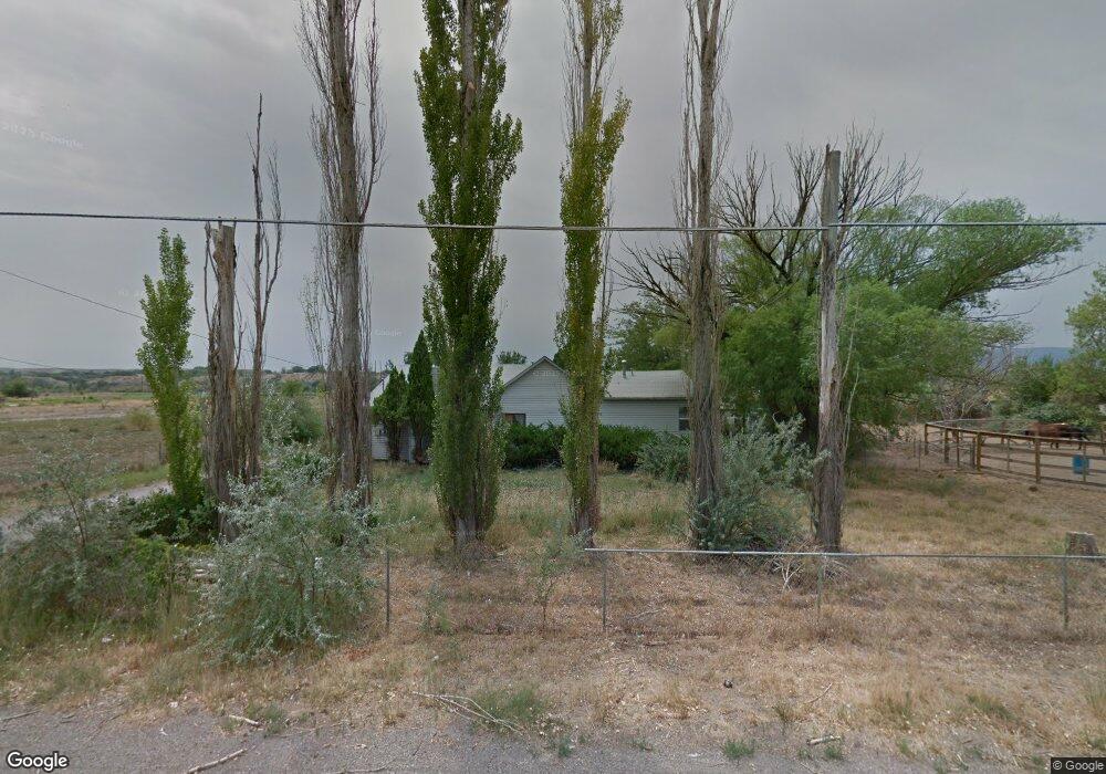
3117 D Rd Grand Junction, CO 81504
Estimated Value: $363,063 - $474,000
3
Beds
1
Bath
1,985
Sq Ft
$212/Sq Ft
Est. Value
About This Home
This home is located at 3117 D Rd, Grand Junction, CO 81504 and is currently estimated at $421,266, approximately $212 per square foot. 3117 D Rd is a home located in Mesa County with nearby schools including Chatfield Elementary School, Grand Mesa Middle School, and Central High School.
Ownership History
Date
Name
Owned For
Owner Type
Purchase Details
Closed on
Mar 28, 2007
Sold by
Ramona A Wing Family Trust
Bought by
Rutkowski Tony W and Rutkowski Sara M
Current Estimated Value
Home Financials for this Owner
Home Financials are based on the most recent Mortgage that was taken out on this home.
Original Mortgage
$196,000
Outstanding Balance
$158,326
Interest Rate
6.3%
Mortgage Type
Unknown
Estimated Equity
$262,940
Purchase Details
Closed on
Aug 28, 2001
Sold by
Wing Theodore A and Wing Ramona A
Bought by
The Ramona A Wing Family Trust
Create a Home Valuation Report for This Property
The Home Valuation Report is an in-depth analysis detailing your home's value as well as a comparison with similar homes in the area
Home Values in the Area
Average Home Value in this Area
Purchase History
| Date | Buyer | Sale Price | Title Company |
|---|---|---|---|
| Rutkowski Tony W | $245,000 | Abstract & Title Company Of | |
| The Ramona A Wing Family Trust | -- | -- |
Source: Public Records
Mortgage History
| Date | Status | Borrower | Loan Amount |
|---|---|---|---|
| Open | Rutkowski Tony W | $196,000 |
Source: Public Records
Tax History Compared to Growth
Tax History
| Year | Tax Paid | Tax Assessment Tax Assessment Total Assessment is a certain percentage of the fair market value that is determined by local assessors to be the total taxable value of land and additions on the property. | Land | Improvement |
|---|---|---|---|---|
| 2024 | $1,452 | $19,530 | $5,690 | $13,840 |
| 2023 | $1,452 | $19,530 | $5,690 | $13,840 |
| 2022 | $1,191 | $15,050 | $4,590 | $10,460 |
| 2021 | $1,144 | $15,480 | $4,720 | $10,760 |
| 2020 | $870 | $12,020 | $4,290 | $7,730 |
| 2019 | $825 | $12,020 | $4,290 | $7,730 |
| 2018 | $939 | $12,530 | $3,600 | $8,930 |
| 2017 | $716 | $12,530 | $3,600 | $8,930 |
| 2016 | $716 | $11,080 | $3,180 | $7,900 |
| 2015 | $726 | $11,080 | $3,180 | $7,900 |
| 2014 | $758 | $11,590 | $2,790 | $8,800 |
Source: Public Records
Map
Nearby Homes
- 3112 Keyser Ct
- 393 Sunnyside Ct Unit E
- 3111 Keyser Ct
- 392 Hidden River Dr
- 391 Blue River Dr
- 392 Green River Dr
- 3148 W Eider Ct
- 424 Steven Creek St
- 3171 Pipe Ct
- 426 Clear Creek Dr
- 416 Wood Duck Ct
- 414 Lark Ct
- 3067 Hummingbird Ct
- 423 Pear Ln
- 458 Ananessa Dr
- 3065 Thrush Dr
- 3108 Ouray Ave
- 417 Allison Way
- 3051 Hawkwood Ct
- 3060 Thrush Dr
- 3117 D Rd
- 3117 D Rd
- 3124 Platte River Dr
- 3126 Platte River Dr
- 3125 Platte River Dr
- 3128 Platte River Dr
- 392 1/2 Dry Fork Ct
- 392 Dry Fork Ct
- 399 Wind River Dr
- 3122 Dry Fork Way
- 3134 Platte River Dr
- 3118 D Rd
- 3120 Dry Fork Way
- 392 Dry Fork Ct
- 3130 Platte River Dr
- 394 Dry Fork Ct
- 397 Wind River Dr
- 0 Dry Fork Way
- 3127 Platte River Dr
- 3132 Platte River Dr