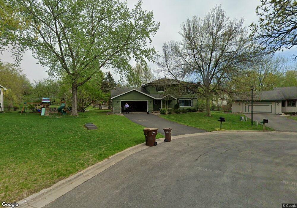
3117 E 126th St Burnsville, MN 55337
Estimated Value: $428,689 - $461,000
3
Beds
3
Baths
2,069
Sq Ft
$214/Sq Ft
Est. Value
About This Home
This home is located at 3117 E 126th St, Burnsville, MN 55337 and is currently estimated at $441,922, approximately $213 per square foot. 3117 E 126th St is a home located in Dakota County with nearby schools including William Byrne Elementary School, Burnsville High School, and Gateway STEM Academy.
Ownership History
Date
Name
Owned For
Owner Type
Purchase Details
Closed on
Jun 22, 2009
Sold by
Heefner Carson and Deangels Ann M
Bought by
Asp William R and Asp Leah Elsie Boyer
Current Estimated Value
Home Financials for this Owner
Home Financials are based on the most recent Mortgage that was taken out on this home.
Original Mortgage
$241,789
Outstanding Balance
$153,506
Interest Rate
4.86%
Mortgage Type
FHA
Estimated Equity
$288,416
Purchase Details
Closed on
Nov 28, 2001
Sold by
Clark Rodney and Clark Deetta K
Bought by
Heefner Carson and Heefner Ann
Create a Home Valuation Report for This Property
The Home Valuation Report is an in-depth analysis detailing your home's value as well as a comparison with similar homes in the area
Home Values in the Area
Average Home Value in this Area
Purchase History
| Date | Buyer | Sale Price | Title Company |
|---|---|---|---|
| Asp William R | $246,250 | -- | |
| Heefner Carson | $220,000 | -- |
Source: Public Records
Mortgage History
| Date | Status | Borrower | Loan Amount |
|---|---|---|---|
| Open | Asp William R | $241,789 |
Source: Public Records
Tax History
| Year | Tax Paid | Tax Assessment Tax Assessment Total Assessment is a certain percentage of the fair market value that is determined by local assessors to be the total taxable value of land and additions on the property. | Land | Improvement |
|---|---|---|---|---|
| 2024 | $4,242 | $402,200 | $96,200 | $306,000 |
| 2023 | $4,242 | $403,800 | $96,300 | $307,500 |
| 2022 | $3,260 | $383,900 | $96,100 | $287,800 |
| 2021 | $3,280 | $310,400 | $83,600 | $226,800 |
| 2020 | $3,216 | $297,000 | $76,300 | $220,700 |
| 2019 | $3,204 | $282,000 | $72,600 | $209,400 |
| 2018 | $3,211 | $268,200 | $69,200 | $199,000 |
| 2017 | $3,176 | $261,300 | $65,900 | $195,400 |
| 2016 | $2,982 | $254,600 | $62,800 | $191,800 |
| 2015 | $2,885 | $215,749 | $56,610 | $159,139 |
| 2014 | -- | $218,038 | $55,673 | $162,365 |
| 2013 | -- | $207,901 | $50,658 | $157,243 |
Source: Public Records
Map
Nearby Homes
- 12625 Sable Dr
- 3101 E 125th St
- 3308 E 125th St
- 12525 Pinehurst Dr
- 12500 Pinehurst Dr
- 12653 Tiffany Ct
- 164 River Woods Ln
- 221 River Woods Ln
- 328 River Woods Ln
- 4809 Four Seasons Dr
- 2708 Lassen Ct
- 2400 E 125th St
- 12209 24th Ave S
- 352 Cimarron Rd
- 12000 Summerset Ln
- 2257 Mahogany Way
- 11926 Summerset Ln
- 2605 Kennelly Place
- 12238 Oak Leaf Cir
- 2305 E 122nd St
- 12604 33rd Ave S
- 3113 E 126th St
- 3205 E 126th St
- 3201 E 126th St
- 3109 E 126th St
- 3105 E 126th St
- 12620 Sable Dr
- 3301 E 126th St
- 12609 33rd Ave S
- 3101 E 126th St
- 12524 33rd Ave S
- 12524 12524 33rd-Avenue-s
- 12525 Norway Point
- 3307 E 126th St
- 12624 Sable Dr
- 3100 E 126th St
- 3309 E 126th St
- 12525 33rd Ave S
- 12529 Norway Point
- 3305 E 126th St
Your Personal Tour Guide
Ask me questions while you tour the home.