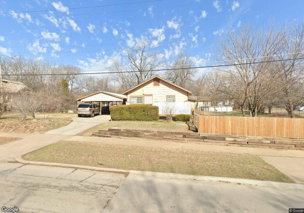
3117 E Independence St Tulsa, OK 74110
Kendall-Whittier NeighborhoodEstimated Value: $87,000 - $160,000
2
Beds
1
Bath
875
Sq Ft
$136/Sq Ft
Est. Value
About This Home
This home is located at 3117 E Independence St, Tulsa, OK 74110 and is currently estimated at $119,367, approximately $136 per square foot. 3117 E Independence St is a home located in Tulsa County with nearby schools including Sequoyah Elementary School, Monroe Demonstration Academy, and McLain High School of Science and Technology.
Ownership History
Date
Name
Owned For
Owner Type
Purchase Details
Closed on
Dec 19, 2025
Sold by
Brooks Karen Olden and Olden Karen
Bought by
Brooks Renae and Brooks Easker
Current Estimated Value
Purchase Details
Closed on
Jul 27, 1999
Sold by
Conner Dean Allison
Bought by
Brooks Easker J
Home Financials for this Owner
Home Financials are based on the most recent Mortgage that was taken out on this home.
Original Mortgage
$41,097
Interest Rate
7.63%
Mortgage Type
VA
Create a Home Valuation Report for This Property
The Home Valuation Report is an in-depth analysis detailing your home's value as well as a comparison with similar homes in the area
Home Values in the Area
Average Home Value in this Area
Purchase History
| Date | Buyer | Sale Price | Title Company |
|---|---|---|---|
| Brooks Renae | -- | None Listed On Document | |
| Brooks Easker J | $40,000 | -- |
Source: Public Records
Mortgage History
| Date | Status | Borrower | Loan Amount |
|---|---|---|---|
| Previous Owner | Brooks Easker J | $41,097 |
Source: Public Records
Tax History
| Year | Tax Paid | Tax Assessment Tax Assessment Total Assessment is a certain percentage of the fair market value that is determined by local assessors to be the total taxable value of land and additions on the property. | Land | Improvement |
|---|---|---|---|---|
| 2025 | -- | -- | -- | -- |
| 2024 | -- | -- | -- | -- |
| 2023 | $0 | $5,602 | $818 | $4,784 |
| 2022 | $0 | $5,438 | $913 | $4,525 |
| 2021 | $0 | $0 | $0 | $0 |
| 2020 | $0 | $0 | $0 | $0 |
| 2019 | $551 | $0 | $0 | $0 |
| 2018 | $564 | $4,104 | $778 | $3,326 |
| 2017 | $563 | $5,104 | $968 | $4,136 |
| 2016 | $551 | $5,104 | $968 | $4,136 |
| 2015 | $552 | $5,104 | $968 | $4,136 |
| 2014 | $547 | $5,104 | $968 | $4,136 |
Source: Public Records
Map
Nearby Homes
- 141 N College Ave
- 724 N Evanston Ave
- 855 N Delaware Place
- 1043 N College Ave
- 3015 E Archer St
- 3118 E Archer St
- 3315 E King Place
- 3310 E Admiral Ct
- 119 N Columbia Ave
- 2724 E Archer St
- 3523 E Admiral Ct
- 2836 E Admiral Blvd
- 111 Waverly Dr
- 2707 E Marshall St
- 2735 E 1st St
- 211 S Florence Ave
- 103 S Knoxville Ave
- 1055 N New Haven Ave
- 3119 E 3rd St
- 3911 E Admiral Ct
- 3109 E Independence St
- 199 N Florence Ave
- 816 N Florence Place
- 3107 E Independence St
- 197 N Florence Ave
- 813 N Florence Ave
- 3103 E Independence St
- 807 N Florence Place
- 820 N Florence Place
- 3133 E Independence St
- 811 N Florence Place
- 817 N Florence Ave
- 198 N Florence Ave
- 191 N Florence Ave
- 815 N Florence Place
- 750 N Florence Place
- 821 N Florence Ave
- 824 N Florence Place
- 823 N Florence Place
- 744 N Florence Place
Your Personal Tour Guide
Ask me questions while you tour the home.