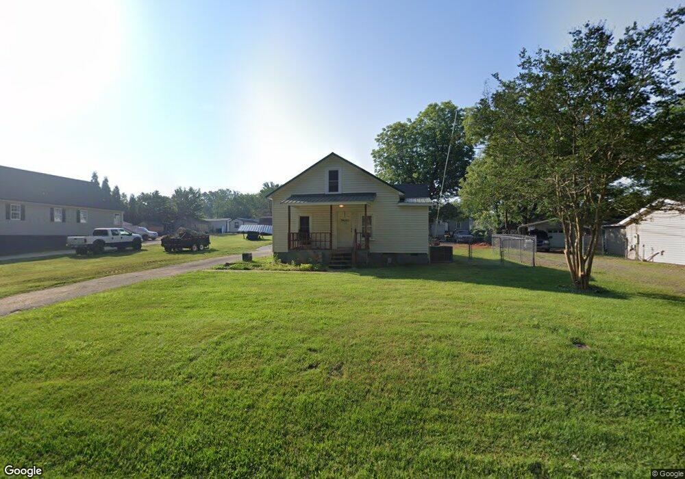
3117 Hodge St Salisbury, NC 28147
Estimated Value: $130,000 - $157,000
--
Bed
1
Bath
922
Sq Ft
$161/Sq Ft
Est. Value
About This Home
This home is located at 3117 Hodge St, Salisbury, NC 28147 and is currently estimated at $148,770, approximately $161 per square foot. 3117 Hodge St is a home located in Rowan County with nearby schools including Knollwood Elementary School, Knox Middle School, and North Rowan Middle School.
Ownership History
Date
Name
Owned For
Owner Type
Purchase Details
Closed on
Aug 30, 2022
Sold by
Wallis William T and Wallis Anita B
Bought by
Burris David A and Burris Melanie Dawn
Current Estimated Value
Home Financials for this Owner
Home Financials are based on the most recent Mortgage that was taken out on this home.
Original Mortgage
$127,000
Outstanding Balance
$121,610
Interest Rate
5.54%
Mortgage Type
New Conventional
Estimated Equity
$27,160
Purchase Details
Closed on
Aug 31, 1998
Bought by
Wallis William T and Wallis Wf
Create a Home Valuation Report for This Property
The Home Valuation Report is an in-depth analysis detailing your home's value as well as a comparison with similar homes in the area
Home Values in the Area
Average Home Value in this Area
Purchase History
| Date | Buyer | Sale Price | Title Company |
|---|---|---|---|
| Burris David A | $125,000 | None Listed On Document | |
| Wallis William T | $57,000 | -- |
Source: Public Records
Mortgage History
| Date | Status | Borrower | Loan Amount |
|---|---|---|---|
| Open | Burris David A | $127,000 |
Source: Public Records
Tax History Compared to Growth
Tax History
| Year | Tax Paid | Tax Assessment Tax Assessment Total Assessment is a certain percentage of the fair market value that is determined by local assessors to be the total taxable value of land and additions on the property. | Land | Improvement |
|---|---|---|---|---|
| 2025 | $1,220 | $102,010 | $17,085 | $84,925 |
| 2024 | $1,220 | $102,010 | $17,085 | $84,925 |
| 2023 | $1,220 | $102,010 | $17,085 | $84,925 |
| 2022 | $1,017 | $73,821 | $11,276 | $62,545 |
| 2021 | $1,017 | $73,821 | $11,276 | $62,545 |
| 2020 | $1,017 | $73,821 | $11,276 | $62,545 |
| 2019 | $1,017 | $73,821 | $11,276 | $62,545 |
| 2018 | $938 | $69,022 | $11,276 | $57,746 |
| 2017 | $933 | $69,022 | $11,276 | $57,746 |
| 2016 | $907 | $69,022 | $11,276 | $57,746 |
| 2015 | $913 | $69,022 | $11,276 | $57,746 |
| 2014 | $965 | $73,875 | $11,276 | $62,599 |
Source: Public Records
Map
Nearby Homes
- 128 Rowan Mill Rd
- 2424 Cranberry Way
- 2248 Cranberry Way
- 282 Winston Ln
- 2260 Cranberry Way
- 0 Suzannes Rd
- 0 601 Hwy Unit CAR4122412
- 110 Par Dr
- 1020 Suzannes Rd
- 0 W Jake Alexander Blvd Unit CAR4313515
- 0 W Jake Alexander Blvd Unit CAR4042762
- 709 Sunset Dr
- 701 Airport Rd
- 704 Colby Cir
- 402 Swaim Ct
- 1011 Rachel Ln
- 1066 Rachel Ln
- 1084 Rachel Ln
- 153 Grants Landing Dr
- 152 Grants Landing Dr
- 3121 Hodge St
- 3111 Hodge St
- 316 Forbes Ave
- 3116 Corliss Ave
- 3118 Corliss Ave
- 3110 Corliss Ave
- 3114 Corliss Ave
- 315 Red Acres Rd
- 309 Red Acres Rd
- 303 Red Acres Rd
- 00 Corliss St
- 0 Corliss St Unit 2179991
- 3115 Corliss St
- 3115 Corliss St Unit C
- 305 Forbes Ave
- 3107 Corliss Ave
- 3111 Corliss Ave
- 3121 Corliss St
- 3121 Corliss St Unit B
- 3023 Victor St