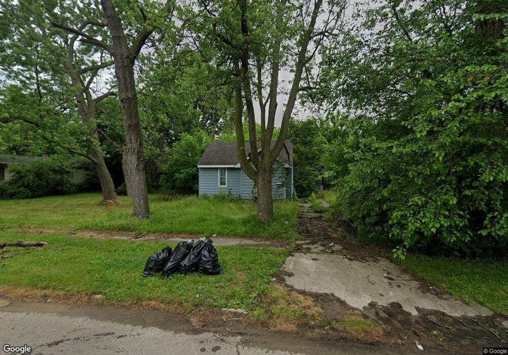
3118 Whittier Ave Flint, MI 48506
Potter Longway NeighborhoodEstimated Value: $46,049 - $54,000
2
Beds
1
Bath
586
Sq Ft
$87/Sq Ft
Est. Value
About This Home
This home is located at 3118 Whittier Ave, Flint, MI 48506 and is currently estimated at $50,762, approximately $86 per square foot. 3118 Whittier Ave is a home located in Genesee County with nearby schools including Potter School, Richfield Public School Academy, and Richfield Early Learning Center.
Ownership History
Date
Name
Owned For
Owner Type
Purchase Details
Closed on
Feb 20, 2013
Sold by
Smith Kevin and Smith Amanda
Bought by
Patriach Holdings Llc
Current Estimated Value
Purchase Details
Closed on
Jan 12, 2011
Sold by
Secretary Of Housing & Urban Development
Bought by
Smith Kevin
Purchase Details
Closed on
Mar 29, 2010
Sold by
Midfirst Bank
Bought by
The Secretary Of Housing & Urban Develop
Purchase Details
Closed on
Feb 24, 2010
Sold by
Keller Curtis W and Keller Debra K
Bought by
Midfirst Bank
Purchase Details
Closed on
Aug 26, 2004
Sold by
T D M Inc
Bought by
Keller Curtis W and Keller Debra K
Create a Home Valuation Report for This Property
The Home Valuation Report is an in-depth analysis detailing your home's value as well as a comparison with similar homes in the area
Home Values in the Area
Average Home Value in this Area
Purchase History
| Date | Buyer | Sale Price | Title Company |
|---|---|---|---|
| Patriach Holdings Llc | $240,000 | Lighthouse Title Inc | |
| Smith Kevin | $2,000 | None Available | |
| The Secretary Of Housing & Urban Develop | -- | None Available | |
| Midfirst Bank | $49,704 | None Available | |
| Keller Curtis W | $48,000 | First American Title |
Source: Public Records
Tax History Compared to Growth
Tax History
| Year | Tax Paid | Tax Assessment Tax Assessment Total Assessment is a certain percentage of the fair market value that is determined by local assessors to be the total taxable value of land and additions on the property. | Land | Improvement |
|---|---|---|---|---|
| 2025 | $887 | $24,100 | $0 | $0 |
| 2024 | $827 | $21,700 | $0 | $0 |
| 2023 | $813 | $17,000 | $0 | $0 |
| 2022 | $0 | $13,600 | $0 | $0 |
| 2021 | $821 | $12,600 | $0 | $0 |
| 2020 | $762 | $10,800 | $0 | $0 |
| 2019 | $749 | $7,400 | $0 | $0 |
| 2018 | $794 | $8,200 | $0 | $0 |
| 2017 | $820 | $0 | $0 | $0 |
| 2016 | $795 | $0 | $0 | $0 |
| 2015 | -- | $0 | $0 | $0 |
| 2014 | -- | $0 | $0 | $0 |
| 2012 | -- | $11,300 | $0 | $0 |
Source: Public Records
Map
Nearby Homes
- 3149 Whittier Ave
- 3205 Holly Ave
- 3220 Woodrow Ave
- 3116 Beechwood Ave
- 3232 Dale Ave
- 2719 Branch Rd
- 3214 Maryland Ave
- 3401 Davison Rd
- 3514 Whittier Ave
- 2211 Torrance St
- 2426 Hoff St
- 3617 Churchill Ave
- 3617 Davison Rd
- 3421 Brewster St
- 3713 Risedorph Ave
- 3602 Dakota Ave
- 3730 Holly Ave
- 1414 Earlmoor Blvd
- 3739 Marmion Ave
- 1324 Earlmoor Blvd
- 2208 Branch Rd
- 3126 Whittier Ave
- 2212 Branch Rd
- 3115 Bennett Ave
- 3119 Bennett Ave
- 3117 Whittier Ave
- 3125 Whittier Ave
- 3134 Whittier Ave
- 3129 Whittier Ave
- 3123 Bennett Ave
- 3113 Whittier Ave
- 3133 Whittier Ave
- 3138 Whittier Ave
- 3127 Bennett Ave
- 2302 Branch Rd
- 3142 Whittier Ave
- 3116 Bennett Ave
- 3128 Woodrow Ave
- 3124 Woodrow Ave
- 3132 Woodrow Ave