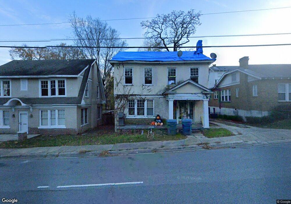
3119 W Markham St Little Rock, AR 72205
Hillcrest NeighborhoodEstimated Value: $264,000 - $344,668
--
Bed
3
Baths
2,232
Sq Ft
$137/Sq Ft
Est. Value
About This Home
This home is located at 3119 W Markham St, Little Rock, AR 72205 and is currently estimated at $305,917, approximately $137 per square foot. 3119 W Markham St is a home located in Pulaski County with nearby schools including M.L. King Elementary School, Dunbar Magnet Middle School, and Central High School.
Ownership History
Date
Name
Owned For
Owner Type
Purchase Details
Closed on
Sep 9, 2025
Sold by
Snc Properties Llc
Bought by
3119 West Markham Llc
Current Estimated Value
Purchase Details
Closed on
Aug 2, 2023
Sold by
Gibson Glynda
Bought by
Snc Properties Llc
Purchase Details
Closed on
Jan 19, 2004
Sold by
Hemphil Christopher
Bought by
Hemphil Glynda and Hemphil Heather
Purchase Details
Closed on
Nov 5, 2002
Sold by
Gibson Heather Hemphill
Bought by
Gibson Glynda
Create a Home Valuation Report for This Property
The Home Valuation Report is an in-depth analysis detailing your home's value as well as a comparison with similar homes in the area
Home Values in the Area
Average Home Value in this Area
Purchase History
| Date | Buyer | Sale Price | Title Company |
|---|---|---|---|
| 3119 West Markham Llc | -- | None Listed On Document | |
| Snc Properties Llc | $60,000 | American Abstract & Title | |
| Hemphil Glynda | -- | -- | |
| Gibson Glynda | -- | -- |
Source: Public Records
Tax History Compared to Growth
Tax History
| Year | Tax Paid | Tax Assessment Tax Assessment Total Assessment is a certain percentage of the fair market value that is determined by local assessors to be the total taxable value of land and additions on the property. | Land | Improvement |
|---|---|---|---|---|
| 2025 | $3,201 | $45,722 | $9,000 | $36,722 |
| 2024 | $1,993 | $45,722 | $9,000 | $36,722 |
| 2023 | $1,993 | $45,722 | $9,000 | $36,722 |
| 2022 | $1,827 | $45,722 | $9,000 | $36,722 |
| 2021 | $1,673 | $31,900 | $3,980 | $27,920 |
| 2020 | $1,551 | $31,900 | $3,980 | $27,920 |
| 2019 | $1,440 | $31,900 | $3,980 | $27,920 |
| 2018 | $1,330 | $31,900 | $3,980 | $27,920 |
| 2017 | $1,219 | $31,900 | $3,980 | $27,920 |
| 2016 | $1,108 | $26,340 | $2,920 | $23,420 |
| 2015 | $1,031 | $14,703 | $2,920 | $11,783 |
| 2014 | $1,031 | $12,443 | $2,920 | $9,523 |
Source: Public Records
Map
Nearby Homes
- 102 Midland St
- 1109 Kavanaugh Blvd
- 1116 Kavanaugh Blvd
- 121 N Woodrow St
- 305 Booker St
- 306 S Woodrow St
- 400 S Booker St
- 1204 Kavanaugh Blvd
- 301 N Woodrow St
- 312 Valmar St
- 220 S Valentine St
- 206 Linwood Ct
- 2717 W Capitol Ave
- 3212 Lamar St
- 310 S Oak St
- 3409 Hill Rd
- 100 Rice St
- 118 N Pine St
- 216 Rice St
- 520 S Oak St
- 101 Rosetta St
- 3115 W Markham St
- 109 Rosetta St
- 111 Rosetta St
- 114 Johnson St
- 115 Rosetta St
- 100 Rosetta St
- 102 Rosetta St
- 116 Johnson St
- 3104 W Markham St
- 104 Rosetta St
- 106 Rosetta St
- 118 Johnson St
- 117 Rosetta St
- 110 Midland St
- 111 Midland St
- 0 Midland Unit 16036172
- 0 Midland Unit 17004799
- 0 Midland Unit 17001058
- 0 Midland Unit 17033091