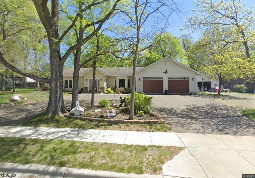
312 2nd St S Delano, MN 55328
Estimated Value: $369,976 - $495,000
3
Beds
3
Baths
1,994
Sq Ft
$205/Sq Ft
Est. Value
About This Home
This home is located at 312 2nd St S, Delano, MN 55328 and is currently estimated at $408,744, approximately $204 per square foot. 312 2nd St S is a home located in Wright County with nearby schools including Delano Elementary School, Delano Middle School, and Delano Senior High School.
Ownership History
Date
Name
Owned For
Owner Type
Purchase Details
Closed on
Aug 1, 2016
Sold by
Vick Daniel Daniel
Bought by
Benson Robin Robin
Current Estimated Value
Home Financials for this Owner
Home Financials are based on the most recent Mortgage that was taken out on this home.
Original Mortgage
$296,900
Outstanding Balance
$236,892
Interest Rate
3.48%
Estimated Equity
$171,852
Create a Home Valuation Report for This Property
The Home Valuation Report is an in-depth analysis detailing your home's value as well as a comparison with similar homes in the area
Home Values in the Area
Average Home Value in this Area
Purchase History
| Date | Buyer | Sale Price | Title Company |
|---|---|---|---|
| Benson Robin Robin | $299,900 | -- |
Source: Public Records
Mortgage History
| Date | Status | Borrower | Loan Amount |
|---|---|---|---|
| Open | Benson Robin Robin | $296,900 |
Source: Public Records
Tax History Compared to Growth
Tax History
| Year | Tax Paid | Tax Assessment Tax Assessment Total Assessment is a certain percentage of the fair market value that is determined by local assessors to be the total taxable value of land and additions on the property. | Land | Improvement |
|---|---|---|---|---|
| 2025 | $4,174 | $343,200 | $44,600 | $298,600 |
| 2024 | $4,132 | $349,700 | $44,000 | $305,700 |
| 2023 | $4,110 | $356,400 | $44,000 | $312,400 |
| 2022 | $3,888 | $324,500 | $43,000 | $281,500 |
| 2021 | $3,844 | $273,800 | $32,900 | $240,900 |
| 2020 | $3,682 | $268,900 | $32,900 | $236,000 |
| 2019 | $3,604 | $248,400 | $0 | $0 |
| 2018 | $3,242 | $226,300 | $0 | $0 |
| 2017 | $2,862 | $201,600 | $0 | $0 |
| 2016 | $2,842 | $0 | $0 | $0 |
| 2015 | $2,212 | $0 | $0 | $0 |
| 2014 | -- | $0 | $0 | $0 |
Source: Public Records
Map
Nearby Homes
- 301 3rd St S
- 428 Saint Peter Ave E
- 4xxx Lincoln St
- 257 6th St NW
- 201 3rd St N
- 205 3rd St N
- 229 3rd St N
- TBD Saint Peter Ave E
- 204 Buffalo St
- 932 Crossing Way
- 1128 Willowbrook Cir
- 508 River St N
- 1234 Willowbrook Cir
- 517 3rd St N
- 1257 Willowbrook Cir
- 1242 Willowbrook Cir
- 258 3rd St SW
- 252 3rd St SW
- 679 Marsh Dr
- 1111 Woods Creek Dr
- 209 Saint Peter St
- 300 2nd St S
- 394 River St S
- 313 3rd St S
- xxxx 2nd St S
- 211 Saint Peter St
- 398 River St S
- 312 River St S
- 301 2nd St S
- 309 3rd St S
- 317 3rd St S
- 204 204 St Peter Ave
- 305 3rd St S
- 204 Saint Peter Ave E
- 325 3rd St S
- 204 Saint Peter St
- 245 3rd St S
- 300 River St S
- 240 2nd St S
- 241 3rd St S