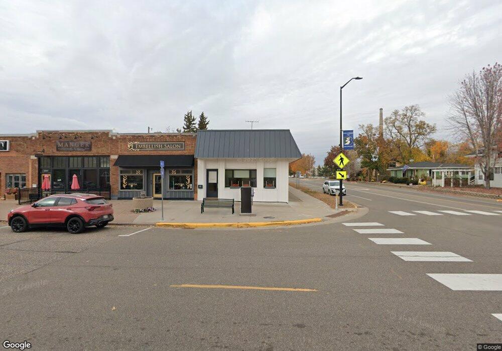
312 5th Ave N Bayport, MN 55003
Estimated Value: $672,794
--
Bed
--
Bath
2,198
Sq Ft
$306/Sq Ft
Est. Value
About This Home
This home is located at 312 5th Ave N, Bayport, MN 55003 and is currently estimated at $672,794, approximately $306 per square foot. 312 5th Ave N is a home located in Washington County with nearby schools including Andersen Elementary School, Oak-Land Middle School, and Stillwater Area High School.
Ownership History
Date
Name
Owned For
Owner Type
Purchase Details
Closed on
Sep 20, 2024
Sold by
Tm Serenity Properties Llc
Bought by
Teel Management Llc
Current Estimated Value
Purchase Details
Closed on
Mar 24, 2023
Sold by
Kearns Max and Kearns Marlene
Bought by
Tm Serenity Properties Llc A Minnesota
Home Financials for this Owner
Home Financials are based on the most recent Mortgage that was taken out on this home.
Original Mortgage
$450,000
Interest Rate
6.12%
Mortgage Type
New Conventional
Purchase Details
Closed on
Jun 29, 1998
Sold by
Nelson Douglas L and Nelson Pamela J
Bought by
Kearns Max J and Kearns Marlene N
Create a Home Valuation Report for This Property
The Home Valuation Report is an in-depth analysis detailing your home's value as well as a comparison with similar homes in the area
Home Values in the Area
Average Home Value in this Area
Purchase History
| Date | Buyer | Sale Price | Title Company |
|---|---|---|---|
| Teel Management Llc | $650,000 | -- | |
| Tm Serenity Properties Llc A Minnesota | $600,000 | -- | |
| Kearns Max J | $158,750 | -- | |
| Kearns Max J | $158,750 | -- |
Source: Public Records
Mortgage History
| Date | Status | Borrower | Loan Amount |
|---|---|---|---|
| Previous Owner | Tm Serenity Properties Llc A Minnesota | $450,000 |
Source: Public Records
Tax History Compared to Growth
Tax History
| Year | Tax Paid | Tax Assessment Tax Assessment Total Assessment is a certain percentage of the fair market value that is determined by local assessors to be the total taxable value of land and additions on the property. | Land | Improvement |
|---|---|---|---|---|
| 2024 | $13,754 | $583,400 | $104,600 | $478,800 |
| 2023 | $13,754 | $559,300 | $104,600 | $454,700 |
| 2022 | $8,574 | $350,100 | $95,900 | $254,200 |
| 2021 | $7,300 | $350,100 | $95,900 | $254,200 |
| 2020 | $7,412 | $311,500 | $82,800 | $228,700 |
| 2019 | $7,618 | $311,500 | $82,800 | $228,700 |
| 2018 | $7,296 | $300,900 | $81,600 | $219,300 |
| 2017 | $8,334 | $286,700 | $69,700 | $217,000 |
| 2016 | $7,780 | $286,700 | $69,700 | $217,000 |
| 2015 | $10,996 | $341,900 | $95,900 | $246,000 |
| 2013 | -- | $341,900 | $95,900 | $246,000 |
Source: Public Records
Map
Nearby Homes
- 656 2nd St N
- 364 4th St N
- 836 6th St N
- 540 2nd Ave S
- 16 Point Rd
- 15385 50th St N
- 216 Prairie Way N
- 231 Prairie Way N
- 280 Primrose Path N
- 1013 Planters Path
- 636 Oakwood St S
- 632 Oakwood St S
- 4908 Pinecroft Ave N
- 640 Inspiration Place
- 479 Mariner Dr
- 530 Lakeside Bay Dr S
- 233 River Heights Trail
- 6201 Saint Croix Trail N Unit 115
- 6201 Saint Croix Trail N Unit 216
- 6311 Saint Croix Trail N
