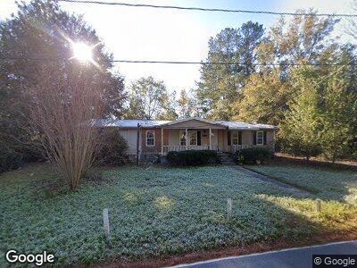
312 Anderson Ave Guyton, GA 31312
Estimated Value: $205,950 - $330,000
--
Bed
1
Bath
1,620
Sq Ft
$155/Sq Ft
Est. Value
About This Home
This home is located at 312 Anderson Ave, Guyton, GA 31312 and is currently estimated at $251,488, approximately $155 per square foot. 312 Anderson Ave is a home located in Effingham County with nearby schools including Guyton Elementary School, Effingham County Middle School, and Effingham County High School.
Ownership History
Date
Name
Owned For
Owner Type
Purchase Details
Closed on
May 2, 2016
Sold by
Coppock Lorene C
Bought by
Coppock Stacie L
Current Estimated Value
Purchase Details
Closed on
Mar 22, 2016
Sold by
Wealth Planning 401K Plan
Bought by
Coppock Lorene C
Purchase Details
Closed on
Aug 4, 2015
Sold by
Coppock Lorene C
Bought by
Wealth Planning 401K Plan
Purchase Details
Closed on
Feb 22, 1994
Bought by
Coppock Lorene C
Create a Home Valuation Report for This Property
The Home Valuation Report is an in-depth analysis detailing your home's value as well as a comparison with similar homes in the area
Home Values in the Area
Average Home Value in this Area
Purchase History
| Date | Buyer | Sale Price | Title Company |
|---|---|---|---|
| Coppock Stacie L | -- | -- | |
| Coppock Lorene C | $2,647 | -- | |
| Wealth Planning 401K Plan | $1,871 | -- | |
| Coppock Lorene C | -- | -- |
Source: Public Records
Tax History Compared to Growth
Tax History
| Year | Tax Paid | Tax Assessment Tax Assessment Total Assessment is a certain percentage of the fair market value that is determined by local assessors to be the total taxable value of land and additions on the property. | Land | Improvement |
|---|---|---|---|---|
| 2024 | $1,561 | $48,024 | $11,352 | $36,672 |
| 2023 | $1,275 | $41,091 | $8,600 | $32,491 |
| 2022 | $1,014 | $29,342 | $6,880 | $22,462 |
| 2021 | $975 | $27,399 | $5,676 | $21,723 |
| 2020 | $902 | $25,676 | $5,160 | $20,516 |
| 2019 | $958 | $27,150 | $4,600 | $22,550 |
| 2018 | $800 | $22,864 | $4,000 | $18,864 |
| 2017 | $776 | $22,864 | $4,000 | $18,864 |
| 2016 | $760 | $22,512 | $4,000 | $18,512 |
| 2015 | -- | $22,512 | $4,000 | $18,512 |
| 2014 | -- | $27,622 | $4,000 | $23,622 |
| 2013 | -- | $27,621 | $4,000 | $23,621 |
Source: Public Records
Map
Nearby Homes
- 124 Buckeye Rd
- 130 Buckeye Rd
- 142 Buckeye Rd
- 119 Buckeye Rd
- 128 Buckeye Rd
- 104 Grove Dr
- 404 Samuel Smalls Sr Ave
- 2760 Georgia 17
- 706 Central Blvd
- 704 Central Blvd
- 1911 Hwy 17 Rd N
- 0 Hunter St
- 0 Ralph Rahn Rd Unit 329204
- 174 Hunter St
- 515 Samuel Smalls Sr Ave
- 75 Blackberry Cir
- 62 Blackberry Cir
- 24 Easy St
- 11 Del A Rae Cir
- 44 Blackberry Cir
- 312 Anderson Ave
- 310 Anderson Ave
- 314 Anderson Ave
- 308 Anderson Ave
- 807 Magnolia St
- 313 Anderson Ave
- 315 Anderson Ave
- 317 Anderson Ave
- 306 Anderson Ave
- 315 Hines Ave
- 0 Hines and Magnolia Unit 7414910
- 0 Hines Ave
- 307 Hines Ave
- 312 Dilmus Jackson St
- 316 Dilmus Jackson St
- 314 Dilmus Jackson St
- 310 Dilmus Jackson St
- 806 Magnolia St
- 303 Anderson Ave
- 302 Anderson Ave