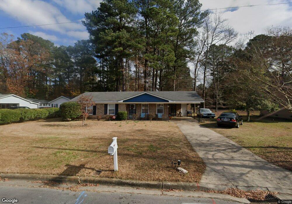
312 Birch St Smithfield, NC 27577
Estimated Value: $194,000 - $202,000
3
Beds
1
Bath
1,198
Sq Ft
$165/Sq Ft
Est. Value
About This Home
This home is located at 312 Birch St, Smithfield, NC 27577 and is currently estimated at $197,169, approximately $164 per square foot. 312 Birch St is a home located in Johnston County with nearby schools including South Smithfield Elementary School, Smithfield Middle School, and Smithfield-Selma High School.
Ownership History
Date
Name
Owned For
Owner Type
Purchase Details
Closed on
May 9, 2019
Sold by
Jacquet Curtis L and Jacquet Joyce L
Bought by
Davis Patrick
Current Estimated Value
Home Financials for this Owner
Home Financials are based on the most recent Mortgage that was taken out on this home.
Original Mortgage
$103,098
Outstanding Balance
$90,255
Interest Rate
3.99%
Mortgage Type
FHA
Estimated Equity
$106,914
Purchase Details
Closed on
Aug 30, 2011
Sold by
Richardson James and Richardson Dorothy H
Bought by
Richardson Linda and Ham Beverly
Create a Home Valuation Report for This Property
The Home Valuation Report is an in-depth analysis detailing your home's value as well as a comparison with similar homes in the area
Home Values in the Area
Average Home Value in this Area
Purchase History
| Date | Buyer | Sale Price | Title Company |
|---|---|---|---|
| Davis Patrick | $115,000 | None Available | |
| Richardson Linda | -- | None Available |
Source: Public Records
Mortgage History
| Date | Status | Borrower | Loan Amount |
|---|---|---|---|
| Open | Davis Patrick | $103,098 |
Source: Public Records
Tax History Compared to Growth
Tax History
| Year | Tax Paid | Tax Assessment Tax Assessment Total Assessment is a certain percentage of the fair market value that is determined by local assessors to be the total taxable value of land and additions on the property. | Land | Improvement |
|---|---|---|---|---|
| 2025 | $2,046 | $210,900 | $45,000 | $165,900 |
| 2024 | $1,204 | $97,100 | $28,500 | $68,600 |
| 2023 | $1,223 | $97,100 | $28,500 | $68,600 |
| 2022 | $1,262 | $97,100 | $28,500 | $68,600 |
| 2021 | $1,262 | $97,100 | $28,500 | $68,600 |
| 2020 | $1,291 | $97,100 | $28,500 | $68,600 |
| 2019 | $1,291 | $97,100 | $28,500 | $68,600 |
| 2018 | $0 | $80,730 | $19,000 | $61,730 |
| 2017 | $1,090 | $80,730 | $19,000 | $61,730 |
| 2016 | $1,090 | $80,730 | $19,000 | $61,730 |
| 2014 | -- | $80,730 | $19,000 | $61,730 |
Source: Public Records
Map
Nearby Homes
- 214 Oak Barrel Rd
- 0 Aspen Dr Unit 10126028
- 91 Lotus Ave
- 359 Thompson Overlook Way
- 706 Caswell St
- 118 N 7th St
- 707 Massey St
- 19 & 21 W Waddell Dr
- 38 W Waddell Dr
- 000 Berkshire Rd
- 604 E Johnston St
- 31 W Waddell Dr
- 602 E Johnston St
- 209 S 6th St
- 211 S 6th St
- 111 S 5th St
- 212 S 6th St
- 612 N 4th St
- 14 E Peedin Rd
- 507 E Woodall St