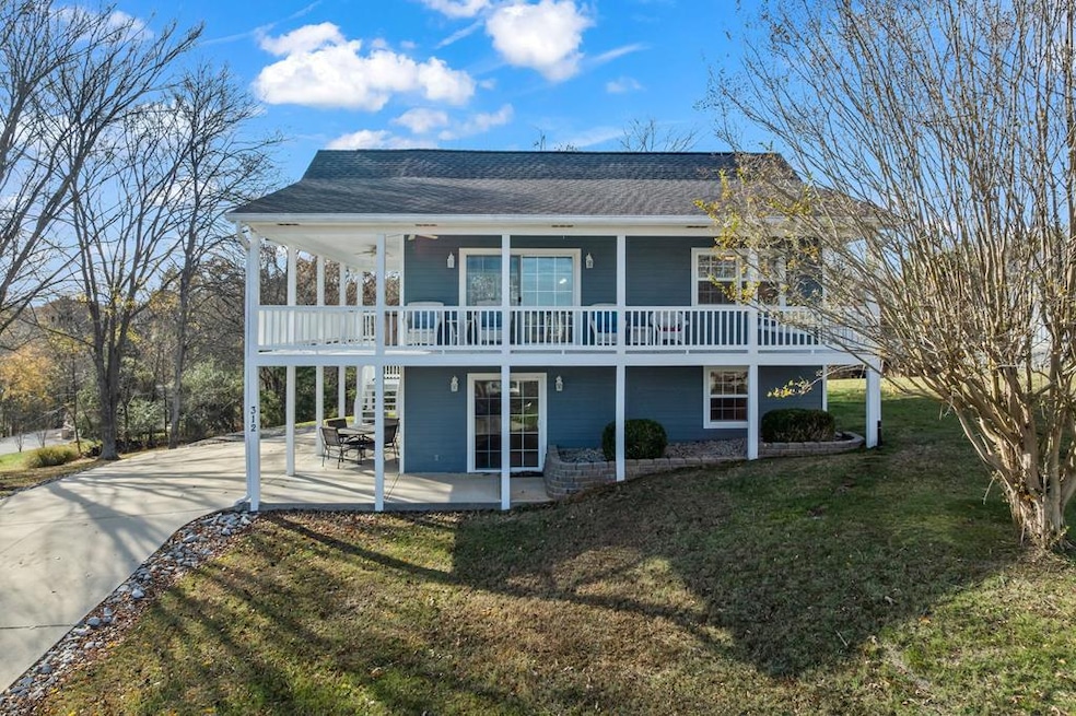
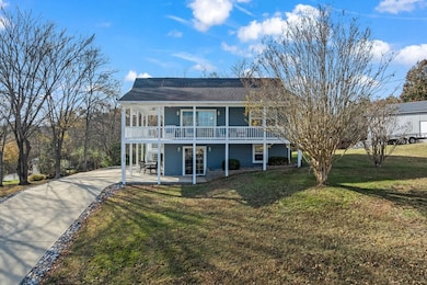
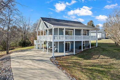
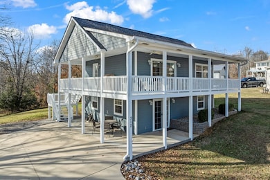
312 Cosby Parris Rd Byrdstown, TN 38549
Estimated payment $2,189/month
Highlights
- Popular Property
- Waterfront
- Vaulted Ceiling
- Lake View
- Newly Painted Property
- No HOA
About This Home
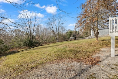
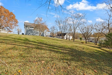
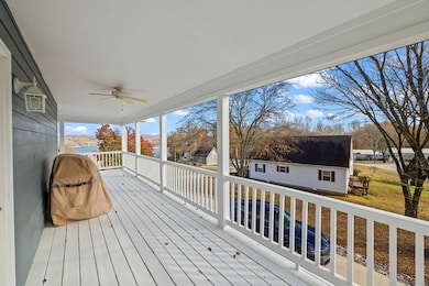
Move-in ready lakeview home in a desirable community near Dale Hollow Lake! This well-maintained 2 bed, 2 bath property offers open living with vaulted ceilings with skylights, a spacious kitchen/dining/living area, and walkout access to a covered porch showcasing stunning lake views. The main floor includes two bedrooms, one bath, and a versatile loft for extra sleeping or office space. The lower level features a family room with wet bar, laundry, bedroom, and full bath, large utility room, plus its own porch with lake views. Freshly painted interior, concrete drive, and selling furnished for immediate enjoyment. Expansive upper and lower porches provide ideal entertaining space. Located minutes from Sunset Marina, Cove Creek boat launch, and close to Star Point and Eagle Cove Marinas, this home blends comfort, convenience, and lake lifestyle. The home was a partial build in 1994 with build out and total remodel in 2006/2007.
Listing Agent
RE/MAX COUNTRY LIVING, LLC Brokerage Phone: 9318643380 License #341825 Listed on: 11/12/2025

Home Details
Home Type
- Single Family
Est. Annual Taxes
- $924
Year Built
- Built in 1994
Lot Details
- Lot Dimensions are 91 x 199 x 102 x 180
- Waterfront
- Landscaped with Trees
Parking
- Open Parking
Home Design
- Newly Painted Property
- Slab Foundation
- Frame Construction
- Shingle Roof
- Composition Roof
- HardiePlank Type
Interior Spaces
- 1,466 Sq Ft Home
- 2-Story Property
- Vaulted Ceiling
- Ceiling Fan
- Lake Views
Kitchen
- Electric Oven
- Electric Range
- Microwave
- Dishwasher
Bedrooms and Bathrooms
- 2 Bedrooms
- 2 Full Bathrooms
Laundry
- Laundry Room
- Laundry on lower level
- Dryer
- Washer
Utilities
- Central Heating and Cooling System
- Heat Pump System
- Natural Gas Not Available
- Electric Water Heater
- Septic Tank
Community Details
- No Home Owners Association
- Sherwood Shores Subdivision
Listing and Financial Details
- Assessor Parcel Number 022.00
Map
Home Values in the Area
Average Home Value in this Area
Tax History
| Year | Tax Paid | Tax Assessment Tax Assessment Total Assessment is a certain percentage of the fair market value that is determined by local assessors to be the total taxable value of land and additions on the property. | Land | Improvement |
|---|---|---|---|---|
| 2025 | $924 | $54,025 | $0 | $0 |
| 2024 | $924 | $54,025 | $7,500 | $46,525 |
| 2023 | $922 | $54,025 | $7,500 | $46,525 |
| 2022 | $825 | $34,225 | $5,000 | $29,225 |
| 2021 | $825 | $34,225 | $5,000 | $29,225 |
| 2020 | $825 | $34,225 | $5,000 | $29,225 |
| 2019 | $842 | $34,225 | $5,000 | $29,225 |
| 2018 | $589 | $34,225 | $5,000 | $29,225 |
| 2017 | $454 | $24,300 | $5,000 | $19,300 |
| 2016 | $454 | $24,300 | $5,000 | $19,300 |
| 2015 | $454 | $24,307 | $0 | $0 |
| 2014 | $455 | $24,307 | $0 | $0 |
Property History
| Date | Event | Price | List to Sale | Price per Sq Ft |
|---|---|---|---|---|
| 11/12/2025 11/12/25 | For Sale | $399,900 | -- | $273 / Sq Ft |
Purchase History
| Date | Type | Sale Price | Title Company |
|---|---|---|---|
| Deed | $115,000 | -- | |
| Deed | $65,000 | -- | |
| Warranty Deed | $13,500 | -- |
Source: Upper Cumberland Association of REALTORS®
MLS Number: 240555
APN: 043D-C-022.00
Disclaimer: Certain information contained herein is derived from information provided by parties other than Homes.com. All information provided is deemed reliable, but is not guaranteed to be accurate and should be independently verified.
![]() Copyright 2025 Upper Cumberland Board of Realtors. All rights reserved. Information deemed to be reliable but not guaranteed. The data relating to real estate for sale on this website comes from Upper Cumberland Board of Realtors.
Copyright 2025 Upper Cumberland Board of Realtors. All rights reserved. Information deemed to be reliable but not guaranteed. The data relating to real estate for sale on this website comes from Upper Cumberland Board of Realtors.
Some or all of the listings displayed may not belong to the firm whose website is being visited.
- 308 Cosby Parris Rd
- 1007 Eastridge Dr
- 502 Midnight Dr
- 122 Abby Ln
- 1020 Center Ln
- 0 Midnight Dr
- 572 Lakeside Rd
- 566 Mallard Pointe Rd
- 5513 Cove Creek Rd
- 108 Lanham Ln
- 1250 Hill Cemetery Rd
- 1080 Dale Hollow Estates Rd
- 0 W Main Old Hwy 42
- Lot 18B Bald Eagle Ln
- LOT # 16 Obey River Shres
- 0 Keisling Ridge Rd Unit LotWP001 21177271
- 0 Keisling Ridge Rd Unit RTC2823717
- 0 Keisling Ridge Rd
- 00 Old Highway 42 S
- 00 Hassler Ln
- 613 Evans St
- 110 Mirandy Rd
- 242 Cypress Ridge Unit 242 Cypress
- 5985 Dodson Branch Rd Unit 5997
- 5985 Dodson Branch Rd Unit 5997
- 117 Phillips Bend Ct
- 164 W Wall St
- 164 W Wall St
- 1054 Johnnie Bud Ln
- 971 Shannon Dr Unit 1
- 2800 Fisk Rd
- 409 Juniper Dr
- 1640 Shipley Rd Unit A
- 1155 Carol Ln
- 2530 Dodson Branch Rd Unit 3
- 1415 N Main St
- 1010 Country Club Rd
- 1535 Bilbrey Park Dr
- 1150 E 10th St
- 1045 Fisk Rd