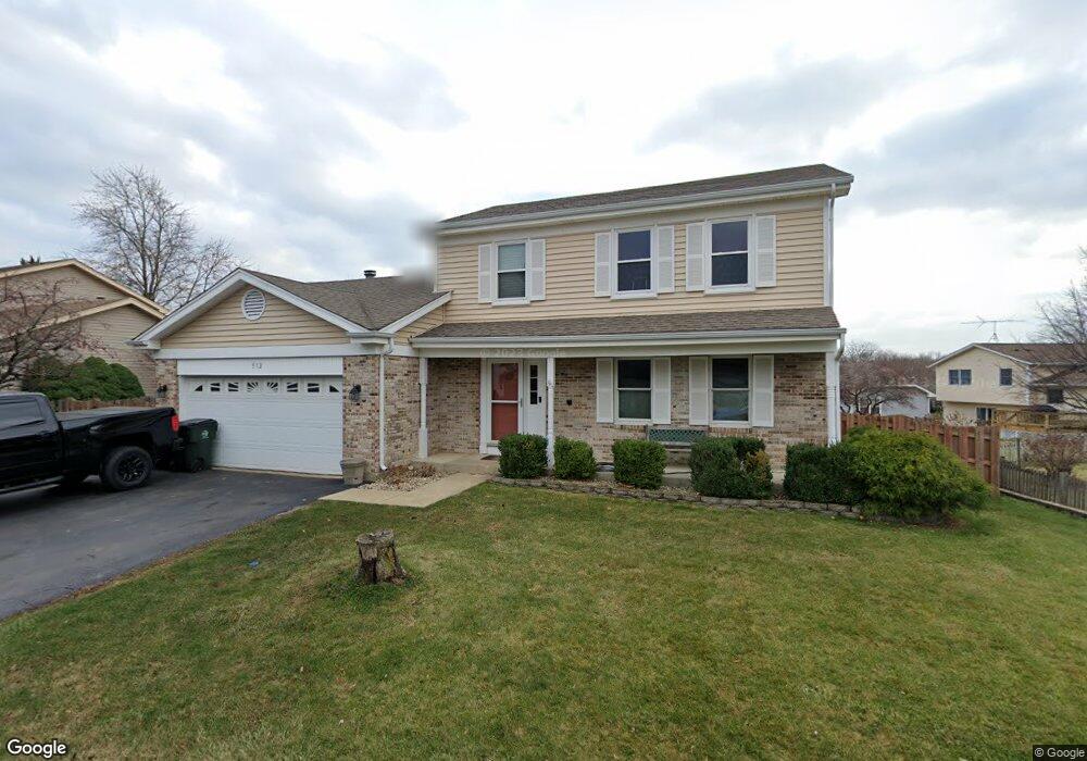
312 Country Ln Algonquin, IL 60102
High Hill Farms NeighborhoodEstimated Value: $345,524 - $379,000
3
Beds
2
Baths
1,725
Sq Ft
$211/Sq Ft
Est. Value
About This Home
This home is located at 312 Country Ln, Algonquin, IL 60102 and is currently estimated at $364,131, approximately $211 per square foot. 312 Country Ln is a home located in McHenry County with nearby schools including Westfield Community School, Kenneth E Neubert Elementary School, and United Junior High School.
Ownership History
Date
Name
Owned For
Owner Type
Purchase Details
Closed on
Mar 21, 2002
Sold by
Avicola Susan J
Bought by
Felder Michael W and Felder Teresa R
Current Estimated Value
Home Financials for this Owner
Home Financials are based on the most recent Mortgage that was taken out on this home.
Original Mortgage
$172,500
Outstanding Balance
$71,398
Interest Rate
6.93%
Estimated Equity
$292,733
Purchase Details
Closed on
May 22, 2001
Sold by
Avicola Timothy M
Bought by
Avicola Susan J
Create a Home Valuation Report for This Property
The Home Valuation Report is an in-depth analysis detailing your home's value as well as a comparison with similar homes in the area
Home Values in the Area
Average Home Value in this Area
Purchase History
| Date | Buyer | Sale Price | Title Company |
|---|---|---|---|
| Felder Michael W | $190,000 | Chicago Title Insurance Co | |
| Avicola Susan J | -- | -- |
Source: Public Records
Mortgage History
| Date | Status | Borrower | Loan Amount |
|---|---|---|---|
| Open | Felder Michael W | $172,500 |
Source: Public Records
Tax History Compared to Growth
Tax History
| Year | Tax Paid | Tax Assessment Tax Assessment Total Assessment is a certain percentage of the fair market value that is determined by local assessors to be the total taxable value of land and additions on the property. | Land | Improvement |
|---|---|---|---|---|
| 2024 | $7,422 | $102,881 | $21,728 | $81,153 |
| 2023 | $7,033 | $92,014 | $19,433 | $72,581 |
| 2022 | $6,892 | $86,360 | $21,044 | $65,316 |
| 2021 | $6,607 | $80,455 | $19,605 | $60,850 |
| 2020 | $6,430 | $77,607 | $18,911 | $58,696 |
| 2019 | $6,270 | $74,279 | $18,100 | $56,179 |
| 2018 | $5,969 | $68,618 | $16,721 | $51,897 |
| 2017 | $5,840 | $64,642 | $15,752 | $48,890 |
| 2016 | $5,745 | $60,628 | $14,774 | $45,854 |
| 2013 | -- | $56,649 | $13,783 | $42,866 |
Source: Public Records
Map
Nearby Homes
- 266 Grandview Ct
- 16 Brian Ct
- 1235 Fairmont Ct
- 909 Roger St
- 1431 Essex St
- 721 Brentwood Ct
- 807 Menominee Dr
- 809 Menominee Dr
- LOT 3 Blackhawk Dr
- 135 Arquilla Dr
- 700 Fairfield Ln
- Lots 10 & 11 Ramble Rd
- 615 Harper Dr
- 900 Windstone Ct
- 937 Mesa Dr
- 305 Buckingham Dr
- 1820 Crofton Dr
- 741 Regal Ln
- 1 N Hubbard St
- SWC Talaga and Algonquin Rd
- 310 Country Ln
- 322 Country Ln Unit 10
- 325 Stoney Brook Ct
- 335 Stoney Brook Ct
- 320 Country Ln
- 315 Stoney Brook Ct
- 300 Country Ln
- 345 Stoney Brook Ct
- 305 Stoney Brook Ct
- 332 Country Ln
- 330 Country Ln
- 305 Country Ln Unit 10
- 355 Stoney Brook Ct
- 315 Country Ln
- 330 Stoney Brook Ct
- 320 Stoney Brook Ct
- 340 Stoney Brook Ct
- 310 Stoney Brook Ct
- 240 Country Ln
- 340 Country Ln