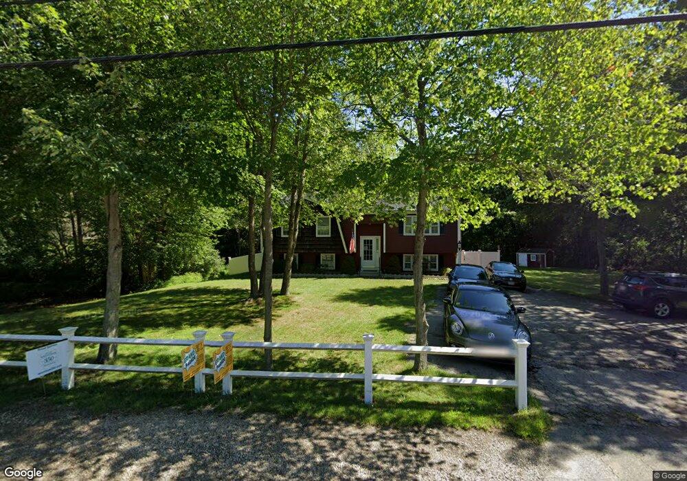
312 Dedham St Wrentham, MA 02093
Estimated Value: $583,000 - $752,000
3
Beds
2
Baths
1,977
Sq Ft
$340/Sq Ft
Est. Value
About This Home
This home is located at 312 Dedham St, Wrentham, MA 02093 and is currently estimated at $672,168, approximately $339 per square foot. 312 Dedham St is a home located in Norfolk County with nearby schools including Delaney Elementary School and Charles E Roderick.
Ownership History
Date
Name
Owned For
Owner Type
Purchase Details
Closed on
Apr 11, 2025
Sold by
Andreozzi Joseph R and Andreozzi Kathleen M
Bought by
Andreozzi Kathleen M
Current Estimated Value
Purchase Details
Closed on
Aug 17, 1977
Bought by
Andreozzi Joseph R and Andreozzi Kathleen
Create a Home Valuation Report for This Property
The Home Valuation Report is an in-depth analysis detailing your home's value as well as a comparison with similar homes in the area
Home Values in the Area
Average Home Value in this Area
Purchase History
| Date | Buyer | Sale Price | Title Company |
|---|---|---|---|
| Andreozzi Kathleen M | -- | None Available | |
| Andreozzi Kathleen M | -- | None Available | |
| Andreozzi Joseph R | -- | -- |
Source: Public Records
Mortgage History
| Date | Status | Borrower | Loan Amount |
|---|---|---|---|
| Previous Owner | Andreozzi Joseph R | $180,000 | |
| Previous Owner | Andreozzi Joseph R | $210,000 | |
| Previous Owner | Andreozzi Joseph R | $137,000 | |
| Previous Owner | Andreozzi Joseph R | $75,000 |
Source: Public Records
Tax History Compared to Growth
Tax History
| Year | Tax Paid | Tax Assessment Tax Assessment Total Assessment is a certain percentage of the fair market value that is determined by local assessors to be the total taxable value of land and additions on the property. | Land | Improvement |
|---|---|---|---|---|
| 2025 | $6,115 | $527,600 | $267,900 | $259,700 |
| 2024 | $5,668 | $472,300 | $267,900 | $204,400 |
| 2023 | $5,380 | $426,300 | $243,900 | $182,400 |
| 2022 | $5,376 | $393,300 | $237,300 | $156,000 |
| 2021 | $4,763 | $338,500 | $222,100 | $116,400 |
| 2020 | $4,819 | $338,200 | $170,700 | $167,500 |
| 2019 | $4,626 | $327,600 | $170,700 | $156,900 |
| 2018 | $4,406 | $309,400 | $170,900 | $138,500 |
| 2017 | $4,178 | $293,200 | $167,600 | $125,600 |
| 2016 | $4,083 | $285,900 | $162,700 | $123,200 |
| 2015 | $3,967 | $264,800 | $156,500 | $108,300 |
| 2014 | $3,921 | $256,100 | $150,500 | $105,600 |
Source: Public Records
Map
Nearby Homes
- 270 Dedham St
- 1 Lorraine Metcalf Dr
- 362 East St
- 10 Nature View Dr
- 15 Nature View Dr
- 246 Forest Grove Ave
- 10 W Birch Rd
- 0 W Birch Rd
- 3 Oak Rd
- 65 Pond St
- 25 Foxboro Rd
- 319 Taunton St
- 131 Creek St Unit 7
- 71 Pond St
- 570 Franklin St
- 7 Hill St Unit 10
- 11 Earle Stewart Ln
- 20 Valley St Unit 20
- 45 Joshua Rd
- 45 King St
- 296 Dedham St
- 299 Dedham St
- 328 Dedham St
- 295 Dedham St
- 332 Dedham St
- 334 Dedham St Unit 332-334
- 332 Dedham St Unit 332
- 332 Dedham St Unit 1
- 334 Dedham St Unit 334
- 291 Dedham St
- 340 Dedham St
- 282 Dedham St
- 274 Dedham St
- 352 Dedham St
- 279 Dedham St
- 370 Dedham St
- 275 Dedham St
- 362 Dedham St
- 258 Dedham St
- 25 Lorraine Metcalf Dr