Estimated Value: $178,000 - $232,000
2
Beds
1
Bath
852
Sq Ft
$236/Sq Ft
Est. Value
About This Home
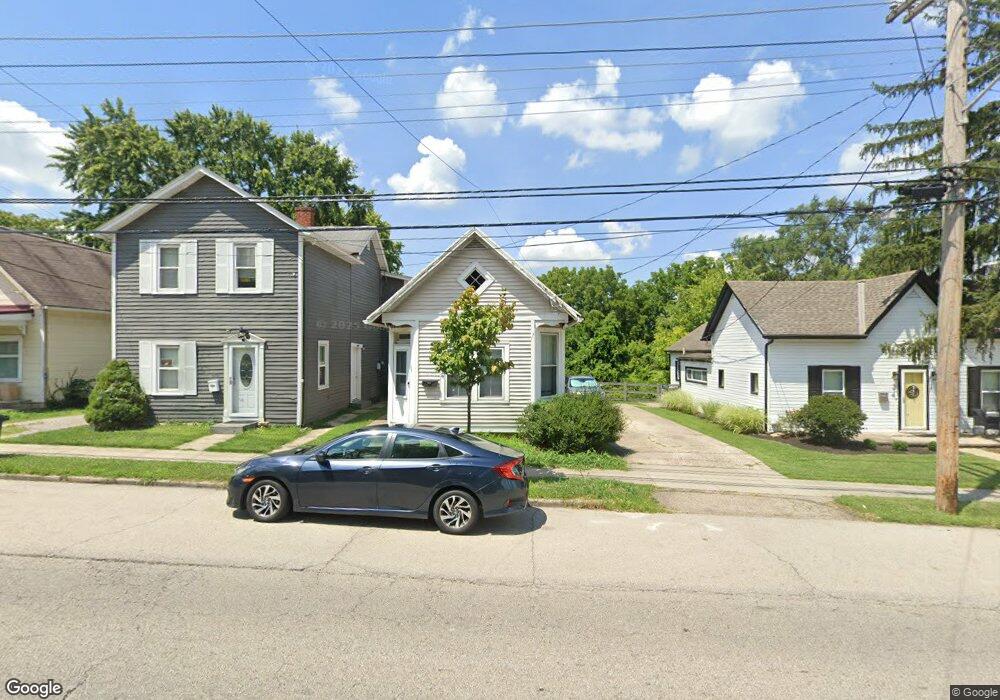
This home is located at 312 E Main St Unit A, Mason, OH 45040 and is currently estimated at $201,015, approximately $235 per square foot. 312 E Main St Unit A is a home located in Warren County with nearby schools including Mason Intermediate Elementary School, Mason Middle School, and William Mason High School.
Ownership History
Date
Name
Owned For
Owner Type
Purchase Details
Closed on
Aug 1, 2005
Sold by
Maine Eric B and Maine Cherie
Bought by
Smith Anthony
Current Estimated Value
Home Financials for this Owner
Home Financials are based on the most recent Mortgage that was taken out on this home.
Original Mortgage
$85,499
Outstanding Balance
$45,058
Interest Rate
5.71%
Mortgage Type
Fannie Mae Freddie Mac
Estimated Equity
$155,957
Purchase Details
Closed on
Apr 7, 1999
Sold by
Maine Jr E Wesley
Bought by
Maine Eric B
Home Financials for this Owner
Home Financials are based on the most recent Mortgage that was taken out on this home.
Original Mortgage
$77,500
Interest Rate
6.94%
Mortgage Type
VA
Purchase Details
Closed on
Jul 7, 1993
Sold by
Long Donna Jean and Jean Donna
Bought by
Maine and Wesley E
Create a Home Valuation Report for This Property
The Home Valuation Report is an in-depth analysis detailing your home's value as well as a comparison with similar homes in the area
Home Values in the Area
Average Home Value in this Area
Purchase History
| Date | Buyer | Sale Price | Title Company |
|---|---|---|---|
| Smith Anthony | $90,000 | Custom Land Title Llc | |
| Maine Eric B | $76,000 | -- | |
| Maine | -- | -- |
Source: Public Records
Mortgage History
| Date | Status | Borrower | Loan Amount |
|---|---|---|---|
| Open | Smith Anthony | $85,499 | |
| Previous Owner | Maine Eric B | $77,500 |
Source: Public Records
Tax History Compared to Growth
Tax History
| Year | Tax Paid | Tax Assessment Tax Assessment Total Assessment is a certain percentage of the fair market value that is determined by local assessors to be the total taxable value of land and additions on the property. | Land | Improvement |
|---|---|---|---|---|
| 2024 | $1,676 | $40,330 | $9,830 | $30,500 |
| 2023 | $1,568 | $31,892 | $4,833 | $27,058 |
| 2022 | $1,547 | $31,892 | $4,834 | $27,059 |
| 2021 | $1,466 | $31,892 | $4,834 | $27,059 |
| 2020 | $1,394 | $25,928 | $3,931 | $21,998 |
| 2019 | $1,285 | $25,928 | $3,931 | $21,998 |
| 2018 | $1,289 | $25,928 | $3,931 | $21,998 |
| 2017 | $1,328 | $24,948 | $3,847 | $21,102 |
| 2016 | $1,368 | $24,948 | $3,847 | $21,102 |
| 2015 | $1,371 | $24,948 | $3,847 | $21,102 |
| 2014 | $1,428 | $24,220 | $3,730 | $20,490 |
| 2013 | $1,431 | $25,490 | $3,930 | $21,560 |
Source: Public Records
Map
Nearby Homes
- 0 Mason Montgomery Rd Unit 944480
- 0 Mason Montgomery Rd Unit 1856522
- 0 Mason Montgomery Rd Unit 1846782
- 220 Kings Mills Rd
- 226 Kings Mills Rd
- 5130 Franklin Park St
- 5239 Concord Crossing Dr
- 216 Short St
- 0 U S Highway 42
- 5088 Carter Ct
- 4821 Bordeaux Ln Unit 4821
- 4734 Margaret Ct
- 6303 Greenwood Ct
- 6292 Greenwood Ct
- 6334 Greenwood Ct
- 6328 Greenwood Ct
- 6279 Greenwood Ct
- 6346 Coverage Ct
- 6350 Coverage Ct
- 6342 Coverage Ct
- 312 E Main St
- 310 E Main St
- 310 E Main St Unit A
- 314 E Main St Unit A
- 308 E Main St
- 308 E Main St Unit A
- 316 E Main St
- 316 E Main St Unit A
- 306 E Main St
- 306 E Main St Unit A
- 304 E Main St
- 304 E Main St Unit A
- 302 E Main St
- 311 E Main St
- 307 E Main St
- 300 E Main St
- 313 E Main St
- 305 E Main St
- 208 E North St
- 205 E North St