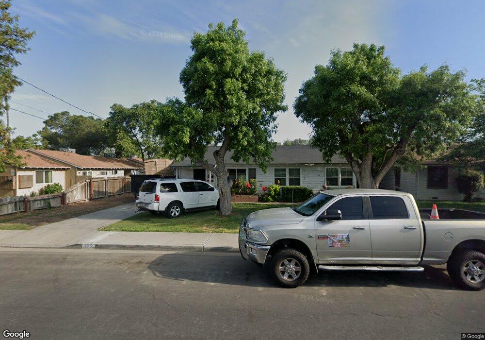
312 E Malone St Hanford, CA 93230
Estimated Value: $217,000 - $288,390
2
Beds
1
Bath
1,006
Sq Ft
$257/Sq Ft
Est. Value
About This Home
This home is located at 312 E Malone St, Hanford, CA 93230 and is currently estimated at $258,098, approximately $256 per square foot. 312 E Malone St is a home located in Kings County with nearby schools including George Washington Elementary School, John F. Kennedy Junior High School, and Hanford High School.
Ownership History
Date
Name
Owned For
Owner Type
Purchase Details
Closed on
Jan 30, 2006
Sold by
Gonzalez Mayda
Bought by
Gonzalez Jorge
Current Estimated Value
Purchase Details
Closed on
Jan 18, 2006
Sold by
Madruga Ida Doris and Ida Doris Madruga Living Trust
Bought by
Orsaba Margarita and Gonzalez Jorge
Purchase Details
Closed on
Feb 9, 2005
Sold by
Madruga Ida Doris and Gamble Roger D
Bought by
Madruga Ida Doris and The Ida Doris Madruga Living T
Purchase Details
Closed on
Feb 21, 2001
Sold by
Madruga Ida Doris
Bought by
Madruga Ida Doris and Gamble Roger D
Create a Home Valuation Report for This Property
The Home Valuation Report is an in-depth analysis detailing your home's value as well as a comparison with similar homes in the area
Home Values in the Area
Average Home Value in this Area
Purchase History
| Date | Buyer | Sale Price | Title Company |
|---|---|---|---|
| Gonzalez Jorge | -- | Chicago Title Co | |
| Orsaba Margarita | $185,000 | Chicago Title Co | |
| Madruga Ida Doris | -- | -- | |
| Madruga Ida Doris | -- | Chicago Title Co |
Source: Public Records
Tax History
| Year | Tax Paid | Tax Assessment Tax Assessment Total Assessment is a certain percentage of the fair market value that is determined by local assessors to be the total taxable value of land and additions on the property. | Land | Improvement |
|---|---|---|---|---|
| 2025 | $2,683 | $252,814 | $88,826 | $163,988 |
| 2023 | $2,683 | $242,999 | $85,378 | $157,621 |
| 2022 | $2,627 | $238,235 | $83,704 | $154,531 |
| 2021 | $1,981 | $180,000 | $65,000 | $115,000 |
| 2020 | $1,798 | $160,000 | $60,000 | $100,000 |
| 2019 | $1,589 | $141,000 | $55,000 | $86,000 |
| 2018 | $1,536 | $137,500 | $50,000 | $87,500 |
| 2017 | $1,458 | $130,000 | $50,000 | $80,000 |
| 2016 | $1,468 | $130,000 | $40,000 | $90,000 |
| 2015 | $1,561 | $137,000 | $40,000 | $97,000 |
| 2014 | $1,265 | $111,002 | $35,159 | $75,843 |
Source: Public Records
Map
Nearby Homes
- 1250 N Harris St
- 1301 N Douty St
- 1395 N Alta Way
- 410 E Florinda St
- 18 E Grangeville Blvd
- #2 E Grangeville Spc 2 Blvd
- 98 E Grangeville Blvd
- 75 W Grangeville Blvd
- 315 E Florinda St
- 402 E Elm St
- 1318 N Redington St
- 325 Neville St
- 0 E Grangeville Blvd
- 1045 E Grangeville Blvd
- 1404 Kaweah St
- 1452 Beulah St
- 1901 N Kensington Way
- 760 Crass Ave
- 403 W Grangeville Blvd
- 605 E Myrtle St
- 314 E Malone St
- 306 E Malone St
- 320 E Malone St
- 307 E Malone St
- 1310 N Green St
- 304 E Malone St
- 1312 N Green St
- 324 E Malone St
- 305 E Malone St
- 321 E Malone St
- 309 E Malone St
- 1314 N Green St
- 230 E Malone St
- 313 E Malone St
- 1241 N Brown St
- 1320 N Green St
- 111 Brown
- 1233 N Brown St
- 404 E Malone St
- 1317 N Brown St
Your Personal Tour Guide
Ask me questions while you tour the home.