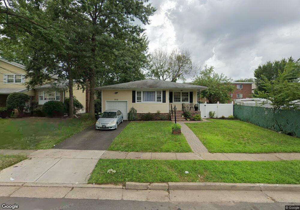
312 Gordon St Roselle, NJ 07203
Estimated Value: $509,000 - $570,000
3
Beds
2
Baths
1,365
Sq Ft
$388/Sq Ft
Est. Value
About This Home
This home is located at 312 Gordon St, Roselle, NJ 07203 and is currently estimated at $529,095, approximately $387 per square foot. 312 Gordon St is a home located in Union County with nearby schools including Washington Elementary School, Leonard V. Moore Middle School, and Grace Wilday Junior High School.
Ownership History
Date
Name
Owned For
Owner Type
Purchase Details
Closed on
Jan 18, 2011
Sold by
Joseph Sandy and Dsilva Edvino
Bought by
Esterile Suzie
Current Estimated Value
Purchase Details
Closed on
Jul 25, 2008
Sold by
Joseph Sandy
Bought by
Joseph Sandy and Dsilva Edvino
Purchase Details
Closed on
May 12, 2003
Sold by
Green Derrick
Bought by
Esterile Suzie
Home Financials for this Owner
Home Financials are based on the most recent Mortgage that was taken out on this home.
Original Mortgage
$198,000
Interest Rate
5.71%
Purchase Details
Closed on
Oct 6, 1999
Sold by
Bank Of America Nt & Sa
Bought by
Green Derrick and Green Zeleta
Home Financials for this Owner
Home Financials are based on the most recent Mortgage that was taken out on this home.
Original Mortgage
$116,440
Interest Rate
7.8%
Purchase Details
Closed on
Mar 9, 1999
Sold by
Tranchant Fred and Tranchant Beatrice
Bought by
Security Pacific National Trust Company
Create a Home Valuation Report for This Property
The Home Valuation Report is an in-depth analysis detailing your home's value as well as a comparison with similar homes in the area
Home Values in the Area
Average Home Value in this Area
Purchase History
| Date | Buyer | Sale Price | Title Company |
|---|---|---|---|
| Esterile Suzie | -- | None Available | |
| Joseph Sandy | -- | None Available | |
| Esterile Suzie | $220,810 | -- | |
| Green Derrick | $117,400 | -- | |
| Security Pacific National Trust Company | $25,000 | -- |
Source: Public Records
Mortgage History
| Date | Status | Borrower | Loan Amount |
|---|---|---|---|
| Previous Owner | Esterile Suzie | $198,000 | |
| Previous Owner | Green Derrick | $116,440 |
Source: Public Records
Tax History
| Year | Tax Paid | Tax Assessment Tax Assessment Total Assessment is a certain percentage of the fair market value that is determined by local assessors to be the total taxable value of land and additions on the property. | Land | Improvement |
|---|---|---|---|---|
| 2025 | $10,599 | $121,900 | $64,000 | $57,900 |
| 2024 | $10,333 | $121,900 | $64,000 | $57,900 |
| 2023 | $10,333 | $121,900 | $64,000 | $57,900 |
| 2022 | $10,405 | $121,900 | $64,000 | $57,900 |
| 2021 | $10,343 | $121,900 | $64,000 | $57,900 |
| 2020 | $10,310 | $121,900 | $64,000 | $57,900 |
| 2019 | $10,179 | $121,900 | $64,000 | $57,900 |
| 2018 | $10,123 | $121,900 | $64,000 | $57,900 |
| 2017 | $10,069 | $121,900 | $64,000 | $57,900 |
| 2016 | $9,847 | $121,900 | $64,000 | $57,900 |
| 2015 | $9,846 | $121,900 | $64,000 | $57,900 |
| 2014 | $9,572 | $121,900 | $64,000 | $57,900 |
Source: Public Records
Map
Nearby Homes
- 620 Prosper Ave
- 14 Arthur St
- 414 Martin St
- 335 Dermody St
- 411 Hory St
- 203 Vine St
- 511 Westfield Ave W
- 454 W 6th Ave
- 463 W 6th Ave
- 320 Pine St
- 204 Pine St
- 538 Dietz St
- 13 Independence Dr
- 119 Columbus Place Unit 2
- 119 Columbus Place
- 14 Colonial Rd
- 540 W 7th Ave
- 38 Pallant Ave
- 291 Seaton Ave Unit 1
- 427 Willow Ave
- 316 Gordon St
- 313 Amsterdam Ave
- 317 Amsterdam Ave
- 317 Amsterdam Ave Unit 3
- 320 Gordon St
- 300 Gordon St
- 401 Aldene Rd Unit 1
- 401 Aldene Rd
- 313 Gordon St
- 317 Gordon St
- 301 Amsterdam Ave
- 309 Gordon St
- 324 Gordon St
- 307 Gordon St
- 325 Gordon St
- 230 Gordon St
- 310 Amsterdam Ave
- 308 Floral St
- 312 Floral St
- 229 Amsterdam Ave
Your Personal Tour Guide
Ask me questions while you tour the home.