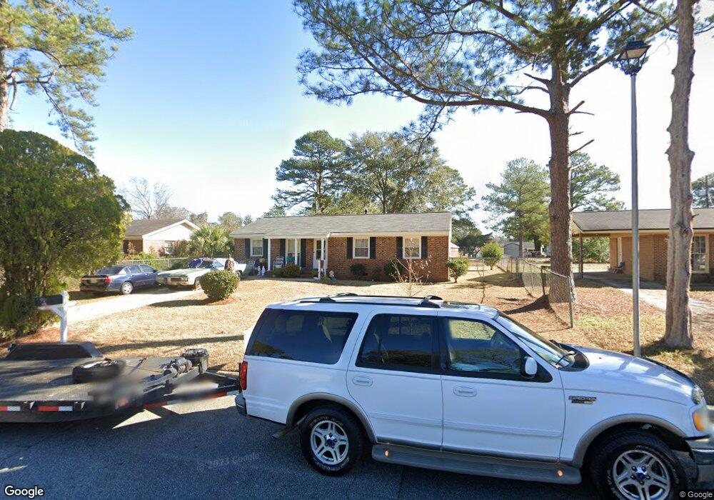
312 Lexington Dr Albany, GA 31705
Estimated Value: $62,000 - $67,000
3
Beds
1
Bath
999
Sq Ft
$64/Sq Ft
Est. Value
About This Home
This home is located at 312 Lexington Dr, Albany, GA 31705 and is currently estimated at $64,178, approximately $64 per square foot. 312 Lexington Dr is a home located in Dougherty County with nearby schools including Turner Elementary School, Albany Middle School, and Radium Springs Middle School.
Ownership History
Date
Name
Owned For
Owner Type
Purchase Details
Closed on
Feb 22, 2021
Sold by
Littleton Phyllis A
Bought by
Young Christopher
Current Estimated Value
Home Financials for this Owner
Home Financials are based on the most recent Mortgage that was taken out on this home.
Original Mortgage
$27,000
Outstanding Balance
$24,128
Interest Rate
2.65%
Mortgage Type
New Conventional
Estimated Equity
$40,050
Purchase Details
Closed on
Mar 27, 2003
Sold by
Sheppard Phyllis L
Bought by
Littleton Phyllis A
Purchase Details
Closed on
Oct 27, 1983
Sold by
Sheppard Phyllis L
Bought by
Littleton Phyllis A
Create a Home Valuation Report for This Property
The Home Valuation Report is an in-depth analysis detailing your home's value as well as a comparison with similar homes in the area
Home Values in the Area
Average Home Value in this Area
Purchase History
| Date | Buyer | Sale Price | Title Company |
|---|---|---|---|
| Young Christopher | $30,000 | -- | |
| Littleton Phyllis A | -- | -- | |
| Littleton Phyllis A | -- | -- |
Source: Public Records
Mortgage History
| Date | Status | Borrower | Loan Amount |
|---|---|---|---|
| Open | Young Christopher | $27,000 |
Source: Public Records
Tax History Compared to Growth
Tax History
| Year | Tax Paid | Tax Assessment Tax Assessment Total Assessment is a certain percentage of the fair market value that is determined by local assessors to be the total taxable value of land and additions on the property. | Land | Improvement |
|---|---|---|---|---|
| 2024 | $926 | $19,400 | $2,200 | $17,200 |
| 2023 | $768 | $19,400 | $2,200 | $17,200 |
| 2022 | $561 | $19,400 | $2,200 | $17,200 |
| 2021 | $841 | $19,400 | $2,200 | $17,200 |
| 2020 | $843 | $19,400 | $2,200 | $17,200 |
| 2019 | $846 | $19,400 | $2,200 | $17,200 |
| 2018 | $850 | $19,400 | $2,200 | $17,200 |
| 2017 | $792 | $19,400 | $2,200 | $17,200 |
| 2016 | $792 | $19,400 | $2,200 | $17,200 |
| 2015 | $712 | $19,400 | $2,200 | $17,200 |
| 2014 | $703 | $19,400 | $2,200 | $17,200 |
Source: Public Records
Map
Nearby Homes
- 308 Forrestal Ln
- 2725 Yorktown Ave
- 2731 Yorktown Ave
- 148 Force Dr
- 2802 Banks Ave
- 2529 Cherokee Dr
- 3007 E Park Ct
- 2523 Cherokee Dr
- 405 Pine Bluff Rd
- 410 Johnson Rd
- 234 Cone St
- 513 Johnson Rd
- 306 Elsom St
- 2921 Madeline Rd
- 2215 E Broad Ave
- 307 Acorn St
- 309 Acorn St
- 2006 Keystone Ave
- 2004 Keystone Ave
- 119 N West Rd
- 314 Lexington Dr
- 310 Lexington Dr
- 316 Lexington Dr
- 308 Lexington Dr
- 309 Lexington Dr
- 311 Lexington Dr
- 317 Enterprise Dr
- 315 Enterprise Dr
- 321 Essex Ct
- 307 Lexington Dr
- 318 Lexington Dr
- 313 Lexington Dr
- 306 Lexington Dr
- 311 Enterprise Dr
- 323 Essex Ct
- 305 Lexington Dr
- 315 Lexington Dr
- 320 Lexington Dr
- 309 Enterprise Dr
- 304 Lexington Dr