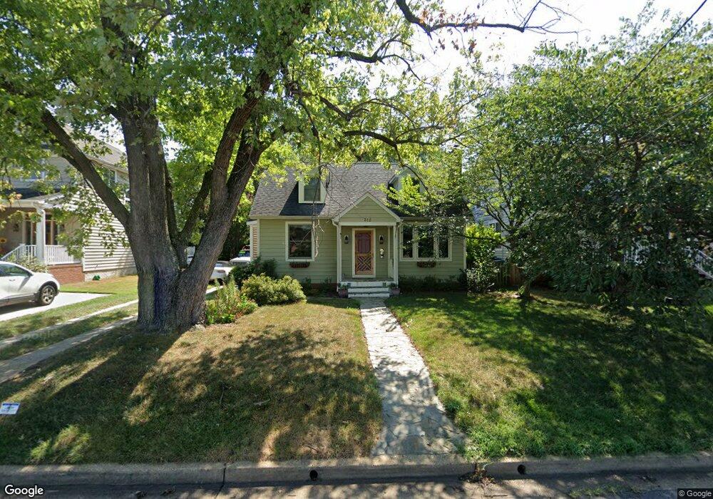
312 Locust Ave Annapolis, MD 21401
West Annapolis-Wardour NeighborhoodEstimated Value: $622,000 - $742,000
--
Bed
2
Baths
1,406
Sq Ft
$490/Sq Ft
Est. Value
About This Home
This home is located at 312 Locust Ave, Annapolis, MD 21401 and is currently estimated at $688,932, approximately $489 per square foot. 312 Locust Ave is a home located in Anne Arundel County with nearby schools including Germantown Elementary School, Wiley H. Bates Middle School, and Annapolis High School.
Ownership History
Date
Name
Owned For
Owner Type
Purchase Details
Closed on
Mar 19, 2003
Sold by
Beall Stacey A
Bought by
Triandos Nick and Drew Dominique
Current Estimated Value
Purchase Details
Closed on
Sep 3, 1999
Sold by
James Shawn D
Bought by
Beall Stacey A and Beall Claiborne B
Purchase Details
Closed on
Dec 5, 1996
Sold by
Lynch Jeremy R
Bought by
James Shawn D and James Cynthia M
Purchase Details
Closed on
Jun 22, 1995
Sold by
Mccormick Michael K
Bought by
Lynch Jeremy R
Home Financials for this Owner
Home Financials are based on the most recent Mortgage that was taken out on this home.
Original Mortgage
$128,000
Interest Rate
7.82%
Create a Home Valuation Report for This Property
The Home Valuation Report is an in-depth analysis detailing your home's value as well as a comparison with similar homes in the area
Home Values in the Area
Average Home Value in this Area
Purchase History
| Date | Buyer | Sale Price | Title Company |
|---|---|---|---|
| Triandos Nick | $324,900 | -- | |
| Beall Stacey A | $220,800 | -- | |
| James Shawn D | $169,000 | -- | |
| Lynch Jeremy R | $160,000 | -- |
Source: Public Records
Mortgage History
| Date | Status | Borrower | Loan Amount |
|---|---|---|---|
| Previous Owner | Lynch Jeremy R | $128,000 | |
| Closed | James Shawn D | -- |
Source: Public Records
Tax History Compared to Growth
Tax History
| Year | Tax Paid | Tax Assessment Tax Assessment Total Assessment is a certain percentage of the fair market value that is determined by local assessors to be the total taxable value of land and additions on the property. | Land | Improvement |
|---|---|---|---|---|
| 2025 | $5,788 | $501,133 | -- | -- |
| 2024 | $5,788 | $473,067 | $0 | $0 |
| 2023 | $5,511 | $445,000 | $331,900 | $113,100 |
| 2022 | $5,311 | $434,600 | $0 | $0 |
| 2021 | $5,074 | $424,200 | $0 | $0 |
| 2020 | $5,074 | $413,800 | $306,300 | $107,500 |
| 2019 | $5,032 | $412,100 | $0 | $0 |
| 2018 | $4,934 | $410,400 | $0 | $0 |
| 2017 | $4,535 | $408,700 | $0 | $0 |
| 2016 | -- | $392,167 | $0 | $0 |
| 2015 | -- | $375,633 | $0 | $0 |
| 2014 | -- | $359,100 | $0 | $0 |
Source: Public Records
Map
Nearby Homes
- 126 Sumner Rd
- 20 Glen Ave
- 233 Farragut Rd
- 10 N Homeland Ave
- 216 Gross Ave
- 1207 Mcguckian St
- 5 Park Place Unit 602
- 5 Park Place Unit 514
- 5 Park Place Unit 224
- 5 Park Place Unit 107
- 5 Park Place Unit 626
- 5 Park Place Unit 431
- 5 Park Place Unit 217
- 5 Park Place Unit 507
- 5 Park Place Unit 428
- 5 Park Place Unit 722
- 5 Park Place Unit 527
- 5 Park Place Unit 314
- 5 Park Place Unit 102
- 201 Bowie Ave