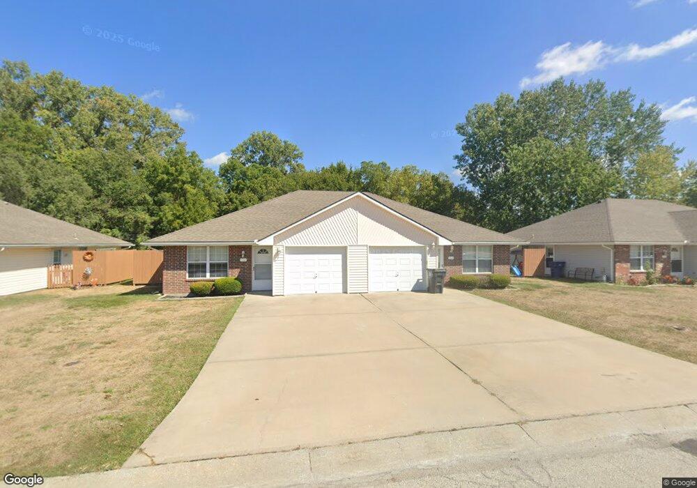
312 Lois Ln Grain Valley, MO 64029
Estimated Value: $288,000 - $338,000
4
Beds
2
Baths
1,880
Sq Ft
$166/Sq Ft
Est. Value
About This Home
This home is located at 312 Lois Ln, Grain Valley, MO 64029 and is currently estimated at $311,919, approximately $165 per square foot. 312 Lois Ln is a home with nearby schools including Grain Valley High School.
Ownership History
Date
Name
Owned For
Owner Type
Purchase Details
Closed on
Feb 5, 2013
Sold by
Wilson Wesley
Bought by
Wilson Erica
Current Estimated Value
Purchase Details
Closed on
Jul 13, 2000
Sold by
Calton Ila J
Bought by
Calton Ila J and Calton Roger W
Home Financials for this Owner
Home Financials are based on the most recent Mortgage that was taken out on this home.
Original Mortgage
$104,000
Outstanding Balance
$38,084
Interest Rate
8.56%
Mortgage Type
Purchase Money Mortgage
Estimated Equity
$273,835
Purchase Details
Closed on
Jul 11, 2000
Sold by
Lafal Rick M and Lafal Sheila L
Bought by
Calton Ila J
Home Financials for this Owner
Home Financials are based on the most recent Mortgage that was taken out on this home.
Original Mortgage
$104,000
Outstanding Balance
$38,084
Interest Rate
8.56%
Mortgage Type
Purchase Money Mortgage
Estimated Equity
$273,835
Create a Home Valuation Report for This Property
The Home Valuation Report is an in-depth analysis detailing your home's value as well as a comparison with similar homes in the area
Home Values in the Area
Average Home Value in this Area
Purchase History
| Date | Buyer | Sale Price | Title Company |
|---|---|---|---|
| Wilson Erica | -- | None Available | |
| Calton Ila J | -- | Stewart Title | |
| Calton Ila J | -- | Stewart Title |
Source: Public Records
Mortgage History
| Date | Status | Borrower | Loan Amount |
|---|---|---|---|
| Open | Calton Ila J | $104,000 |
Source: Public Records
Tax History Compared to Growth
Tax History
| Year | Tax Paid | Tax Assessment Tax Assessment Total Assessment is a certain percentage of the fair market value that is determined by local assessors to be the total taxable value of land and additions on the property. | Land | Improvement |
|---|---|---|---|---|
| 2025 | $3,322 | $44,225 | $7,040 | $37,185 |
| 2024 | $3,198 | $40,329 | $6,401 | $33,928 |
| 2023 | $3,198 | $40,329 | $5,736 | $34,593 |
| 2022 | $3,031 | $33,440 | $3,515 | $29,925 |
| 2021 | $2,960 | $33,440 | $3,515 | $29,925 |
| 2020 | $2,633 | $29,336 | $3,515 | $25,821 |
| 2019 | $2,579 | $29,336 | $3,515 | $25,821 |
| 2018 | $2,373 | $25,218 | $3,196 | $22,022 |
| 2017 | $2,312 | $25,218 | $3,196 | $22,022 |
| 2016 | $2,312 | $24,586 | $4,066 | $20,520 |
| 2014 | $2,071 | $21,850 | $4,276 | $17,574 |
Source: Public Records
Map
Nearby Homes
- 1024 Christie Ln
- 200 Cross Creek Ln
- 209 SW Cross Creek Dr
- 207 Pebblebrook St
- 725 SW Tisha Ln
- 636 SW Lakeview Dr
- 640 SW Crestview Dr
- 509 SW Joseph Ct
- 714 SW Brome Dr
- 1215 SW Lone Star Ct
- 506 SW Meadowood Dr
- 1418 SW Blue Branch Dr
- 401 S Minter Rd
- 1214 SW Windcrest Ct
- 518 South St
- 621 SW Tisha Ln
- 1219 SW Windcrest Ct
- 512 Broadway St
- 913 SW Abar Dr
- 1309 SW Graystone Cir
- 316 Lois Ln
- 308 Lois Ln
- 304 Lois Ln
- 1002 SW Sandy Ln
- 930 SW Sandy Ln
- 0 Sandy Ln
- 1001 Christie Ln
- 1003 Christie Ln
- 30612 Duncan Rd
- 995 SW Sandy Ln
- 300 Lois Ln
- 926 SW Sandy Ln
- 1005 Christie Ln
- 1006 Sandy Ln
- 1001 SW Sandy Ln
- 931 SW Sandy Ln
- 998 Christie Ln
- 1000 Christie Ln
- 1002 Christie Ln
- 1005 SW Sandy Ln