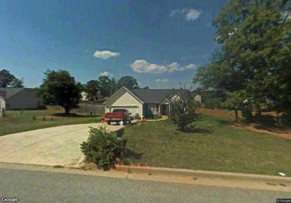
312 Lokeys Ridge Rd Bethlehem, GA 30620
Estimated Value: $311,000 - $329,000
--
Bed
2
Baths
1,518
Sq Ft
$212/Sq Ft
Est. Value
About This Home
This home is located at 312 Lokeys Ridge Rd, Bethlehem, GA 30620 and is currently estimated at $321,620, approximately $211 per square foot. 312 Lokeys Ridge Rd is a home located in Barrow County with nearby schools including Yargo Elementary School, Haymon-Morris Middle School, and Apalachee High School.
Ownership History
Date
Name
Owned For
Owner Type
Purchase Details
Closed on
Nov 10, 2025
Sold by
Craft Robin Kay
Bought by
Perez Samuel Remigio Reyes
Current Estimated Value
Purchase Details
Closed on
Feb 6, 2013
Sold by
Craft John
Bought by
Craft Smith Robin Kay
Purchase Details
Closed on
May 14, 2007
Sold by
Cooper Lewis
Bought by
Craft John
Purchase Details
Closed on
Sep 27, 2000
Sold by
Parkview Development
Bought by
Star Home Builders I
Purchase Details
Closed on
Feb 3, 2000
Bought by
Parkview Development
Create a Home Valuation Report for This Property
The Home Valuation Report is an in-depth analysis detailing your home's value as well as a comparison with similar homes in the area
Home Values in the Area
Average Home Value in this Area
Purchase History
| Date | Buyer | Sale Price | Title Company |
|---|---|---|---|
| Perez Samuel Remigio Reyes | $200,000 | -- | |
| Craft Smith Robin Kay | -- | -- | |
| Craft John | -- | -- | |
| Star Home Builders I | $280,000 | -- | |
| Parkview Development | -- | -- |
Source: Public Records
Tax History Compared to Growth
Tax History
| Year | Tax Paid | Tax Assessment Tax Assessment Total Assessment is a certain percentage of the fair market value that is determined by local assessors to be the total taxable value of land and additions on the property. | Land | Improvement |
|---|---|---|---|---|
| 2024 | $2,617 | $106,270 | $25,200 | $81,070 |
| 2023 | $3,002 | $106,670 | $25,200 | $81,470 |
| 2022 | $2,122 | $74,784 | $20,000 | $54,784 |
| 2021 | $1,955 | $65,365 | $16,000 | $49,365 |
| 2020 | $1,739 | $58,141 | $16,000 | $42,141 |
| 2019 | $1,771 | $58,221 | $16,000 | $42,221 |
| 2018 | $1,662 | $55,421 | $13,200 | $42,221 |
| 2017 | $1,375 | $47,218 | $13,200 | $34,018 |
| 2016 | $1,248 | $42,957 | $13,200 | $29,757 |
| 2015 | $1,254 | $42,957 | $13,200 | $29,757 |
| 2014 | $1,065 | $36,558 | $6,468 | $30,090 |
| 2013 | -- | $35,100 | $6,468 | $28,632 |
Source: Public Records
Map
Nearby Homes
- 303 Ron Dr
- 209 Angie Way
- 1129 Loganville Hwy
- 1441 Dillard Heights Dr
- 1111 Otis Dr
- 0 Jb Owens Unit 7552902
- 0 Jb Owens Unit 7552891
- 0 Jb Owens Unit LOT 2 - 2.09 ACRES
- 0 Jb Owens Unit LOT 3 - 2.01 ACRES
- 1024 Lyndhurst Ln
- The Barnes Plan at River Meadows
- The Paisley Plan at River Meadows
- The Rose II Plan at River Meadows
- The Logan Plan at River Meadows
- 758 Clarence Edwards Rd
- 1164 Otis Dr
- 190 Lokeys Ln
- 637 Sleeping Meadow Ln
- 0 Tanners Bridge Rd Unit 10588144
- 286 Meadows Dr
- 314 Lokeys Ridge Rd
- 308 Lokeys Ridge Rd
- 410 Lokeys Ridge Rd
- 408 Lokeys Ridge Rd
- 316 Lokeys Ridge Rd
- 412 Lokeys Ridge Rd Unit GA1235
- 412 Lokeys Ridge Rd
- 412 Lokeys Ridge Rd
- 412 Lokeys Ridge Rd Unit GA12350
- 309 Lokey's Ridge Rd
- 302 Lokeys Ridge Rd
- 311 Lokeys Ridge Rd
- 313 Lokeys Ridge Rd
- 309 Lokeys Ridge Rd
- 406 Lokeys Ridge Rd Unit 45B
- 406 Lokeys Ridge Rd
- 420 Lokeys Ridge Rd
- 315 Lokeys Ridge Rd
- 307 Lokeys Ridge Rd
- 318 Lokeys Ridge Rd