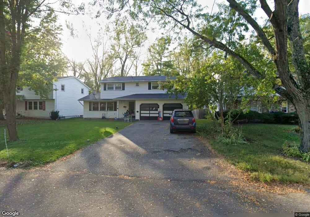
312 Longmeadow Dr Syracuse, NY 13205
South Valley NeighborhoodEstimated Value: $244,112 - $303,000
4
Beds
3
Baths
1,744
Sq Ft
$159/Sq Ft
Est. Value
About This Home
This home is located at 312 Longmeadow Dr, Syracuse, NY 13205 and is currently estimated at $277,528, approximately $159 per square foot. 312 Longmeadow Dr is a home located in Onondaga County with nearby schools including Meachem Elementary School, Clary Middle School, and Corcoran High School.
Ownership History
Date
Name
Owned For
Owner Type
Purchase Details
Closed on
Nov 20, 2020
Sold by
Trf Property Llc
Bought by
Ulm Davis
Current Estimated Value
Home Financials for this Owner
Home Financials are based on the most recent Mortgage that was taken out on this home.
Original Mortgage
$233,750
Outstanding Balance
$204,238
Interest Rate
2.7%
Mortgage Type
Stand Alone Refi Refinance Of Original Loan
Estimated Equity
$73,290
Purchase Details
Closed on
Feb 20, 2015
Sold by
Stroman Latonia
Bought by
Stroman Joseph
Purchase Details
Closed on
May 3, 2007
Sold by
Theodore Kenol
Bought by
Stroman Joseph
Purchase Details
Closed on
Jun 28, 2001
Sold by
Knapp Timothy and Knapp Patricia S
Bought by
Theodore Kenol and Theodore Nanette M.S.
Create a Home Valuation Report for This Property
The Home Valuation Report is an in-depth analysis detailing your home's value as well as a comparison with similar homes in the area
Home Values in the Area
Average Home Value in this Area
Purchase History
We collect this data history from publicly available records. To have your information removed, we recommend requesting removal directly through your county’s website.
| Date | Buyer | Sale Price | Title Company |
|---|---|---|---|
| Ulm Davis | $275,000 | None Available | |
| Ulm Davis B | $275,000 | None Available | |
| Stroman Joseph | -- | -- | |
| Stroman Joseph | $122,850 | Susan N Esce | |
| Theodore Kenol | $106,000 | Joel Wenk |
Source: Public Records
Mortgage History
We collect this data history from publicly available records. To have your information removed, we recommend requesting removal directly through your county’s website.
| Date | Status | Borrower | Loan Amount |
|---|---|---|---|
| Open | Ulm Davis B | $233,750 | |
| Closed | Ulm Davis | $233,750 |
Source: Public Records
Tax History
| Year | Tax Paid | Tax Assessment Tax Assessment Total Assessment is a certain percentage of the fair market value that is determined by local assessors to be the total taxable value of land and additions on the property. | Land | Improvement |
|---|---|---|---|---|
| 2025 | $2,597 | $107,000 | $17,200 | $89,800 |
| 2024 | $1,600 | $107,000 | $17,200 | $89,800 |
| 2023 | $1,639 | $107,000 | $17,200 | $89,800 |
| 2022 | $1,548 | $107,000 | $17,200 | $89,800 |
| 2021 | $1,548 | $97,000 | $17,200 | $79,800 |
| 2020 | $1,642 | $97,000 | $17,200 | $79,800 |
| 2019 | $1,647 | $97,000 | $17,200 | $79,800 |
| 2018 | $1,647 | $97,000 | $17,200 | $79,800 |
| 2017 | $1,593 | $97,000 | $17,200 | $79,800 |
| 2016 | $1,622 | $97,000 | $17,200 | $79,800 |
| 2015 | -- | $97,000 | $17,200 | $79,800 |
| 2014 | -- | $97,000 | $17,200 | $79,800 |
Source: Public Records
Map
Nearby Homes
- 117 Rosemont Dr
- 206 Rosemont Dr
- 204 Stonefield Rd
- 221 Stonefield Rd
- 207 Brooklea Dr
- 118 Ruhamah Ave
- 210 Ruhamah Ave
- 225 Ruhamah Ave
- 208 Harding Place
- 203 E Cheltenham Rd
- 1925 Valley Dr
- 108 Byrne Place
- 4902 Salina S St
- 4896 St
- 139 Sunrise Dr
- 144 W Roswell Ave
- 111 Macon St
- 256 Wendell Ave
- 120 Snell Terrace
- 308 Kramer Dr
- 314 Longmeadow Dr
- 310 Longmeadow Dr
- 316 Longmeadow Dr
- 308 Longmeadow Dr
- 306 Longmeadow Dr
- 318 Longmeadow Dr
- 313 Longmeadow Dr
- 315 Longmeadow Dr
- 317 Longmeadow Dr
- 309 Longmeadow Dr
- 304 Longmeadow Dr
- 320 Longmeadow Dr
- 307 Longmeadow Dr
- 101 Longmeadow Cir
- 302 Longmeadow Dr
- 105 Longmeadow Cir
- 311 Longmeadow Dr
- 305 Longmeadow Dr
- 400 Longmeadow Dr
- 100 Longmeadow Cir
Your Personal Tour Guide
Ask me questions while you tour the home.