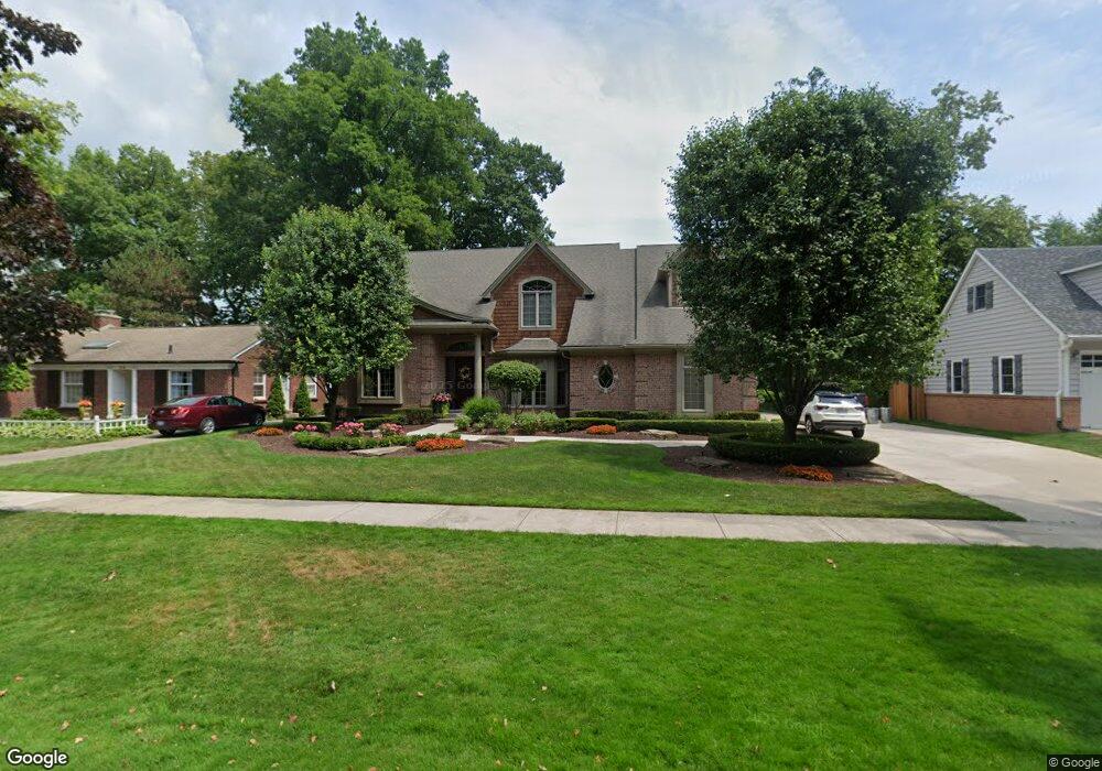
312 Lothrop Rd Grosse Pointe Farms, MI 48236
Estimated Value: $912,899 - $1,084,000
--
Bed
1
Bath
3,416
Sq Ft
$291/Sq Ft
Est. Value
About This Home
This home is located at 312 Lothrop Rd, Grosse Pointe Farms, MI 48236 and is currently estimated at $993,633, approximately $290 per square foot. 312 Lothrop Rd is a home located in Wayne County with nearby schools including Kerby Elementary School, Brownell Middle School, and Grosse Pointe South High School.
Ownership History
Date
Name
Owned For
Owner Type
Purchase Details
Closed on
Nov 8, 2006
Sold by
Michigan Home Builders Inc
Bought by
Fett Eric
Current Estimated Value
Purchase Details
Closed on
Jun 13, 2005
Sold by
Bowling Jean H
Bought by
Paluzzi Joseph
Create a Home Valuation Report for This Property
The Home Valuation Report is an in-depth analysis detailing your home's value as well as a comparison with similar homes in the area
Home Values in the Area
Average Home Value in this Area
Purchase History
| Date | Buyer | Sale Price | Title Company |
|---|---|---|---|
| Fett Eric | -- | Lawyers Title Insurance Co | |
| Michigan Home Builders Inc | -- | None Available | |
| Paluzzi Joseph | -- | Lawyers Title Ins |
Source: Public Records
Tax History Compared to Growth
Tax History
| Year | Tax Paid | Tax Assessment Tax Assessment Total Assessment is a certain percentage of the fair market value that is determined by local assessors to be the total taxable value of land and additions on the property. | Land | Improvement |
|---|---|---|---|---|
| 2025 | $4,688 | $547,400 | $0 | $0 |
| 2024 | $4,688 | $512,100 | $0 | $0 |
| 2023 | $4,295 | $468,500 | $0 | $0 |
| 2022 | $4,295 | $427,800 | $0 | $0 |
| 2021 | $7,880 | $404,300 | $0 | $0 |
| 2019 | $7,749 | $233,600 | $0 | $0 |
| 2018 | $3,966 | $212,400 | $0 | $0 |
| 2017 | $6,881 | $212,400 | $0 | $0 |
| 2016 | $7,213 | $192,100 | $0 | $0 |
| 2015 | $14,286 | $159,100 | $0 | $0 |
| 2013 | $13,840 | $138,400 | $0 | $0 |
| 2012 | $3,609 | $135,700 | $51,400 | $84,300 |
Source: Public Records
Map
Nearby Homes
- 302 Mount Vernon Ave
- 314 Mount Vernon Ave
- 317 Mount Vernon Ave
- 343 Mount Vernon Ave
- 380 Merriweather Rd
- 265 Williams Ave
- 259 Mount Vernon Ave
- 351 Moselle Place
- 415 Lothrop Rd
- 341 Mcmillan Rd
- 352 Mckinley Ave
- 218 Merriweather Rd
- 441 Manor St
- 194 Charlevoix Ave
- 276 Lewiston Rd
- 257 Ridge Rd
- 216 Ridge Rd
- 189 Cloverly Rd
- 827 Fisher Rd
- 432 Calvin Ave
- 316 Lothrop Rd
- 304 Lothrop Rd
- 233 Beaupre Ave
- 320 Lothrop Rd
- 311 Stephens Rd
- 305 Stephens Rd
- 317 Stephens Rd
- 303 Stephens Rd
- 324 Lothrop Rd
- 303 Lothrop Rd
- 311 Lothrop Rd
- 315 Lothrop Rd
- 319 Lothrop Rd
- 330 Lothrop Rd
- 331 Stephens Rd
- 306 Stephens Rd
- 296 Lothrop Rd
- 234 Beaupre Ave
- 295 Stephens Rd
- 225 Beaupre Ave