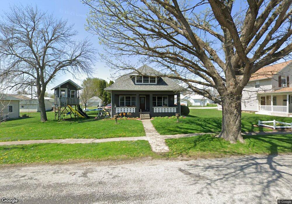
312 Maple St Bennett, IA 52721
Estimated Value: $152,395 - $196,000
4
Beds
2
Baths
1,614
Sq Ft
$110/Sq Ft
Est. Value
About This Home
This home is located at 312 Maple St, Bennett, IA 52721 and is currently estimated at $177,849, approximately $110 per square foot. 312 Maple St is a home located in Cedar County with nearby schools including Bennett Elementary School.
Ownership History
Date
Name
Owned For
Owner Type
Purchase Details
Closed on
May 23, 2014
Sold by
Schulz Mitchel D
Bought by
Costello Jeremiah E and Costello Sarah L
Current Estimated Value
Home Financials for this Owner
Home Financials are based on the most recent Mortgage that was taken out on this home.
Original Mortgage
$89,100
Interest Rate
4.34%
Mortgage Type
Future Advance Clause Open End Mortgage
Purchase Details
Closed on
Sep 22, 2008
Sold by
Jones Gerald Thomas and Jones Shirley A
Bought by
Schulz Mithcel D
Home Financials for this Owner
Home Financials are based on the most recent Mortgage that was taken out on this home.
Original Mortgage
$55,000
Interest Rate
6.52%
Mortgage Type
New Conventional
Create a Home Valuation Report for This Property
The Home Valuation Report is an in-depth analysis detailing your home's value as well as a comparison with similar homes in the area
Purchase History
| Date | Buyer | Sale Price | Title Company |
|---|---|---|---|
| Costello Jeremiah E | $60,000 | None Available | |
| Schulz Mithcel D | $44,000 | None Available |
Source: Public Records
Mortgage History
| Date | Status | Borrower | Loan Amount |
|---|---|---|---|
| Closed | Costello Jeremiah E | $89,100 | |
| Previous Owner | Schulz Mithcel D | $55,000 |
Source: Public Records
Tax History
| Year | Tax Paid | Tax Assessment Tax Assessment Total Assessment is a certain percentage of the fair market value that is determined by local assessors to be the total taxable value of land and additions on the property. | Land | Improvement |
|---|---|---|---|---|
| 2025 | $2,130 | $168,060 | $15,000 | $153,060 |
| 2024 | $2,130 | $138,410 | $15,000 | $123,410 |
| 2023 | $1,860 | $130,230 | $15,000 | $115,230 |
| 2022 | $1,632 | $98,340 | $13,130 | $85,210 |
| 2021 | $1,668 | $98,340 | $13,130 | $85,210 |
| 2020 | $1,672 | $98,340 | $13,130 | $85,210 |
| 2019 | $1,630 | $90,120 | $13,130 | $85,210 |
| 2018 | $1,578 | $90,120 | $0 | $0 |
| 2017 | $1,578 | $83,240 | $0 | $0 |
| 2016 | $1,098 | $62,520 | $0 | $0 |
| 2015 | $1,224 | $66,040 | $0 | $0 |
| 2014 | $1,016 | $66,040 | $0 | $0 |
Source: Public Records
Map
Nearby Homes
- 235 Main St
- 2248 250th St
- TBD 102nd Ave
- 2239 290th St
- 1614 270th St
- Lot 37 280th St
- Lot 42 280th St
- Lot 38 280th St
- Lot 14 Linda Ln
- Lot 13 Linda Ln
- Tbd 102nd Ave
- 445 Rhonda Rd
- 455 Rhonda Rd
- Lot 29 Rhonda Rd
- Lot 35 Rhonda Rd
- Lot 36 Rhonda Rd
- 829 Union Ave
- 0 200th St Unit NOC6335338
- 1748 190th St
- 320 East St
Your Personal Tour Guide
Ask me questions while you tour the home.