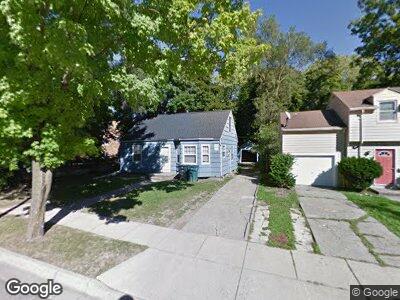
312 Milford St East Lansing, MI 48823
Estimated Value: $204,000 - $266,000
2
Beds
2
Baths
1,380
Sq Ft
$164/Sq Ft
Est. Value
About This Home
This home is located at 312 Milford St, East Lansing, MI 48823 and is currently estimated at $226,023, approximately $163 per square foot. 312 Milford St is a home located in Ingham County with nearby schools including Marble Elementary School, MacDonald Middle School, and East Lansing High School.
Ownership History
Date
Name
Owned For
Owner Type
Purchase Details
Closed on
Jun 11, 2010
Sold by
Federal Home Loan Mortgage Corporation
Bought by
J J Investment Properties Llc
Current Estimated Value
Purchase Details
Closed on
Mar 25, 2010
Sold by
Schmidt Barbara J
Bought by
Federal Home Loan Mortgage Corp
Purchase Details
Closed on
Nov 1, 1986
Create a Home Valuation Report for This Property
The Home Valuation Report is an in-depth analysis detailing your home's value as well as a comparison with similar homes in the area
Home Values in the Area
Average Home Value in this Area
Purchase History
| Date | Buyer | Sale Price | Title Company |
|---|---|---|---|
| Federal Home Loan Mortgage Corp | $43,848 | None Available | |
| -- | $43,000 | -- |
Source: Public Records
Mortgage History
| Date | Status | Borrower | Loan Amount |
|---|---|---|---|
| Open | J J Investment Properties Llc | $4,545,000 |
Source: Public Records
Tax History Compared to Growth
Tax History
| Year | Tax Paid | Tax Assessment Tax Assessment Total Assessment is a certain percentage of the fair market value that is determined by local assessors to be the total taxable value of land and additions on the property. | Land | Improvement |
|---|---|---|---|---|
| 2024 | $43 | $99,500 | $18,000 | $81,500 |
| 2023 | $4,633 | $92,400 | $15,900 | $76,500 |
| 2022 | $4,432 | $83,100 | $14,400 | $68,700 |
| 2021 | $4,340 | $81,000 | $12,700 | $68,300 |
| 2020 | $4,290 | $73,000 | $13,100 | $59,900 |
| 2019 | $4,137 | $65,700 | $14,800 | $50,900 |
| 2018 | $4,403 | $63,700 | $14,200 | $49,500 |
| 2017 | $4,248 | $61,900 | $16,000 | $45,900 |
| 2016 | -- | $60,700 | $15,900 | $44,800 |
| 2015 | -- | $56,700 | $30,770 | $25,930 |
| 2014 | -- | $54,000 | $30,550 | $23,450 |
Source: Public Records
Map
Nearby Homes
- 501 Virginia Ave
- 508 Lexington Ave
- 657 Spartan Ave
- 670 Stoddard Ave
- 1124 Burcham Dr
- 600 Albert Ave Unit 320
- 420 Bailey St
- 1561 Roseland Ave
- 1566 Snyder Rd
- 420 John R St
- 1653 Melrose Ave
- 466 Wayland Ave
- 635 Division St
- 632 Charles St
- 683 Moorland Dr
- 1424 Cedarhill Dr
- 254 Ridge Rd
- 1555 Ridgewood Dr
- 1833 Burrwood Cir Unit 23
- 1842 Burcham Dr