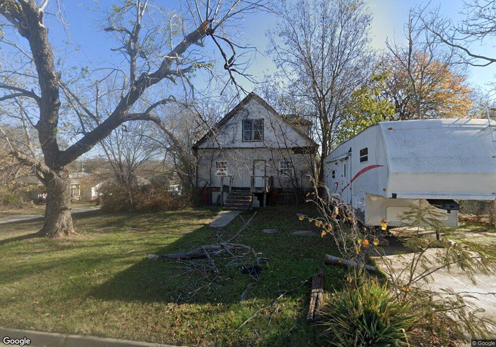
312 N 4th St Henryetta, OK 74437
Estimated Value: $64,761 - $94,000
2
Beds
1
Bath
1,326
Sq Ft
$60/Sq Ft
Est. Value
About This Home
This home is located at 312 N 4th St, Henryetta, OK 74437 and is currently estimated at $79,440, approximately $59 per square foot. 312 N 4th St is a home located in Okmulgee County with nearby schools including Henryetta Elementary School, Henryetta Middle School, and Henryetta High School.
Ownership History
Date
Name
Owned For
Owner Type
Purchase Details
Closed on
Jul 14, 2015
Sold by
Robertson David R
Bought by
Sellers Brittany
Current Estimated Value
Home Financials for this Owner
Home Financials are based on the most recent Mortgage that was taken out on this home.
Original Mortgage
$50,997
Outstanding Balance
$39,958
Interest Rate
4.08%
Mortgage Type
Purchase Money Mortgage
Estimated Equity
$39,482
Purchase Details
Closed on
Sep 11, 1998
Sold by
Shannon Anna
Bought by
Foster Eddie
Purchase Details
Closed on
Sep 8, 1994
Sold by
Hester Bridgey
Bought by
Childress Wally
Create a Home Valuation Report for This Property
The Home Valuation Report is an in-depth analysis detailing your home's value as well as a comparison with similar homes in the area
Home Values in the Area
Average Home Value in this Area
Purchase History
| Date | Buyer | Sale Price | Title Company |
|---|---|---|---|
| Sellers Brittany | $50,000 | None Available | |
| Foster Eddie | $7,500 | -- | |
| Childress Wally | $5,000 | -- |
Source: Public Records
Mortgage History
| Date | Status | Borrower | Loan Amount |
|---|---|---|---|
| Open | Sellers Brittany | $50,997 |
Source: Public Records
Tax History Compared to Growth
Tax History
| Year | Tax Paid | Tax Assessment Tax Assessment Total Assessment is a certain percentage of the fair market value that is determined by local assessors to be the total taxable value of land and additions on the property. | Land | Improvement |
|---|---|---|---|---|
| 2025 | $172 | $1,796 | $244 | $1,552 |
| 2024 | $172 | $1,796 | $244 | $1,552 |
| 2023 | $159 | $1,630 | $244 | $1,386 |
| 2022 | $152 | $1,552 | $244 | $1,308 |
| 2021 | $191 | $2,019 | $244 | $1,775 |
| 2020 | $182 | $1,832 | $244 | $1,588 |
| 2019 | $171 | $1,744 | $244 | $1,500 |
| 2018 | $164 | $1,662 | $244 | $1,418 |
| 2017 | $156 | $1,582 | $244 | $1,338 |
| 2016 | $149 | $1,507 | $244 | $1,263 |
| 2015 | $113 | $1,435 | $244 | $1,191 |
| 2014 | $110 | $1,366 | $244 | $1,122 |
Source: Public Records
Map
Nearby Homes
- 512 N 4th St
- 407 N 2nd St
- 502 W Merrick St
- 602 W Cummings St
- 112 W Merrick St
- 611 W Gentry St
- 805 W Gentry St
- 612 NE 1st St
- 810 W Gentry St
- 201 E Main St
- 214 N B St
- 202 E John St
- 318 E Trudgeon St
- 104500 S 4095 Rd
- 911 W Trudgeon St
- 305307 E Lewis St
- 1103 Oakwood Cir
- 310 W Corporation
- 512 E Trudgeon St
- 0 W Corporation St Unit 2535865
- 308 N 4th St
- 307 W Gentry St
- 305 W Gentry St
- 306 N 4th St
- 311 N 4th St
- 310 W Gentry St
- 404 N 4th St
- 311 N 3rd St
- 308 W Gentry St
- 308 W Division St
- 401 N 4th St
- 306 W Gentry St
- 310 W Division St
- 306 W Division St
- 304 W Gentry St
- 405 W Gentry St
- 402 W Division St
- 301 N 3rd St
- 401 N 3rd St
- 309 Henryetta Rt 3