Estimated Value: $296,601 - $297,000
3
Beds
3
Baths
1,851
Sq Ft
$160/Sq Ft
Est. Value
About This Home
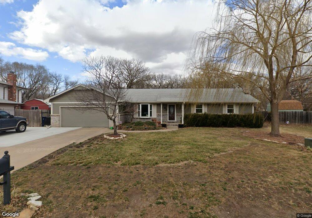
This home is located at 312 N Brookwood Dr, Derby, KS 67037 and is currently estimated at $296,801, approximately $160 per square foot. 312 N Brookwood Dr is a home located in Sedgwick County with nearby schools including Swaney Elementary School, Derby Middle School, and Derby High School.
Ownership History
Date
Name
Owned For
Owner Type
Purchase Details
Closed on
Aug 31, 2007
Sold by
Bullinger Norman P and Bullinger Susan E
Bought by
Myers Charles T
Current Estimated Value
Home Financials for this Owner
Home Financials are based on the most recent Mortgage that was taken out on this home.
Original Mortgage
$167,337
Outstanding Balance
$106,274
Interest Rate
6.72%
Mortgage Type
FHA
Estimated Equity
$190,527
Create a Home Valuation Report for This Property
The Home Valuation Report is an in-depth analysis detailing your home's value as well as a comparison with similar homes in the area
Home Values in the Area
Average Home Value in this Area
Purchase History
| Date | Buyer | Sale Price | Title Company |
|---|---|---|---|
| Myers Charles T | -- | None Available |
Source: Public Records
Mortgage History
| Date | Status | Borrower | Loan Amount |
|---|---|---|---|
| Open | Myers Charles T | $167,337 |
Source: Public Records
Tax History Compared to Growth
Tax History
| Year | Tax Paid | Tax Assessment Tax Assessment Total Assessment is a certain percentage of the fair market value that is determined by local assessors to be the total taxable value of land and additions on the property. | Land | Improvement |
|---|---|---|---|---|
| 2025 | $3,801 | $31,752 | $7,142 | $24,610 |
| 2023 | $3,801 | $27,900 | $4,106 | $23,794 |
| 2022 | $3,516 | $24,841 | $3,876 | $20,965 |
| 2021 | $3,338 | $23,219 | $3,243 | $19,976 |
| 2020 | $3,186 | $22,115 | $3,243 | $18,872 |
| 2019 | $2,978 | $20,666 | $3,243 | $17,423 |
| 2018 | $2,818 | $19,619 | $2,576 | $17,043 |
| 2017 | $2,560 | $0 | $0 | $0 |
| 2016 | $2,535 | $0 | $0 | $0 |
| 2015 | $2,491 | $0 | $0 | $0 |
| 2014 | $2,391 | $0 | $0 | $0 |
Source: Public Records
Map
Nearby Homes
- 201 N Willow Dr
- 1406 E Maple St
- 107 S Lauber Ln
- 1401 E Hickory Branch
- 1407 E Hickory Branch
- 931 E Wedgewood Dr
- 2 S Woodlawn Blvd
- 1301 E Pinion Rd
- 329 N Sarah Ct
- 428 S Spring Creek Dr
- 1118 E Oakwood Ct
- 1424 E Cresthill Rd
- 301 S Rock Rd
- 101 S Rock Rd
- 932 N El Paso Dr
- 1709 E Pinion Rd
- 610 S Honeybrook Ln
- 1625 E Tiara Pines Ct
- 416 S Westview Dr
- 1707 E Cresthill Rd
- 306 N Brookwood Dr
- 307 N Brookwood Dr
- 315 N Brookwood Dr
- 300 N Brookwood Dr
- 321 N Brookwood Dr
- 400 N Willow Dr
- 1112 E Post Oak St
- 1106 E Post Oak St
- 406 N Willow Dr
- 218 N Brookwood Dr
- 344 N Willow Dr
- 1100 E Post Oak St
- 412 N Willow Dr
- 419 N Brook Forest Rd
- 401 N Willow Dr
- 1018 E Post Oak St
- 212 N Brookwood Dr
- 338 N Willow Dr
- 407 N Willow Dr
- 1107 E Post Oak St