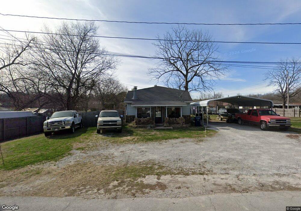
312 N College St Siloam Springs, AR 72761
Estimated Value: $179,341 - $253,000
--
Bed
1
Bath
1,519
Sq Ft
$143/Sq Ft
Est. Value
About This Home
This home is located at 312 N College St, Siloam Springs, AR 72761 and is currently estimated at $217,085, approximately $142 per square foot. 312 N College St is a home located in Benton County with nearby schools including Northside Elementary School, Southside Elementary School, and Delbert Pete & Pat Allen Elementary School.
Ownership History
Date
Name
Owned For
Owner Type
Purchase Details
Closed on
May 29, 2003
Bought by
Mackey
Current Estimated Value
Purchase Details
Closed on
Jan 26, 1998
Bought by
Mackey
Purchase Details
Closed on
May 3, 1985
Bought by
Mackey
Purchase Details
Closed on
Oct 16, 1981
Bought by
Eubanks
Purchase Details
Closed on
Jul 8, 1981
Bought by
Cox
Purchase Details
Closed on
Apr 28, 1981
Bought by
Eubanks
Create a Home Valuation Report for This Property
The Home Valuation Report is an in-depth analysis detailing your home's value as well as a comparison with similar homes in the area
Home Values in the Area
Average Home Value in this Area
Purchase History
| Date | Buyer | Sale Price | Title Company |
|---|---|---|---|
| Mackey | -- | -- | |
| Mackey | -- | -- | |
| Mackey | $9,000 | -- | |
| Eubanks | $5,000 | -- | |
| Cox | $12,000 | -- | |
| Eubanks | $8,000 | -- |
Source: Public Records
Tax History Compared to Growth
Tax History
| Year | Tax Paid | Tax Assessment Tax Assessment Total Assessment is a certain percentage of the fair market value that is determined by local assessors to be the total taxable value of land and additions on the property. | Land | Improvement |
|---|---|---|---|---|
| 2025 | $1,046 | $28,298 | $7,400 | $20,898 |
| 2024 | $1,025 | $28,298 | $7,400 | $20,898 |
| 2023 | $976 | $19,800 | $5,600 | $14,200 |
| 2022 | $557 | $19,800 | $5,600 | $14,200 |
| 2021 | $513 | $19,800 | $5,600 | $14,200 |
| 2020 | $473 | $15,080 | $5,600 | $9,480 |
| 2019 | $441 | $15,080 | $5,600 | $9,480 |
| 2018 | $435 | $15,080 | $5,600 | $9,480 |
| 2017 | $371 | $15,080 | $5,600 | $9,480 |
| 2016 | $371 | $15,080 | $5,600 | $9,480 |
| 2015 | $639 | $11,090 | $1,600 | $9,490 |
| 2014 | $289 | $11,090 | $1,600 | $9,490 |
Source: Public Records
Map
Nearby Homes
- 411 N Maple St
- 503 N Wright St
- TBD South N Elm St
- 0000 N Elm St
- 114 S College St
- 605 N Wright St
- 210 E Ashley St
- 414 N Maxwell St
- 403 E University St
- 716 N Mount Olive St
- 0 Tbd St Andrews
- 517 N Madison St
- 506 E Ashley St
- 730 N Walnut Ct
- 111 E Helena St
- 101 E Central St
- 402 Greenwood
- 607 Amanda Dr
- 908 Willow Ct
- 606 Gail Dr
- 318 N College St
- 306 N College St
- 302 W Benton St
- 316 W Benton St
- 302 N College St
- 305 N Maple St
- 309 W Ashley St
- 216 W Benton St
- 305 W Benton St
- 315 W Benton St
- 217 W Benton St
- 306 N Wright St
- 414 N College St
- 300 N Wright St
- 201 N College St
- 406 N Maple St
- 404 N Wright St
- 413 N College St
- 849/851 N Wright St
- 418 N College St