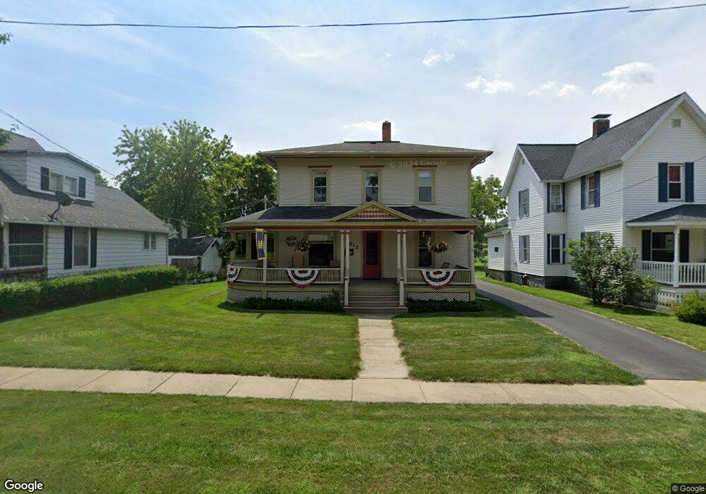
312 Perry St Albion, MI 49224
Estimated Value: $151,000 - $158,000
3
Beds
1
Bath
1,505
Sq Ft
$103/Sq Ft
Est. Value
About This Home
This home is located at 312 Perry St, Albion, MI 49224 and is currently estimated at $155,038, approximately $103 per square foot. 312 Perry St is a home located in Calhoun County with nearby schools including Harrington Elementary School, Lakeside Charter School - Albion, and St. John School.
Ownership History
Date
Name
Owned For
Owner Type
Purchase Details
Closed on
Mar 11, 2004
Sold by
Haeske William A and Haeske Lois A
Bought by
Clark Thomas E and Clark Ruth E
Current Estimated Value
Purchase Details
Closed on
Feb 1, 2004
Sold by
Haeske William L and Haeske Judith M
Bought by
Haeske William A and Clark Ruth E
Purchase Details
Closed on
Jan 20, 2004
Sold by
Clark Adam P and Clark Leanne R
Bought by
Haeske William A and Clark Ruth E
Purchase Details
Closed on
Dec 30, 2003
Sold by
Hicks Amy R
Bought by
Haeske William A and Clark Ruth E
Purchase Details
Closed on
Dec 18, 2003
Sold by
Haeske William L and Haeske Barcia J
Bought by
Clark Adam P and Clark Thomas E
Create a Home Valuation Report for This Property
The Home Valuation Report is an in-depth analysis detailing your home's value as well as a comparison with similar homes in the area
Home Values in the Area
Average Home Value in this Area
Purchase History
| Date | Buyer | Sale Price | Title Company |
|---|---|---|---|
| Clark Thomas E | -- | -- | |
| Haeske William A | -- | -- | |
| Haeske William A | -- | -- | |
| Haeske William A | -- | -- | |
| Haeske William A | -- | -- | |
| Clark Adam P | -- | -- |
Source: Public Records
Tax History Compared to Growth
Tax History
| Year | Tax Paid | Tax Assessment Tax Assessment Total Assessment is a certain percentage of the fair market value that is determined by local assessors to be the total taxable value of land and additions on the property. | Land | Improvement |
|---|---|---|---|---|
| 2025 | $1,145 | $62,700 | $0 | $0 |
| 2024 | $763 | $57,100 | $0 | $0 |
| 2023 | $962 | $47,400 | $0 | $0 |
| 2022 | $692 | $39,700 | $0 | $0 |
| 2021 | $934 | $40,000 | $0 | $0 |
| 2020 | $936 | $36,800 | $0 | $0 |
| 2019 | $848 | $31,700 | $0 | $0 |
| 2018 | $848 | $23,300 | $6,500 | $16,800 |
| 2017 | $0 | $17,400 | $0 | $0 |
| 2016 | $0 | $18,100 | $0 | $0 |
| 2015 | -- | $19,900 | $0 | $0 |
| 2014 | -- | $22,300 | $0 | $0 |
Source: Public Records
Map
Nearby Homes
- 116 E Mulberry St
- 112 E Mulberry St
- 211 E Mulberry St
- 404 N Superior St
- 410 Bidwell St
- 116 W Vine St
- 508 Linden Ave
- 214 W Porter St
- 117 E Walnut St
- 208 W Erie St
- 211 W Erie St
- 310 Fitch St
- 505 Fitch St
- 208 E Oak St
- 813 Prospect St
- 408 Washington St
- 211 S Ann St
- 217 S Ann St
- 901 Barnes St
- 501 W Cass St
- 306 Perry St
- 304 Perry St
- 111 N Berrien St
- 107 N Berrien St
- 317 E Cass St
- 302 Perry St
- 307 E Cass St
- 311 Perry St
- 307 Perry St
- 317 Perry St
- 102 S Monroe St
- 303 Perry St
- 101 N Berrien St
- 301 Perry St
- 203 N Berrien St
- 201 N Berrien St
- 205 N Berrien St
- 310 E Michigan Ave
- 112 N Berrien St
- 206 N Monroe St