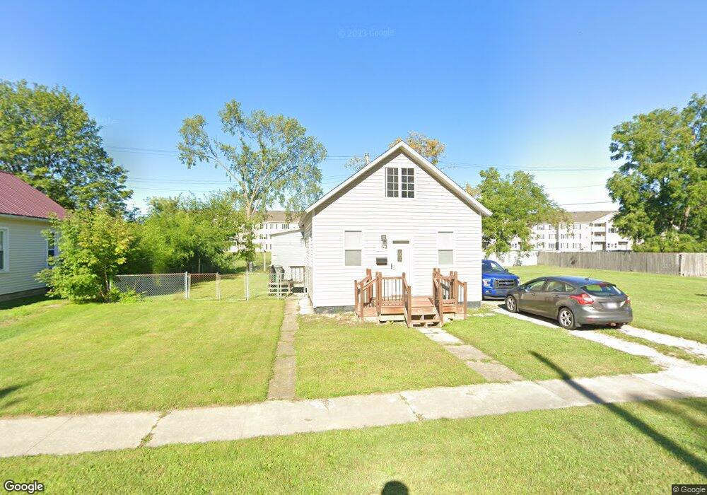
312 S 10th St Saint Clair, MI 48079
Estimated Value: $95,000 - $146,000
2
Beds
1
Bath
920
Sq Ft
$133/Sq Ft
Est. Value
About This Home
This home is located at 312 S 10th St, Saint Clair, MI 48079 and is currently estimated at $122,357, approximately $132 per square foot. 312 S 10th St is a home located in St. Clair County with nearby schools including Pine River Elementary School, St. Clair Middle School, and St. Clair High School.
Ownership History
Date
Name
Owned For
Owner Type
Purchase Details
Closed on
Feb 11, 2012
Sold by
Stocki Robert J and Stocki Christine L
Bought by
Bolduc Lawrence Joseph
Current Estimated Value
Purchase Details
Closed on
Jan 20, 2012
Sold by
Williams Catherine and Williams William
Bought by
Stocki Robert J and Stocki Christin L
Purchase Details
Closed on
Oct 29, 2010
Sold by
Stocki Robert and Stocki Christine
Bought by
Williams Catherine and Williams William
Purchase Details
Closed on
Jan 8, 2009
Sold by
Ernst Leroy J
Bought by
Us Bank National Association
Create a Home Valuation Report for This Property
The Home Valuation Report is an in-depth analysis detailing your home's value as well as a comparison with similar homes in the area
Home Values in the Area
Average Home Value in this Area
Purchase History
| Date | Buyer | Sale Price | Title Company |
|---|---|---|---|
| Bolduc Lawrence Joseph | $36,000 | Devon Title Agency | |
| Bolduc Lawrence Joseph | -- | Devon Title Agency | |
| Stocki Robert J | -- | None Available | |
| Williams Catherine | -- | Devon Title Agency | |
| Us Bank National Association | $80,653 | None Available |
Source: Public Records
Tax History
| Year | Tax Paid | Tax Assessment Tax Assessment Total Assessment is a certain percentage of the fair market value that is determined by local assessors to be the total taxable value of land and additions on the property. | Land | Improvement |
|---|---|---|---|---|
| 2025 | $1,046 | $50,100 | $0 | $0 |
| 2024 | $1,018 | $45,700 | $0 | $0 |
| 2023 | $955 | $45,600 | $0 | $0 |
| 2022 | $1,051 | $37,400 | $0 | $0 |
| 2020 | $993 | $36,300 | $36,300 | $0 |
| 2019 | $988 | $32,400 | $0 | $0 |
| 2018 | $994 | $28,700 | $0 | $0 |
| 2017 | $924 | $24,400 | $0 | $0 |
| 2016 | $854 | $24,400 | $0 | $0 |
| 2015 | -- | $24,300 | $24,300 | $0 |
| 2014 | -- | $22,600 | $22,600 | $0 |
| 2013 | -- | $23,100 | $0 | $0 |
Source: Public Records
Map
Nearby Homes
- 920 Clinton Ave
- 841 S 12th St
- 206 S 4th St
- 409 N 5th St
- 412 Orchard St
- 606 N 6th St
- 231 S Carney Dr
- 211 N Carney Dr
- 1760 Ash St
- TBD Range
- 1810 Riley Rd
- 1932 Sheldrake Ln Unit 30
- 1924 Shelldrake Ln Unit 32
- 249 Shelldrake Ln
- 239 Shelldrake Ln Unit 40
- 252 Shelldrake Ln
- 669 N Riverside Ave Unit 4
- 1423 S Riverside Ave
- 740 Highland Dr
- 1637 S Riverside Ave
Your Personal Tour Guide
Ask me questions while you tour the home.