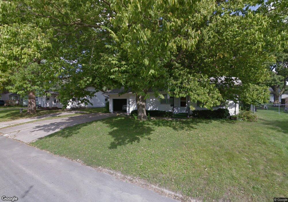
312 W 11th St N Newton, IA 50208
Estimated Value: $145,000 - $169,000
3
Beds
2
Baths
1,040
Sq Ft
$152/Sq Ft
Est. Value
About This Home
This home is located at 312 W 11th St N, Newton, IA 50208 and is currently estimated at $157,737, approximately $151 per square foot. 312 W 11th St N is a home located in Jasper County with nearby schools including Thomas Jefferson Elementary School, Woodrow Wilson Elementary School, and Berg Middle School.
Ownership History
Date
Name
Owned For
Owner Type
Purchase Details
Closed on
May 18, 2018
Sold by
Rhone Myron A and Rhone Betty J
Bought by
Straight Shamus
Current Estimated Value
Home Financials for this Owner
Home Financials are based on the most recent Mortgage that was taken out on this home.
Original Mortgage
$85,722
Outstanding Balance
$73,809
Interest Rate
4.4%
Mortgage Type
New Conventional
Estimated Equity
$83,928
Create a Home Valuation Report for This Property
The Home Valuation Report is an in-depth analysis detailing your home's value as well as a comparison with similar homes in the area
Home Values in the Area
Average Home Value in this Area
Purchase History
| Date | Buyer | Sale Price | Title Company |
|---|---|---|---|
| Straight Shamus | $85,500 | -- |
Source: Public Records
Mortgage History
| Date | Status | Borrower | Loan Amount |
|---|---|---|---|
| Open | Straight Shamus | $85,722 |
Source: Public Records
Tax History Compared to Growth
Tax History
| Year | Tax Paid | Tax Assessment Tax Assessment Total Assessment is a certain percentage of the fair market value that is determined by local assessors to be the total taxable value of land and additions on the property. | Land | Improvement |
|---|---|---|---|---|
| 2025 | $2,252 | $143,290 | $24,500 | $118,790 |
| 2024 | $2,252 | $129,070 | $24,500 | $104,570 |
| 2023 | $2,234 | $129,070 | $24,500 | $104,570 |
| 2022 | $2,232 | $117,250 | $24,500 | $92,750 |
| 2021 | $1,790 | $109,280 | $24,500 | $84,780 |
| 2020 | $1,790 | $84,940 | $20,810 | $64,130 |
| 2019 | $1,576 | $73,820 | $0 | $0 |
| 2018 | $1,576 | $73,820 | $0 | $0 |
| 2017 | $1,742 | $73,820 | $0 | $0 |
| 2016 | $1,784 | $73,820 | $0 | $0 |
| 2015 | $1,742 | $73,820 | $0 | $0 |
| 2014 | $1,674 | $73,820 | $0 | $0 |
Source: Public Records
Map
Nearby Homes
- 304 W 11th St N
- 549 W 10th St N
- 1000 1st Ave W
- 1100 1st Ave W
- 8 Chancery Ct
- 1221 Monroe Dr
- 210 W 13th St S
- 237 W 12th St S
- 308 W 8th St S
- 606 W 16th St N
- 429 1st Ave W
- 420 1st Ave W
- 625 S 3rd Ave W
- 303 W 5th St S
- 623 S 4th Ave W
- 1005 W 8th St N
- 316 N 9th Ave W
- 1431 Cardinal Ridge Dr
- 726 W 9th St S
- 702 W 6th St S
- 316 W 11th St N
- 308 W 11th St N
- 303 W 10th St N
- 322 W 11th St N
- 309 W 10th St N
- 301 W 10th St N Unit A
- 301 W 10th St N
- 307 W 11th St N
- 311 W 11th St N
- 224 W 11th St N
- 309 W 11th St N
- 313 W 11th St N
- 313 W 10th St N
- 315 W 11th St N Unit A
- 315 W 11th St N
- 221 W 11th St N
- 216 W 11th St N
- 317 W 10th St N
- 330 W 11th St N
- 215 W 10th St N