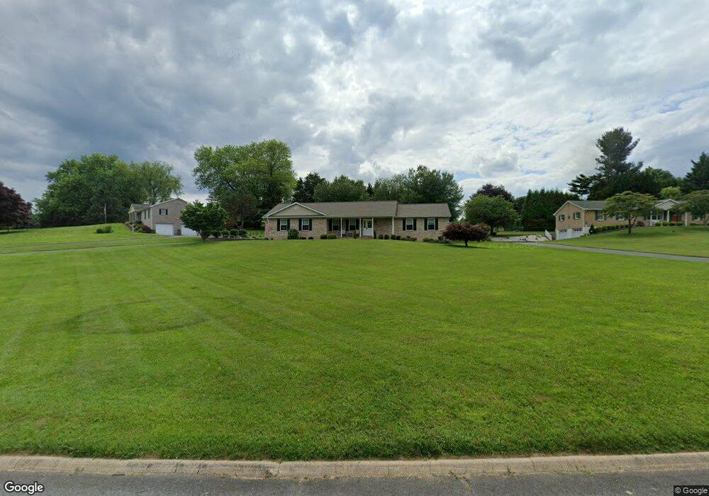
312 Whetstone Rd Forest Hill, MD 21050
Estimated Value: $468,000 - $552,000
Studio
3
Baths
1,906
Sq Ft
$270/Sq Ft
Est. Value
About This Home
This home is located at 312 Whetstone Rd, Forest Hill, MD 21050 and is currently estimated at $514,533, approximately $269 per square foot. 312 Whetstone Rd is a home located in Harford County with nearby schools including Forest Hill Elementary School, North Harford Middle School, and North Harford High School.
Ownership History
Date
Name
Owned For
Owner Type
Purchase Details
Closed on
Jul 13, 2021
Sold by
Brown Karen L and Estate Of Lawrence Acomes Sr
Bought by
Battlsta Anthony G and Battlsta Suzanne T
Current Estimated Value
Purchase Details
Closed on
Jan 8, 2019
Sold by
Comes Lawrence A and Brown Karen L
Bought by
Comes Lawrence A
Purchase Details
Closed on
Mar 2, 2011
Sold by
Comes Lawrence A
Bought by
Comes Lawrence A and Comes Helen M
Purchase Details
Closed on
Feb 18, 2011
Sold by
Comes Lawrence A
Bought by
Comes Lawrence A and Comes Helen M
Purchase Details
Closed on
Jan 11, 1996
Sold by
Shamrock Constr Inc
Bought by
Comes Lawrence A and Comes Helen M
Create a Home Valuation Report for This Property
The Home Valuation Report is an in-depth analysis detailing your home's value as well as a comparison with similar homes in the area
Purchase History
| Date | Buyer | Sale Price | Title Company |
|---|---|---|---|
| Battlsta Anthony G | $425,000 | Land Abstract & Escrow Llc | |
| Comes Lawrence A | -- | None Available | |
| Comes Lawrence A | -- | -- | |
| Comes Lawrence A | -- | -- | |
| Comes Lawrence A | $75,000 | -- |
Source: Public Records
Tax History
| Year | Tax Paid | Tax Assessment Tax Assessment Total Assessment is a certain percentage of the fair market value that is determined by local assessors to be the total taxable value of land and additions on the property. | Land | Improvement |
|---|---|---|---|---|
| 2025 | $4,216 | $403,000 | $113,900 | $289,100 |
| 2024 | $4,216 | $382,967 | $0 | $0 |
| 2023 | $4,016 | $362,933 | $0 | $0 |
| 2022 | $3,737 | $342,900 | $113,900 | $229,000 |
| 2020 | $3,780 | $322,367 | $0 | $0 |
| 2019 | $3,662 | $312,100 | $134,200 | $177,900 |
| 2018 | $3,534 | $306,233 | $0 | $0 |
| 2017 | $3,428 | $312,100 | $0 | $0 |
| 2016 | -- | $294,500 | $0 | $0 |
| 2015 | $3,646 | $294,500 | $0 | $0 |
| 2014 | $3,646 | $294,500 | $0 | $0 |
Source: Public Records
Map
Nearby Homes
- 308 Rock Spring Church Rd
- 2401 Scotlon Ct
- 600 Rock Spring Church Rd
- 2433 Maxa Meadows Ln
- 2032 Tiffany Terrace
- 2110 Mardic Dr
- 809 Gail Ct
- 2027 Mardic Dr
- 209 Christopher Rd
- 1817 Rock Spring Rd
- 2026 Mardic Dr
- 841 Bear Cabin Dr
- 1986 Esther Ct
- 106 Bower Ln
- 313 Willrich Cir Unit E
- 112 Gwen Dr Unit 1K
- 112 Gwen Dr Unit 1J
- 103 Sunshine Ct Unit C
- 111 Sunshine Ct Unit A
- 311 Willrich Cir Unit G
- 310 Whetstone Rd
- 314 Whetstone Rd
- 307 Whetstone Rd
- 311 Whetstone Rd
- 308 Whetstone Rd
- 316 Whetstone Rd
- 2305 Warfield Dr
- 2303 Warfield Dr
- 313 Whetstone Rd
- 305 Whetstone Rd
- 2307 Warfield Dr
- 315 Whetstone Rd
- 2301 Warfield Dr
- 306 Whetstone Rd
- 317 Whetstone Rd
- 303 Whetstone Rd
- 2309 Warfield Dr
- 2302 Warfield Dr
- 2235 Warfield Dr
- 304 Whetstone Rd