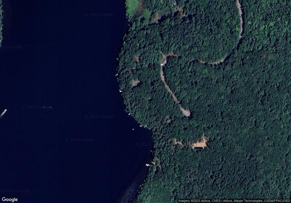
31213 Lawrence Dr Cushing, MN 56443
Estimated Value: $405,083 - $640,000
2
Beds
1
Bath
1,029
Sq Ft
$481/Sq Ft
Est. Value
About This Home
This home is located at 31213 Lawrence Dr, Cushing, MN 56443 and is currently estimated at $495,271, approximately $481 per square foot. 31213 Lawrence Dr is a home with nearby schools including Staples Motley Senior High School.
Ownership History
Date
Name
Owned For
Owner Type
Purchase Details
Closed on
Apr 2, 2021
Sold by
Loon Jon A Van and Bates Lori A
Bought by
Loon Jon A Van and Loon Revocable Trust
Current Estimated Value
Purchase Details
Closed on
Nov 2, 2012
Sold by
Douglas Linda A
Bought by
Vanloon Jon A and Bates Lori A
Home Financials for this Owner
Home Financials are based on the most recent Mortgage that was taken out on this home.
Original Mortgage
$240,000
Interest Rate
3.34%
Mortgage Type
New Conventional
Purchase Details
Closed on
Jul 29, 2005
Sold by
Douglas Linda A
Bought by
Vanloon Jon A and Bates Lori A
Home Financials for this Owner
Home Financials are based on the most recent Mortgage that was taken out on this home.
Original Mortgage
$315,000
Interest Rate
5.8%
Mortgage Type
Seller Take Back
Create a Home Valuation Report for This Property
The Home Valuation Report is an in-depth analysis detailing your home's value as well as a comparison with similar homes in the area
Purchase History
| Date | Buyer | Sale Price | Title Company |
|---|---|---|---|
| Loon Jon A Van | -- | None Available | |
| Vanloon Jon A | $365,000 | None Available | |
| Vanloon Jon A | $365,000 | Land Title Inc |
Source: Public Records
Mortgage History
| Date | Status | Borrower | Loan Amount |
|---|---|---|---|
| Previous Owner | Vanloon Jon A | $240,000 | |
| Previous Owner | Vanloon Jon A | $315,000 |
Source: Public Records
Tax History Compared to Growth
Tax History
| Year | Tax Paid | Tax Assessment Tax Assessment Total Assessment is a certain percentage of the fair market value that is determined by local assessors to be the total taxable value of land and additions on the property. | Land | Improvement |
|---|---|---|---|---|
| 2025 | $3,506 | $387,500 | $189,500 | $198,000 |
| 2024 | $3,456 | $382,200 | $176,500 | $205,700 |
| 2023 | $3,524 | $373,900 | $153,000 | $220,900 |
| 2022 | $3,102 | $339,500 | $153,000 | $186,500 |
| 2021 | $2,362 | $259,800 | $153,000 | $106,800 |
| 2020 | $2,408 | $709,000 | $459,000 | $250,000 |
| 2019 | $2,340 | $242,800 | $153,000 | $89,800 |
| 2018 | $2,370 | $223,400 | $153,000 | $70,400 |
| 2017 | $2,398 | $223,400 | $153,000 | $70,400 |
| 2016 | $2,372 | $0 | $0 | $0 |
| 2014 | $2,482 | $0 | $0 | $0 |
| 2013 | $2,482 | $0 | $0 | $0 |
Source: Public Records
Map
Nearby Homes
- 3287 Bluebird Rd
- 30883 Fish Trap Lake Dr
- 31604 Lowry Cir
- 3302 Telemark Trail
- TBD Lakeview Dr
- 32619 40th Ave
- TBD Ridge Rd
- L5 B1 Ridge Rd
- L3 B2 Ridge Rd
- 34497 Quiken Rd
- XXX Lake Camile Dr
- xxx Cedar Rd Marble Dr
- Diamond Dr
- Diamond Dr
- XXX Pebble Pass
- TBD Golf Course Cir
- TBDxxxx Golf Course Dr
- TBDxx Golf Course Dr
- TBDx Golf Course Dr
- TBDxxx Golf Course Dr
- 31235 Lawrence Dr
- 31191 Lawrence Dr
- 31287 Lawrence Dr
- 31291 Lawrence Dr
- TBD Lawrence Dr
- 31187 Lawrence Dr
- 3225 Thoroughfare Dr
- 31306 Lawrence Dr
- 3191 Thoroughfare Dr
- 3187 Thoroughfare Dr
- 31304 Lawrence Dr
- 3145 Thoroughfare Dr
- 3113 Thoroughfare Dr
- 3105 Thoroughfare Dr
- 31527 Lakeview Dr
- 3063 Thoroughfare Dr
- 30894 Fish Trap Lake Dr
- Tract A Thoroughfare Dr
- Tract B Thoroughfare Dr
- 2995 Thoroughfare Dr
