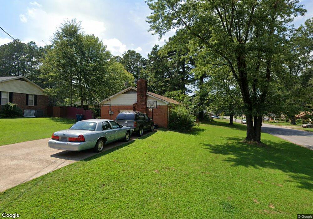
3126 N Circle Dr Humboldt, TN 38343
Estimated Value: $159,000 - $222,000
4
Beds
2
Baths
2,001
Sq Ft
$101/Sq Ft
Est. Value
About This Home
This home is located at 3126 N Circle Dr, Humboldt, TN 38343 and is currently estimated at $201,906, approximately $100 per square foot. 3126 N Circle Dr is a home located in Gibson County with nearby schools including Stigall Primary School, East Elementary School, and Humboldt Middle School.
Ownership History
Date
Name
Owned For
Owner Type
Purchase Details
Closed on
Jun 21, 2011
Sold by
Federal National Mortgage Association
Bought by
Johnson Ebony
Current Estimated Value
Purchase Details
Closed on
Feb 1, 2011
Sold by
Wade Erica
Bought by
Federal National Mtg Associati
Purchase Details
Closed on
Jan 24, 2005
Sold by
Fonville Steven B
Bought by
Wade James
Home Financials for this Owner
Home Financials are based on the most recent Mortgage that was taken out on this home.
Original Mortgage
$69,600
Interest Rate
5.66%
Purchase Details
Closed on
Apr 4, 2000
Sold by
Benjamin Vicki Ann
Bought by
Fonville Steven B
Purchase Details
Closed on
Jul 1, 1987
Bought by
Plunk Harold J and Vicki Ann
Purchase Details
Closed on
Sep 6, 1979
Purchase Details
Closed on
Mar 13, 1972
Purchase Details
Closed on
Jan 4, 1900
Create a Home Valuation Report for This Property
The Home Valuation Report is an in-depth analysis detailing your home's value as well as a comparison with similar homes in the area
Home Values in the Area
Average Home Value in this Area
Purchase History
| Date | Buyer | Sale Price | Title Company |
|---|---|---|---|
| Johnson Ebony | $47,250 | -- | |
| Federal National Mtg Associati | $92,236 | -- | |
| Wade James | $87,000 | -- | |
| Fonville Steven B | $74,500 | -- | |
| Plunk Harold J | -- | -- | |
| -- | -- | -- | |
| -- | -- | -- | |
| -- | -- | -- |
Source: Public Records
Mortgage History
| Date | Status | Borrower | Loan Amount |
|---|---|---|---|
| Previous Owner | Not Available | $69,600 |
Source: Public Records
Tax History Compared to Growth
Tax History
| Year | Tax Paid | Tax Assessment Tax Assessment Total Assessment is a certain percentage of the fair market value that is determined by local assessors to be the total taxable value of land and additions on the property. | Land | Improvement |
|---|---|---|---|---|
| 2025 | $1,314 | $48,475 | $0 | $0 |
| 2024 | $1,314 | $48,475 | $4,500 | $43,975 |
| 2023 | $256 | $23,200 | $3,000 | $20,200 |
| 2022 | $239 | $23,200 | $3,000 | $20,200 |
| 2021 | $239 | $23,200 | $3,000 | $20,200 |
| 2020 | $872 | $23,200 | $3,000 | $20,200 |
| 2019 | $872 | $23,200 | $3,000 | $20,200 |
| 2018 | $914 | $22,525 | $3,000 | $19,525 |
| 2017 | $898 | $22,525 | $3,000 | $19,525 |
| 2016 | $898 | $22,400 | $3,000 | $19,400 |
| 2015 | $890 | $22,400 | $3,000 | $19,400 |
| 2014 | -- | $22,400 | $3,000 | $19,400 |
Source: Public Records
Map
Nearby Homes
- 1320 Eastview Dr
- 3117 Laurel St
- 1211 N 29th Ave
- 1549 Eastview Dr
- 1012 Parkway Cove
- 0 Eastend Dr
- 1338 Dungan St
- 1110 Woodgate Dr
- 700 N 29th Ave
- 2900 E Mitchell St
- 2508 Vine St
- 00000 Lot 7 Mullins St
- 0000 lot 6-C Mullins St
- 000Lot 6-B Mullins St
- 00-lot 6-A Mullins St
- 2425 St Mary Dr
- 804 N 24th Ave
- 811 N 24th Ave
- 171 N 28th Ave
- 604 Hillside Dr
- 1123 N 32nd Ave
- 3120 N Circle Dr
- 1113 N 32nd Ave
- 1122 N 31st Ave
- 3127 N Circle Dr
- 1134 N 31st Ave
- 3133 N Circle Dr
- 3123 N Circle Dr
- 1118 N 32nd Ave
- 1112 N 31st Ave
- 3109 N Circle Dr
- 3121 Redwood St
- 3105 N Circle Dr
- 3115 Redwood St
- 1123 N 31st Ave
- 1221 Eastview Dr
- 3107 Redwood Dr
- 1213 Eastview Dr
- 1104 N 32nd Ave
- 1305 Eastview Dr