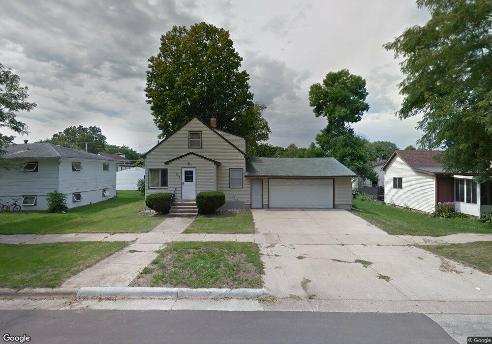
313 313 Sherman-- Houston, MN 55943
Estimated Value: $168,000 - $241,000
3
Beds
1
Bath
1,105
Sq Ft
$178/Sq Ft
Est. Value
About This Home
This home is located at 313 313 Sherman--, Houston, MN 55943 and is currently estimated at $196,668, approximately $177 per square foot. 313 313 Sherman-- is a home located in Houston County with nearby schools including Houston Elementary School and Houston High School.
Ownership History
Date
Name
Owned For
Owner Type
Purchase Details
Closed on
Sep 17, 2010
Sold by
Secretary Of Veterans Affairs
Bought by
Rohweder Todd
Current Estimated Value
Purchase Details
Closed on
Aug 31, 2007
Sold by
Lauritzen Dale C and Lauritzen Lois
Bought by
Arndt Roger A
Home Financials for this Owner
Home Financials are based on the most recent Mortgage that was taken out on this home.
Original Mortgage
$129,187
Interest Rate
6.72%
Mortgage Type
VA
Purchase Details
Closed on
Dec 13, 2006
Sold by
Lauritzen Lois and Lauritzen Dale C
Bought by
Lauritzen Dale C and Lauritzen Lois
Create a Home Valuation Report for This Property
The Home Valuation Report is an in-depth analysis detailing your home's value as well as a comparison with similar homes in the area
Home Values in the Area
Average Home Value in this Area
Purchase History
| Date | Buyer | Sale Price | Title Company |
|---|---|---|---|
| Rohweder Todd | $59,850 | None Available | |
| Arndt Roger A | $125,000 | None Available | |
| Lauritzen Dale C | -- | None Available |
Source: Public Records
Mortgage History
| Date | Status | Borrower | Loan Amount |
|---|---|---|---|
| Previous Owner | Arndt Roger A | $129,187 |
Source: Public Records
Tax History Compared to Growth
Tax History
| Year | Tax Paid | Tax Assessment Tax Assessment Total Assessment is a certain percentage of the fair market value that is determined by local assessors to be the total taxable value of land and additions on the property. | Land | Improvement |
|---|---|---|---|---|
| 2025 | $2,430 | $161,700 | $24,500 | $137,200 |
| 2024 | $2,342 | $160,600 | $24,500 | $136,100 |
| 2023 | $1,924 | $143,300 | $14,000 | $129,300 |
| 2022 | $2,200 | $118,200 | $14,000 | $104,200 |
| 2021 | $1,974 | $113,700 | $14,000 | $99,700 |
| 2020 | $1,880 | $99,200 | $14,000 | $85,200 |
| 2019 | $1,584 | $96,600 | $14,000 | $82,600 |
| 2018 | $1,538 | $79,400 | $11,200 | $68,200 |
| 2017 | $1,538 | $47,800 | $6,864 | $40,936 |
| 2016 | $1,640 | $78,000 | $11,200 | $66,800 |
| 2015 | $1,360 | $80,500 | $11,200 | $69,300 |
| 2014 | $1,360 | $51,700 | $7,793 | $43,907 |
Source: Public Records
Map
Nearby Homes
- 413 S Sherman St
- 313 S Washington St
- 310 S Erickson St
- 301 Stoddard St
- Tbd County Road 13
- TBD County 26
- 2740 Christianson Hill Rd
- xxx E Twin Ridge Rd
- TBD River Dr
- 3681 Berland Rd
- River Dr
- 12818 County 10
- 32653 Stinson Ridge Rd
- 14327 County 1
- 11512 County 4
- tbd County 13 Rd
- Tbd County 26
- 707 N Hokah St
- 21091 Norgard Dr
- 524 N Kingston St
- 313 313 Sherman-Street-s
- 317 S Sherman St
- 313 S Sherman St
- 109 E Elm St
- 309 S Sherman St
- 401 S Sherman St
- 305 S Sherman St
- 110 E Elm St
- 405 S Sherman St
- 301 S Sherman St
- 314 S Grant St
- 318 S Grant St
- 310 S Grant St
- 409 S Sherman St
- 306 S Grant St
- 410 S Grant St
- 302 S Grant St
- 221 S Sherman St
- 305 S Sheridan St
- XXX S Grant St