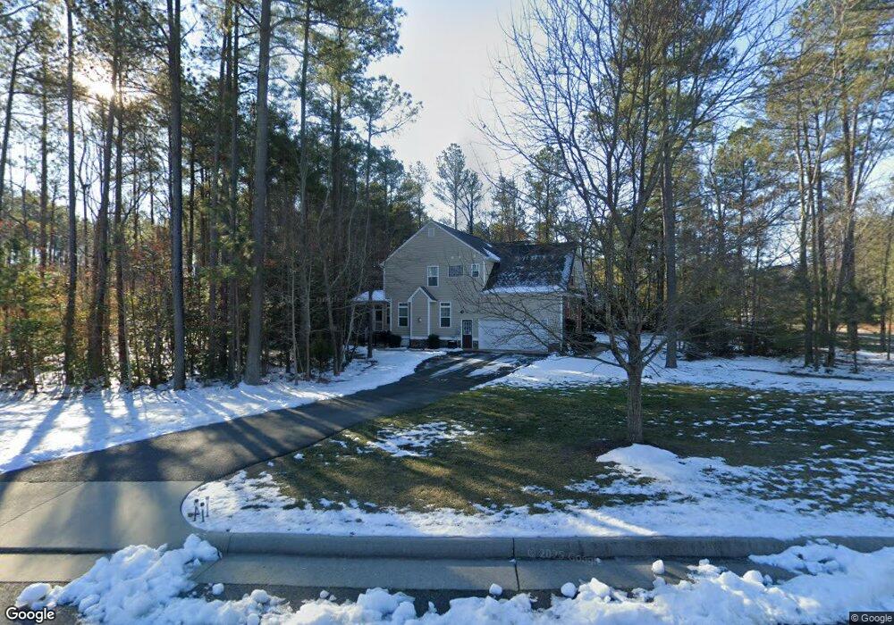
313 Carter Forest Dr Ashland, VA 23005
Estimated Value: $586,000 - $736,000
4
Beds
3
Baths
2,822
Sq Ft
$235/Sq Ft
Est. Value
About This Home
This home is located at 313 Carter Forest Dr, Ashland, VA 23005 and is currently estimated at $663,870, approximately $235 per square foot. 313 Carter Forest Dr is a home located in Hanover County with nearby schools including Henry Clay Elementary School, Liberty Middle School, and Patrick Henry High School.
Ownership History
Date
Name
Owned For
Owner Type
Purchase Details
Closed on
Apr 5, 2021
Sold by
Bajcsi Brett J and Bajcsi Ana I
Bought by
Robb Paul and Robb Joanne
Current Estimated Value
Purchase Details
Closed on
Jun 29, 2011
Sold by
Rci Builders Llc
Bought by
Bajcsi Brett J
Home Financials for this Owner
Home Financials are based on the most recent Mortgage that was taken out on this home.
Original Mortgage
$423,665
Interest Rate
4.62%
Mortgage Type
FHA
Create a Home Valuation Report for This Property
The Home Valuation Report is an in-depth analysis detailing your home's value as well as a comparison with similar homes in the area
Home Values in the Area
Average Home Value in this Area
Purchase History
| Date | Buyer | Sale Price | Title Company |
|---|---|---|---|
| Robb Paul | $505,000 | Attorney | |
| Bajcsi Brett J | $434,686 | -- |
Source: Public Records
Mortgage History
| Date | Status | Borrower | Loan Amount |
|---|---|---|---|
| Previous Owner | Bajcsi Brett J | $423,665 |
Source: Public Records
Tax History
| Year | Tax Paid | Tax Assessment Tax Assessment Total Assessment is a certain percentage of the fair market value that is determined by local assessors to be the total taxable value of land and additions on the property. | Land | Improvement |
|---|---|---|---|---|
| 2025 | $4,942 | $610,100 | $135,000 | $475,100 |
| 2024 | $4,435 | $547,500 | $125,000 | $422,500 |
| 2023 | $4,216 | $547,500 | $125,000 | $422,500 |
| 2022 | $3,967 | $489,700 | $120,000 | $369,700 |
| 2021 | $237 | $479,500 | $120,000 | $359,500 |
| 2020 | $3,647 | $450,300 | $120,000 | $330,300 |
| 2019 | $3,148 | $432,100 | $120,000 | $312,100 |
| 2018 | $3,148 | $388,700 | $105,000 | $283,700 |
| 2017 | $3,148 | $388,700 | $105,000 | $283,700 |
| 2016 | $3,148 | $388,700 | $105,000 | $283,700 |
| 2015 | $3,148 | $388,700 | $105,000 | $283,700 |
| 2014 | $3,133 | $386,800 | $105,000 | $281,800 |
Source: Public Records
Map
Nearby Homes
- 720 Chapman St
- 728 Chapman St
- 568 N James St
- 204 Lauradell Rd
- 118 Lauradell Rd
- 102 Brookneal Aly
- 814 Chapman St
- 104 Linden St
- 0 N Snead St
- 303 N Snead St
- 13976 Hungryjack Ct
- 11224 Hill Ridge Ct
- 213 Berkley St
- 14106 Falcon Crest Ct
- 307 S Railroad Ave
- Lot 73 Lauradell Rd
- 126 Arlington Square
- 709 Virginia St
- 10298 Jamestown Rd
- 14150 Bear Slash Trail
- 709 Wales Way
- 311 Carter Forest Dr
- 402 Carter Forest Dr
- 400 Carter Forest Dr
- 400 Carter Forest Dr
- 309 Carter Forest Dr
- 404 Carter Forest Dr
- 310 Carter Forest Dr
- 406 Carter Forest Dr
- 310 Hillsway Dr
- 406 Carter Forest Dr
- 312 Hillsway Dr
- 307 Carter Forest Dr
- 308 Carter Forest Dr
- 705 Wales Way
- 308 Hillsway Dr
- 0 Gamekeeper Place Unit 1204068
- 0 Gamekeeper Place Unit 1311989
- 314 Hillsway Dr
- 711 Wales Way
Your Personal Tour Guide
Ask me questions while you tour the home.