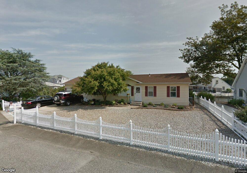
313 Richard Rd Forked River, NJ 08731
Estimated Value: $590,082 - $727,000
3
Beds
2
Baths
1,500
Sq Ft
$426/Sq Ft
Est. Value
About This Home
This home is located at 313 Richard Rd, Forked River, NJ 08731 and is currently estimated at $639,021, approximately $426 per square foot. 313 Richard Rd is a home located in Ocean County with nearby schools including Lacey Township High School.
Ownership History
Date
Name
Owned For
Owner Type
Purchase Details
Closed on
Dec 13, 2021
Sold by
Good James P
Bought by
Good James P
Current Estimated Value
Purchase Details
Closed on
Mar 30, 2006
Sold by
Weygand Katherine A
Bought by
Good James P and Franco Donna M
Home Financials for this Owner
Home Financials are based on the most recent Mortgage that was taken out on this home.
Original Mortgage
$376,000
Interest Rate
6.32%
Mortgage Type
Stand Alone First
Purchase Details
Closed on
Jan 18, 2001
Sold by
Raab Robert
Bought by
Weygand Richard and Weygand Katherine
Home Financials for this Owner
Home Financials are based on the most recent Mortgage that was taken out on this home.
Original Mortgage
$212,400
Interest Rate
7.39%
Create a Home Valuation Report for This Property
The Home Valuation Report is an in-depth analysis detailing your home's value as well as a comparison with similar homes in the area
Home Values in the Area
Average Home Value in this Area
Purchase History
| Date | Buyer | Sale Price | Title Company |
|---|---|---|---|
| Good James P | $350,000 | Sendzik-Haines Kate | |
| Good James P | $350,000 | None Listed On Document | |
| Good James P | $485,000 | None Available | |
| Weygand Richard | $249,900 | -- | |
| Weygand Richard | $249,900 | -- |
Source: Public Records
Mortgage History
| Date | Status | Borrower | Loan Amount |
|---|---|---|---|
| Previous Owner | Good James P | $376,000 | |
| Previous Owner | Weygand Richard | $212,400 |
Source: Public Records
Tax History
| Year | Tax Paid | Tax Assessment Tax Assessment Total Assessment is a certain percentage of the fair market value that is determined by local assessors to be the total taxable value of land and additions on the property. | Land | Improvement |
|---|---|---|---|---|
| 2025 | $7,615 | $300,500 | $168,000 | $132,500 |
| 2024 | $7,119 | $300,500 | $168,000 | $132,500 |
| 2023 | $6,800 | $300,500 | $168,000 | $132,500 |
| 2022 | $6,800 | $300,500 | $168,000 | $132,500 |
| 2021 | $6,686 | $300,500 | $168,000 | $132,500 |
| 2020 | $6,473 | $300,500 | $168,000 | $132,500 |
| 2019 | $6,359 | $300,500 | $168,000 | $132,500 |
| 2018 | $6,283 | $300,500 | $168,000 | $132,500 |
| 2017 | $6,139 | $300,500 | $168,000 | $132,500 |
| 2016 | $6,115 | $300,500 | $168,000 | $132,500 |
| 2015 | $5,842 | $300,500 | $168,000 | $132,500 |
| 2014 | $6,849 | $398,200 | $268,000 | $130,200 |
Source: Public Records
Map
Nearby Homes
- 404 Beach Blvd
- 10 Dolphin Ct
- 463 Ensign Rd
- 69 Saltspray Dr
- 75 Saltspray Dr
- 79 Saltspray Dr
- 123 Oakwood Place
- 72 Saltspray Dr
- 217 Nantucket Rd
- 9 Hollywood Blvd S
- 417 Riverview Rd
- 615 Beach Blvd
- 0 Nautical Dr
- 22 Saltspray Dr
- 101 Clearwater Dr
- 634 Fairview Ln
- 102 Maria Loretta Ln
- 635 Oakwood Dr
- 126 Bay Ave
- 117 E Lacey Rd
- 314 Richard Rd
- 312 Richard Rd
- 310 Richard Rd
- 311 Richard Rd
- 423 Middle Branch Dr
- 308 Richard Rd
- 316 Richard Rd
- 412 Whyatt Ct
- 410 Whyatt Ct
- 422 Middle Branch Dr
- 414 Whyatt Ct
- 408 Whyatt Ct
- 307 Richard Rd
- 317 Richard Rd
- 424 Middle Branch Dr
- 421 Middle Branch Dr
- 425 Middle Branch Dr
- 406 Whyatt Ct
- 416 Whyatt Ct
- 318 Richard Rd
Your Personal Tour Guide
Ask me questions while you tour the home.