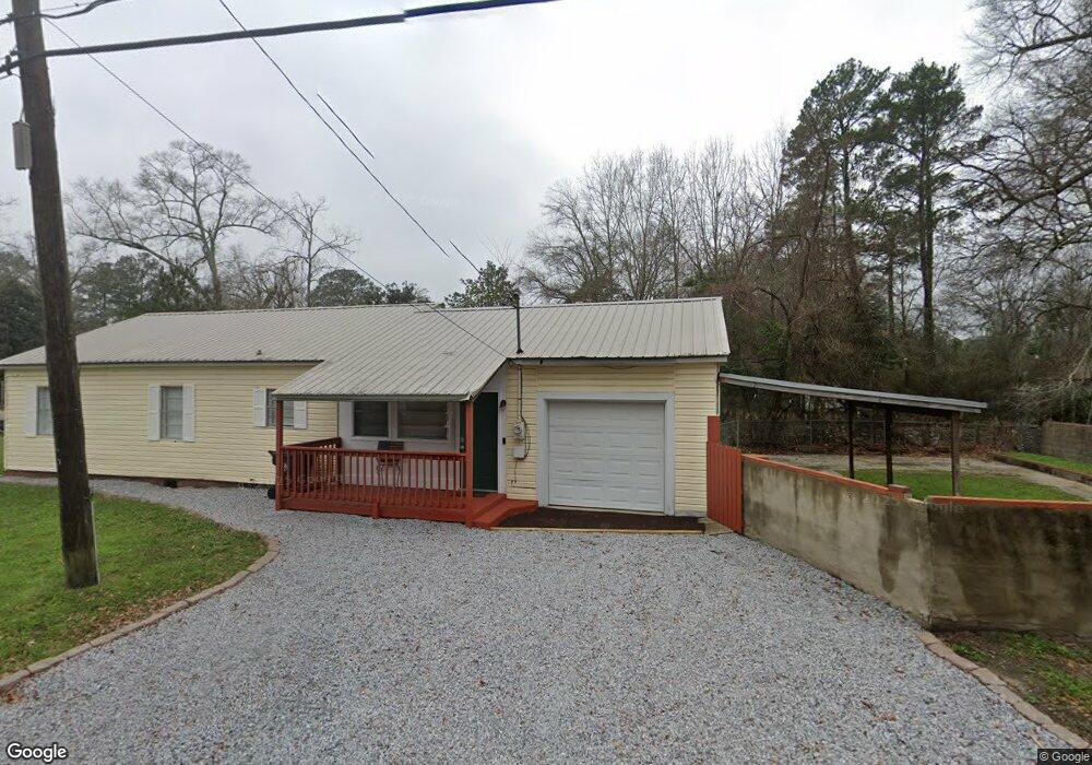
313 S 19th Ave Hattiesburg, MS 39401
Parkhaven NeighborhoodEstimated Value: $138,000 - $180,000
2
Beds
2
Baths
1,536
Sq Ft
$100/Sq Ft
Est. Value
About This Home
This home is located at 313 S 19th Ave, Hattiesburg, MS 39401 and is currently estimated at $153,836, approximately $100 per square foot. 313 S 19th Ave is a home located in Forrest County with nearby schools including Woodley Elementary School, N.R. Burger Middle School, and Hattiesburg High School.
Ownership History
Date
Name
Owned For
Owner Type
Purchase Details
Closed on
Jul 21, 2022
Sold by
Mark Andrews
Bought by
Livingscapes I Llc
Current Estimated Value
Purchase Details
Closed on
Nov 18, 2009
Sold by
Donovan Shaun
Bought by
Andrews Pamela D and Andrews Mark A
Home Financials for this Owner
Home Financials are based on the most recent Mortgage that was taken out on this home.
Original Mortgage
$32,000
Interest Rate
4.98%
Purchase Details
Closed on
Jun 17, 2009
Sold by
Bac Home Loans Servicing Lp
Bought by
Secretary Of Housing And Urban Developme
Create a Home Valuation Report for This Property
The Home Valuation Report is an in-depth analysis detailing your home's value as well as a comparison with similar homes in the area
Home Values in the Area
Average Home Value in this Area
Purchase History
| Date | Buyer | Sale Price | Title Company |
|---|---|---|---|
| Livingscapes I Llc | -- | Fillingane Law Firm Pllc | |
| Andrews Pamela D | -- | -- | |
| Secretary Of Housing And Urban Developme | -- | -- |
Source: Public Records
Mortgage History
| Date | Status | Borrower | Loan Amount |
|---|---|---|---|
| Previous Owner | Andrews Pamela D | $32,000 |
Source: Public Records
Tax History Compared to Growth
Tax History
| Year | Tax Paid | Tax Assessment Tax Assessment Total Assessment is a certain percentage of the fair market value that is determined by local assessors to be the total taxable value of land and additions on the property. | Land | Improvement |
|---|---|---|---|---|
| 2024 | $1,424 | $7,728 | $0 | $0 |
| 2023 | $1,424 | $51,520 | $0 | $0 |
| 2022 | $1,427 | $7,728 | $0 | $0 |
| 2021 | $1,427 | $7,728 | $0 | $0 |
| 2020 | $1,373 | $7,508 | $0 | $0 |
| 2019 | $1,369 | $7,508 | $0 | $0 |
| 2018 | $1,373 | $7,508 | $0 | $0 |
| 2017 | $1,364 | $7,508 | $0 | $0 |
| 2016 | $1,353 | $7,499 | $0 | $0 |
| 2015 | $1,332 | $7,499 | $0 | $0 |
| 2014 | -- | $7,499 | $0 | $0 |
Source: Public Records
Map
Nearby Homes
- 1917 Brooklane Dr
- 1811 Eva St
- 1805 Mamie St
- 1810 1st Terrace
- 209 S 21st Ave
- 1701 Adeline St
- 1718 2nd Terrace
- 113 S 22nd Ave
- 610 S 22nd Ave
- 109 N 20th Ave
- 704 Crestview Dr
- 317 S 24th Ave
- 201 N 21st Ave
- 2306 Mimosa Ln
- 1403 Concart St
- 210 S 14th Ave
- 1616 Adeline St
- 1004 Estelle St
- 902 S 17th Ave
- 907 Wedgewood Dr