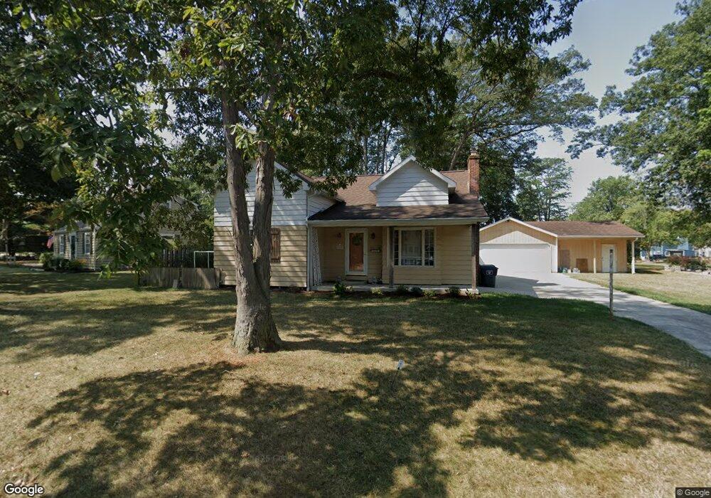
313 Singleton Ave Lima, OH 45805
Westgate NeighborhoodEstimated Value: $143,820 - $159,000
3
Beds
1
Bath
1,149
Sq Ft
$131/Sq Ft
Est. Value
About This Home
This home is located at 313 Singleton Ave, Lima, OH 45805 and is currently estimated at $150,455, approximately $130 per square foot. 313 Singleton Ave is a home located in Allen County with nearby schools including Heritage Elementary School, Lima West Middle School, and Lima North Middle School.
Ownership History
Date
Name
Owned For
Owner Type
Purchase Details
Closed on
Sep 5, 1997
Sold by
Knott Kurt
Bought by
Robinson Charles and Lenix Lisa
Current Estimated Value
Home Financials for this Owner
Home Financials are based on the most recent Mortgage that was taken out on this home.
Original Mortgage
$66,900
Outstanding Balance
$10,432
Interest Rate
7.54%
Mortgage Type
New Conventional
Estimated Equity
$140,023
Purchase Details
Closed on
Aug 3, 1992
Bought by
Knott Kurt Theodore
Create a Home Valuation Report for This Property
The Home Valuation Report is an in-depth analysis detailing your home's value as well as a comparison with similar homes in the area
Home Values in the Area
Average Home Value in this Area
Purchase History
| Date | Buyer | Sale Price | Title Company |
|---|---|---|---|
| Robinson Charles | $71,900 | -- | |
| Knott Kurt Theodore | $60,000 | -- |
Source: Public Records
Mortgage History
| Date | Status | Borrower | Loan Amount |
|---|---|---|---|
| Open | Robinson Charles | $66,900 |
Source: Public Records
Tax History
| Year | Tax Paid | Tax Assessment Tax Assessment Total Assessment is a certain percentage of the fair market value that is determined by local assessors to be the total taxable value of land and additions on the property. | Land | Improvement |
|---|---|---|---|---|
| 2024 | $1,449 | $40,220 | $6,090 | $34,130 |
| 2023 | $1,180 | $28,140 | $4,270 | $23,870 |
| 2022 | $1,186 | $28,140 | $4,270 | $23,870 |
| 2021 | $1,255 | $28,140 | $4,270 | $23,870 |
| 2020 | $1,163 | $23,040 | $4,100 | $18,940 |
| 2019 | $1,163 | $23,040 | $4,100 | $18,940 |
| 2018 | $1,093 | $23,040 | $4,100 | $18,940 |
| 2017 | $1,044 | $20,450 | $4,100 | $16,350 |
| 2016 | $1,061 | $20,620 | $4,100 | $16,520 |
| 2015 | $1,154 | $20,620 | $4,100 | $16,520 |
| 2014 | $1,154 | $22,300 | $4,030 | $18,270 |
| 2013 | $1,123 | $22,300 | $4,030 | $18,270 |
Source: Public Records
Map
Nearby Homes
- 1918 Oakland Pkwy
- 1716 Oakland Pkwy
- 2057 W High St
- 275 N Dale Dr
- 1607 W Wayne St
- 1541 Oakland Pkwy
- 2201 W High St
- 161 S Cable Rd
- 1508 Oakland Pkwy
- 1517 Allentown Rd
- 1753 Leland Ave
- 705 Cornell Dr
- 1600 Leland Ave
- 3 Poulston Place
- 1605 Hazel Ave
- 308 S Judkins Ave
- 1880 Wendell Ave
- 1323 W Elm St
- 2250 Kunneke Ave
- 1407 Latham Ave
- 1900 Idlewild Dr
- 1841 Oakland Pkwy
- 1904 Idlewild Dr
- 1925 Oakland Pkwy
- 1870 Idlewild Dr
- 1900 Oakland Pkwy
- 1837 Oakland Pkwy
- 1812 Oakland Pkwy
- 317 Singleton Ave
- 1933 Oakland Pkwy
- 1924 Oakland Pkwy
- 1885 Idlewild Dr
- 1893 Idlewild Dr
- 1875 Idlewild Dr
- 1910 Idlewild Dr
- 328 Singleton Ave
- 1865 Idlewild Dr
- 0000 Idlewild Dr
Your Personal Tour Guide
Ask me questions while you tour the home.