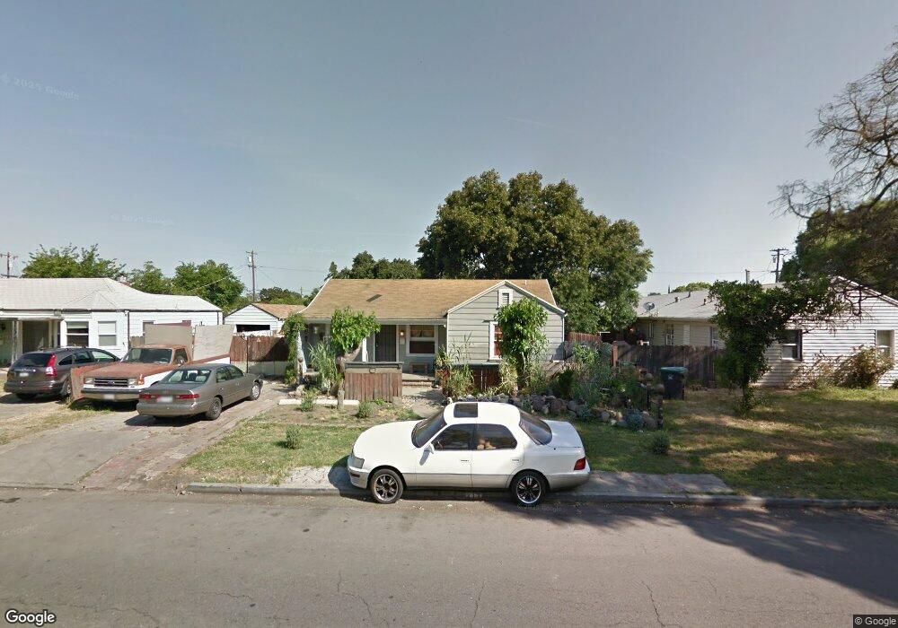
313 W Swain Rd Stockton, CA 95207
Lincoln Village NeighborhoodEstimated Value: $266,000 - $345,000
2
Beds
1
Bath
1,096
Sq Ft
$286/Sq Ft
Est. Value
About This Home
This home is located at 313 W Swain Rd, Stockton, CA 95207 and is currently estimated at $313,477, approximately $286 per square foot. 313 W Swain Rd is a home located in San Joaquin County with nearby schools including Lincoln Elementary School, Sierra Middle School, and Lincoln High School.
Ownership History
Date
Name
Owned For
Owner Type
Purchase Details
Closed on
Jan 23, 2002
Sold by
Holt Virginia and Holt Family 2000 Trust
Bought by
Ledford Michael C and Ledford Tracey
Current Estimated Value
Home Financials for this Owner
Home Financials are based on the most recent Mortgage that was taken out on this home.
Original Mortgage
$60,000
Interest Rate
7.17%
Purchase Details
Closed on
Mar 8, 2001
Sold by
Holt Virginia
Bought by
Holt Family 2000 Trust
Purchase Details
Closed on
Dec 3, 1999
Sold by
Covieo Betty June and Covieo Betty
Bought by
Schoonover Harvey
Home Financials for this Owner
Home Financials are based on the most recent Mortgage that was taken out on this home.
Original Mortgage
$28,500
Interest Rate
7.96%
Create a Home Valuation Report for This Property
The Home Valuation Report is an in-depth analysis detailing your home's value as well as a comparison with similar homes in the area
Home Values in the Area
Average Home Value in this Area
Purchase History
| Date | Buyer | Sale Price | Title Company |
|---|---|---|---|
| Ledford Michael C | $85,000 | Alliance Title Company | |
| Holt Family 2000 Trust | -- | -- | |
| Schoonover Harvey | $28,500 | Fidelity National Title Co |
Source: Public Records
Mortgage History
| Date | Status | Borrower | Loan Amount |
|---|---|---|---|
| Closed | Ledford Michael C | $60,000 | |
| Previous Owner | Schoonover Harvey | $28,500 |
Source: Public Records
Tax History Compared to Growth
Tax History
| Year | Tax Paid | Tax Assessment Tax Assessment Total Assessment is a certain percentage of the fair market value that is determined by local assessors to be the total taxable value of land and additions on the property. | Land | Improvement |
|---|---|---|---|---|
| 2025 | $1,614 | $125,556 | $81,245 | $44,311 |
| 2024 | $1,582 | $123,095 | $79,652 | $43,443 |
| 2023 | $1,569 | $120,683 | $78,091 | $42,592 |
| 2022 | $1,497 | $118,317 | $76,560 | $41,757 |
| 2021 | $1,478 | $115,998 | $75,059 | $40,939 |
| 2020 | $1,476 | $114,810 | $74,290 | $40,520 |
| 2019 | $1,454 | $112,560 | $72,834 | $39,726 |
| 2018 | $1,424 | $110,354 | $71,406 | $38,948 |
| 2017 | $1,397 | $108,191 | $70,006 | $38,185 |
| 2016 | $1,382 | $106,071 | $68,634 | $37,437 |
| 2014 | $1,347 | $102,000 | $66,279 | $35,721 |
Source: Public Records
Map
Nearby Homes
- 210 W Pearl Ave
- 311 W Norwich Dr
- 5614 Tamworth Way
- 20 W Norwich Dr
- 126 Nottingham Dr
- 5806 N El Dorado St
- 1140 Douglas Rd Unit 3
- 518 W Lincoln Rd
- 6510 N El Dorado St
- 332 Jean Ave
- 36 Lynda Ave
- 6009 Glenbrook Ln
- 7 W Loretta Ave
- 6523 Vicksburg Place
- 6905 N El Dorado St
- 7015 N El Dorado St
- 1489 W Swain Rd
- 722 E Swain Rd
- 1001 W Lincoln Rd Unit C
- 1583 W Swain Rd
- 6007 Inglewood Ave
- 6009 Inglewood Ave
- 323 W Swain Rd
- 333 W Swain Rd
- 314 W Pearl Ave
- 6039 Inglewood Ave
- 324 W Pearl Ave
- 245 W Swain Rd
- 343 W Swain Rd
- 334 W Pearl Ave
- 302 W Swain Rd
- 235 W Swain Rd
- 6036 Inglewood Ave
- 353 W Swain Rd
- 344 W Pearl Ave
- 318 Swain B Ct
- 318 W Swain Rd Unit B
- 264 W Pearl Ave
- 234 Swain C Ct
- 225 W Swain Rd