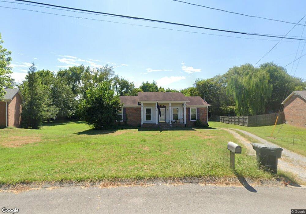
313 Westwind Dr Springfield, TN 37172
Estimated Value: $265,000 - $281,000
Studio
2
Baths
1,326
Sq Ft
$206/Sq Ft
Est. Value
About This Home
This home is located at 313 Westwind Dr, Springfield, TN 37172 and is currently estimated at $272,568, approximately $205 per square foot. 313 Westwind Dr is a home located in Robertson County with nearby schools including Coopertown Elementary School, Coopertown Middle School, and Springfield High School.
Ownership History
Date
Name
Owned For
Owner Type
Purchase Details
Closed on
Feb 13, 2026
Sold by
Durward Powell
Bought by
Powell Allison
Current Estimated Value
Purchase Details
Closed on
May 16, 2010
Sold by
Powell Lionel D
Bought by
Powell Lionel D
Home Financials for this Owner
Home Financials are based on the most recent Mortgage that was taken out on this home.
Original Mortgage
$78,323
Interest Rate
5.5%
Mortgage Type
FHA
Purchase Details
Closed on
May 31, 1996
Sold by
Kirkland Randall T
Bought by
Djr Powell Lionel
Purchase Details
Closed on
May 29, 1996
Bought by
Powell Lionel D
Create a Home Valuation Report for This Property
The Home Valuation Report is an in-depth analysis detailing your home's value as well as a comparison with similar homes in the area
Home Values in the Area
Average Home Value in this Area
Purchase History
| Date | Buyer | Sale Price | Title Company |
|---|---|---|---|
| Powell Allison | -- | None Listed On Document | |
| Powell Lionel D | -- | -- | |
| Djr Powell Lionel | $76,145 | -- | |
| Powell Lionel D | $76,100 | -- |
Source: Public Records
Mortgage History
| Date | Status | Borrower | Loan Amount |
|---|---|---|---|
| Closed | Powell Lionel D | $78,323 |
Source: Public Records
Tax History
| Year | Tax Paid | Tax Assessment Tax Assessment Total Assessment is a certain percentage of the fair market value that is determined by local assessors to be the total taxable value of land and additions on the property. | Land | Improvement |
|---|---|---|---|---|
| 2025 | -- | $56,400 | $13,750 | $42,650 |
| 2024 | -- | $56,400 | $13,750 | $42,650 |
| 2023 | $1,413 | $56,400 | $13,750 | $42,650 |
| 2022 | $1,423 | $39,000 | $6,200 | $32,800 |
| 2021 | $1,423 | $39,000 | $6,200 | $32,800 |
| 2020 | $1,423 | $39,000 | $6,200 | $32,800 |
| 2019 | $42,805 | $39,000 | $6,200 | $32,800 |
| 2018 | $1,423 | $39,000 | $6,200 | $32,800 |
| 2017 | $1,272 | $29,700 | $5,250 | $24,450 |
| 2016 | $1,272 | $29,700 | $5,250 | $24,450 |
| 2015 | $1,236 | $29,700 | $5,250 | $24,450 |
| 2014 | $1,236 | $29,700 | $5,250 | $24,450 |
Source: Public Records
Map
Nearby Homes
- 5148 Highway 49 W
- 2060 Beverly Ct
- 2086 Beverly Ct
- 7373 New Chapel Rd
- 588 19th Ave W
- 213 21st Ave W
- 2067 Bessie St
- 2083 Bessie St
- 2130 Bessie St
- 1 Bessie St
- 0 Bessie St
- 1511 Cheatham St
- 244 Green Hills Dr
- 1421 Lawrence Ln
- 155 Julia Ann Ct
- 301 E 22nd Ave
- 126 Julia Ann Ct
- 458 Laramie Dr
- 1309 Batts Blvd
- 1205 S Main St
- 311 Westwind Dr
- 315 Westwind Dr
- 306 Westwind Dr
- 317 Westwind Dr
- 309 Westwind Dr
- 304 Westwind Dr
- 319 Westwind Dr
- 307 Westwind Dr
- 308 Westwind Dr
- 302 Westwind Dr
- 321 Westwind Dr
- 105 Teresa Ln
- 305 Westwind Dr
- 103 Teresa Ln
- 401 Westwind Dr
- 303 Westwind Dr
- 300 Westwind Dr
- 400 Westwind Dr
- 103 Rw Gordon Dr
- 104 Teresa Ln
Your Personal Tour Guide
Ask me questions while you tour the home.