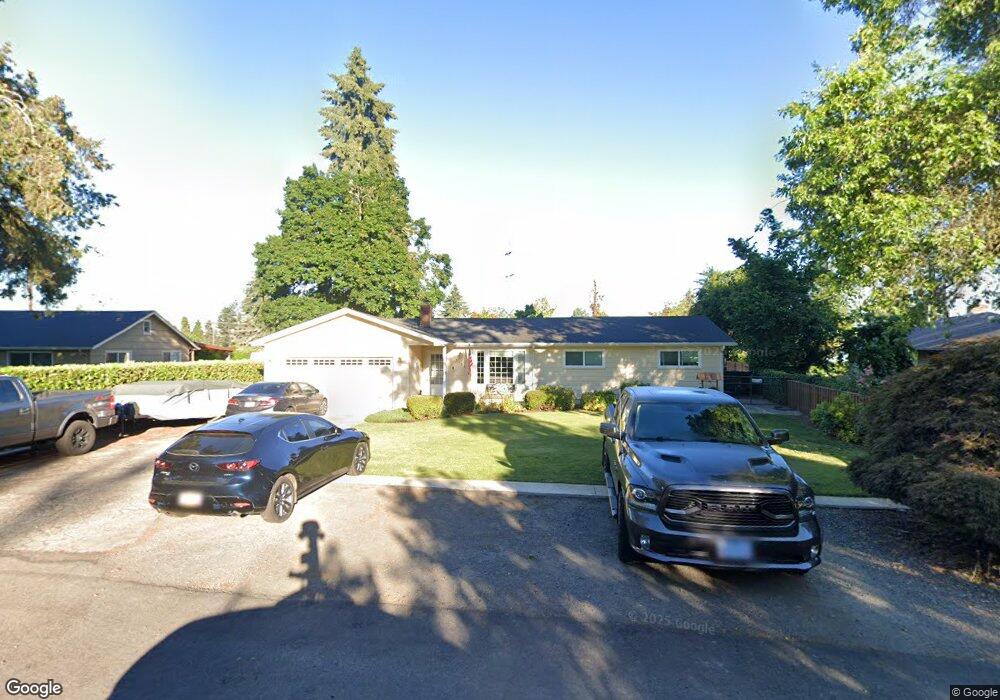
3131 Wayside Loop Springfield, OR 97477
North Springfield NeighborhoodEstimated Value: $425,000 - $471,000
4
Beds
2
Baths
1,564
Sq Ft
$288/Sq Ft
Est. Value
About This Home
This home is located at 3131 Wayside Loop, Springfield, OR 97477 and is currently estimated at $450,716, approximately $288 per square foot. 3131 Wayside Loop is a home located in Lane County with nearby schools including Guy Lee Elementary School, Hamlin Middle School, and Springfield High School.
Ownership History
Date
Name
Owned For
Owner Type
Purchase Details
Closed on
Nov 9, 2004
Sold by
Aldridge Steven Wright and Aldridge Yumiko Mahone
Bought by
City Of Springfield
Current Estimated Value
Purchase Details
Closed on
Jul 8, 2002
Sold by
Selco Credit Union
Bought by
Millers Jay and Millers Cheri
Purchase Details
Closed on
Feb 13, 2002
Sold by
Va
Bought by
Millers Jay and Millers Cheri
Create a Home Valuation Report for This Property
The Home Valuation Report is an in-depth analysis detailing your home's value as well as a comparison with similar homes in the area
Home Values in the Area
Average Home Value in this Area
Purchase History
| Date | Buyer | Sale Price | Title Company |
|---|---|---|---|
| City Of Springfield | $11,290 | Evergreen Land Title Co | |
| Millers Jay | -- | Western Title & Escrow Compa | |
| Millers Jay | $41,000 | Western Title & Escrow Compa |
Source: Public Records
Tax History
| Year | Tax Paid | Tax Assessment Tax Assessment Total Assessment is a certain percentage of the fair market value that is determined by local assessors to be the total taxable value of land and additions on the property. | Land | Improvement |
|---|---|---|---|---|
| 2025 | $3,017 | $205,986 | -- | -- |
| 2024 | $2,935 | $199,987 | -- | -- |
| 2023 | $2,935 | $194,163 | $0 | $0 |
| 2022 | $2,790 | $188,508 | $0 | $0 |
| 2021 | $2,730 | $183,018 | $0 | $0 |
| 2020 | $2,651 | $177,688 | $0 | $0 |
| 2019 | $2,558 | $172,513 | $0 | $0 |
| 2018 | $2,461 | $162,611 | $0 | $0 |
| 2017 | $2,387 | $162,611 | $0 | $0 |
| 2016 | $2,334 | $157,875 | $0 | $0 |
| 2015 | $2,277 | $153,277 | $0 | $0 |
| 2014 | $2,181 | $148,813 | $0 | $0 |
Source: Public Records
Map
Nearby Homes
- 472 Springdale Ave
- 590 Flamingo Ave
- 40 Allen Ave
- 3198 Pheasant Blvd
- 3215 Pheasant Blvd
- 624 Tinamou Ln
- 3227 Partridge Way
- 212 Hayden Bridge Way
- 520 Ethan Ct
- 126 Woodlane Dr
- 2150 Laura (#57) St Unit 57
- 2150 Laura St Unit 119
- 2150 Laura St Unit 111
- 2150 Laura St Unit 39
- 2150 Laura St Unit 57
- 2150 Laura St Unit 83
- 2150 Laura St Unit 44
- 2727 Gateway St Unit 27
- 421 Woodlane Dr
- 451 Lochaven Ave
- 55 Ann Ct
- 3147 Wayside Loop
- 45 Ann Ct
- 3163 Wayside Loop
- 3150 Wayside Loop
- 3097 Wayside Loop
- 3098 Wayside Loop
- 35 Ann Ct
- 3184 Wayside Loop
- 25 Ann Ct
- 2937 Game Farm Rd
- 2923 Game Farm Rd
- 3076 Wayside Loop
- 2945 Game Farm Rd
- 3089 Wayside Loop
- 3195 Wayside Loop
- 2969 Game Farm Rd
- 2890 Wayside Loop
- 2915 Game Farm Rd
- 3065 Wayside Loop
Your Personal Tour Guide
Ask me questions while you tour the home.