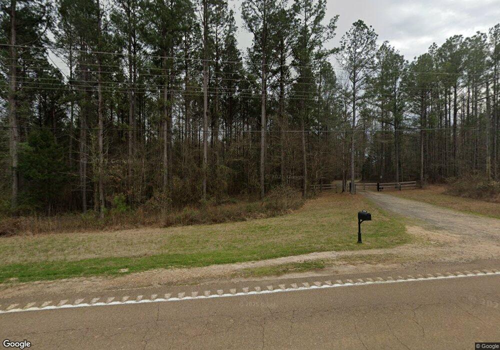
3132 Highway 471 Brandon, MS 39047
Estimated Value: $467,000 - $803,293
5
Beds
4
Baths
5,066
Sq Ft
$136/Sq Ft
Est. Value
About This Home
This home is located at 3132 Highway 471, Brandon, MS 39047 and is currently estimated at $689,764, approximately $136 per square foot. 3132 Highway 471 is a home located in Rankin County with nearby schools including Oakdale Elementary School, Northwest Rankin Middle School, and Northwest Rankin High School.
Ownership History
Date
Name
Owned For
Owner Type
Purchase Details
Closed on
Jul 7, 2020
Sold by
Potts Alan W and Potts Robyn K
Bought by
Hargett Joe D and Hargett Pamela D
Current Estimated Value
Home Financials for this Owner
Home Financials are based on the most recent Mortgage that was taken out on this home.
Original Mortgage
$510,400
Outstanding Balance
$452,589
Interest Rate
3.1%
Mortgage Type
Stand Alone Refi Refinance Of Original Loan
Estimated Equity
$237,175
Purchase Details
Closed on
Jun 27, 2018
Sold by
Osborn Billy C
Bought by
Potts Alan W and Kerr-Potts Robyn
Home Financials for this Owner
Home Financials are based on the most recent Mortgage that was taken out on this home.
Original Mortgage
$787,591
Interest Rate
4.6%
Mortgage Type
Stand Alone Refi Refinance Of Original Loan
Purchase Details
Closed on
May 14, 2013
Sold by
Osbon Clifton and Stoner Donna
Bought by
Osborn Clifton
Create a Home Valuation Report for This Property
The Home Valuation Report is an in-depth analysis detailing your home's value as well as a comparison with similar homes in the area
Home Values in the Area
Average Home Value in this Area
Purchase History
| Date | Buyer | Sale Price | Title Company |
|---|---|---|---|
| Hargett Joe D | -- | None Available | |
| Potts Alan W | -- | -- | |
| Osborn Clifton | -- | -- |
Source: Public Records
Mortgage History
| Date | Status | Borrower | Loan Amount |
|---|---|---|---|
| Open | Hargett Joe D | $510,400 | |
| Previous Owner | Potts Alan W | $787,591 |
Source: Public Records
Tax History Compared to Growth
Tax History
| Year | Tax Paid | Tax Assessment Tax Assessment Total Assessment is a certain percentage of the fair market value that is determined by local assessors to be the total taxable value of land and additions on the property. | Land | Improvement |
|---|---|---|---|---|
| 2024 | $4,155 | $41,361 | $0 | $0 |
| 2023 | $3,858 | $38,591 | $0 | $0 |
| 2022 | $3,792 | $38,527 | $0 | $0 |
| 2021 | $4,068 | $38,295 | $0 | $0 |
| 2020 | $3,769 | $38,305 | $0 | $0 |
| 2019 | $3,358 | $33,575 | $0 | $0 |
| 2018 | $3,293 | $33,575 | $0 | $0 |
| 2017 | $3,291 | $33,561 | $0 | $0 |
| 2016 | $2,762 | $32,925 | $0 | $0 |
| 2015 | $2,760 | $32,900 | $0 | $0 |
| 2014 | $2,688 | $32,875 | $0 | $0 |
| 2013 | $2,686 | $32,857 | $0 | $0 |
Source: Public Records
Map
Nearby Homes
- 0 Stull Rd Unit 24042681
- 0 Stull Rd Unit 10 11529116
- 208 Kitty Hawk Cir
- 1 Highway 25 Hwy
- Lot 10 Mt Helms
- 000 Highway 25 Hwy
- 416 Lennon Ln
- 130 Horseshoe Cir
- 0 Fallen Oak Dr
- 0 Hamilton Place Unit 4122193
- 211 Lost Oak Ln
- 212 Lost Oak Ln
- 290 Mount Helm Rd
- Lot 11 Mount Helm Rd
- Lot 7 Mount Helm Rd
- Lot 5 Mount Helm Rd
- 1053 Woodbridge Dr
- 2713 Highway 471
- 118 Bonne Vie Dr
- 127 Bonne Vie Dr
- 3132 Highway 471
- 3132 Hwy 471
- 3112 Highway 471
- 3108 Highway 471
- 3 Stull Rd Unit 3
- 1 Stull Rd Unit 1
- 5 Stull Rd Unit 5
- 6 Stull Rd Unit 6
- 000 Stull Rd
- 00A Stull Rd
- 0 Stull Rd
- 0 Stull Rd Unit 11399916
- 0 Stull Rd Unit Tract 2 1341322
- 0 Stull Rd Unit 1170939
- 0 Stull Rd Unit Tract 4 1303601
- 0 Stull Rd Unit 1112672
- 0 Stull Rd Unit 4075578
- 0 Stull Rd Unit 1174101
- 0 Stull Rd Unit 1210396
- 1 Stull Rd
