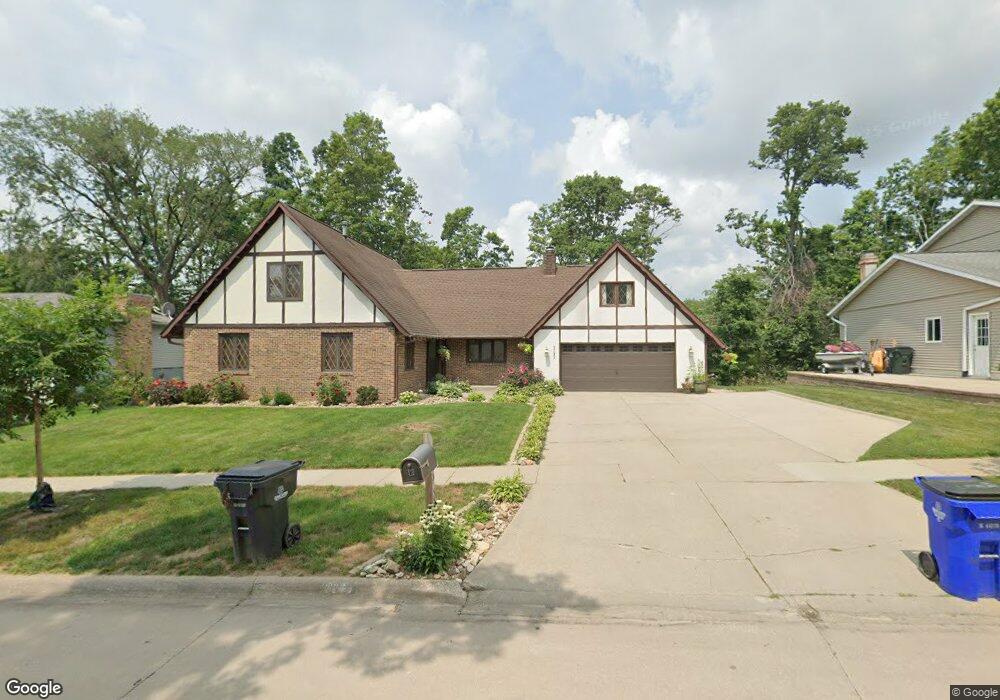
3133 Adirondack Dr NE Cedar Rapids, IA 52402
Estimated Value: $299,578 - $325,000
4
Beds
3
Baths
1,954
Sq Ft
$159/Sq Ft
Est. Value
About This Home
This home is located at 3133 Adirondack Dr NE, Cedar Rapids, IA 52402 and is currently estimated at $310,145, approximately $158 per square foot. 3133 Adirondack Dr NE is a home located in Linn County with nearby schools including Ponderosa Elementary School, Pierce Elementary School, and Franklin Middle School.
Ownership History
Date
Name
Owned For
Owner Type
Purchase Details
Closed on
Jan 13, 2005
Sold by
Lucken Pamela Mahany and Lucken Wesley O
Bought by
Rouw Joshua D and Rouw Rebecca A
Current Estimated Value
Home Financials for this Owner
Home Financials are based on the most recent Mortgage that was taken out on this home.
Original Mortgage
$145,200
Interest Rate
5.9%
Mortgage Type
Unknown
Create a Home Valuation Report for This Property
The Home Valuation Report is an in-depth analysis detailing your home's value as well as a comparison with similar homes in the area
Home Values in the Area
Average Home Value in this Area
Purchase History
| Date | Buyer | Sale Price | Title Company |
|---|---|---|---|
| Rouw Joshua D | $181,000 | -- |
Source: Public Records
Mortgage History
| Date | Status | Borrower | Loan Amount |
|---|---|---|---|
| Previous Owner | Rouw Joshua D | $145,200 |
Source: Public Records
Tax History Compared to Growth
Tax History
| Year | Tax Paid | Tax Assessment Tax Assessment Total Assessment is a certain percentage of the fair market value that is determined by local assessors to be the total taxable value of land and additions on the property. | Land | Improvement |
|---|---|---|---|---|
| 2025 | $4,192 | $274,700 | $63,700 | $211,000 |
| 2024 | $4,666 | $256,500 | $63,700 | $192,800 |
| 2023 | $4,666 | $247,400 | $59,000 | $188,400 |
| 2022 | $4,698 | $230,100 | $54,300 | $175,800 |
| 2021 | $4,552 | $235,700 | $49,500 | $186,200 |
| 2020 | $4,552 | $214,900 | $37,700 | $177,200 |
| 2019 | $4,194 | $203,100 | $37,700 | $165,400 |
| 2018 | $4,074 | $203,100 | $37,700 | $165,400 |
| 2017 | $4,004 | $211,100 | $37,700 | $173,400 |
| 2016 | $4,004 | $188,400 | $37,700 | $150,700 |
| 2015 | $4,212 | $197,904 | $33,023 | $164,881 |
| 2014 | $4,212 | $197,904 | $33,023 | $164,881 |
| 2013 | $4,120 | $197,904 | $33,023 | $164,881 |
Source: Public Records
Map
Nearby Homes
- 3130 Adirondack Dr NE
- 3100 Blue Ridge Ct NE
- 310 McKinsie Ct NE
- 1585 Matterhorn Dr NE
- 2445 Glass Rd NE
- 1759 Applewood Place NE
- 3604 Heatheridge Dr NE
- 2817 Old Orchard Rd NE
- 122 Lakota Ct NE
- 1724 Applewood Place NE
- 1724 Pikes Peak Ct NE Unit C
- 2611 Brookland Dr NE
- 618 J Ave NE
- 664 J Ave NE Unit A
- 3920 Wyndham Dr NE
- 2400 Brookland Dr NE
- 3707 Foxborough Terrace NE Unit B
- 3607 Foxborough Terrace NE Unit A
- 3008 Circle Hill Ct NE
- 3524 Swallow Ct NE
- 3131 Adirondack Dr NE
- 3135 Adirondack Dr NE
- 3137 Adirondack Dr NE
- 3132 Adirondack Dr NE
- 3127 Adirondack Dr NE
- 3136 Adirondack Dr NE
- 3128 Adirondack Dr NE
- 3138 Adirondack Dr NE
- 3126 Adirondack Dr NE
- 3123 Adirondack Dr NE
- 2633 Whitney Dr NE
- 2625 Whitney Dr NE
- 2641 Whitney Dr NE
- 3143 Adirondack Dr NE
- 3137 Blue Ridge Ct NE
- 3122 Adirondack Dr NE
- 3121 Adirondack Dr NE
- 3133 Blue Ridge Ct NE
- 3148 Adirondack Dr NE
- 3151 Adirondack Dr NE