Estimated Value: $476,790 - $502,000
3
Beds
3
Baths
2,982
Sq Ft
$163/Sq Ft
Est. Value
About This Home
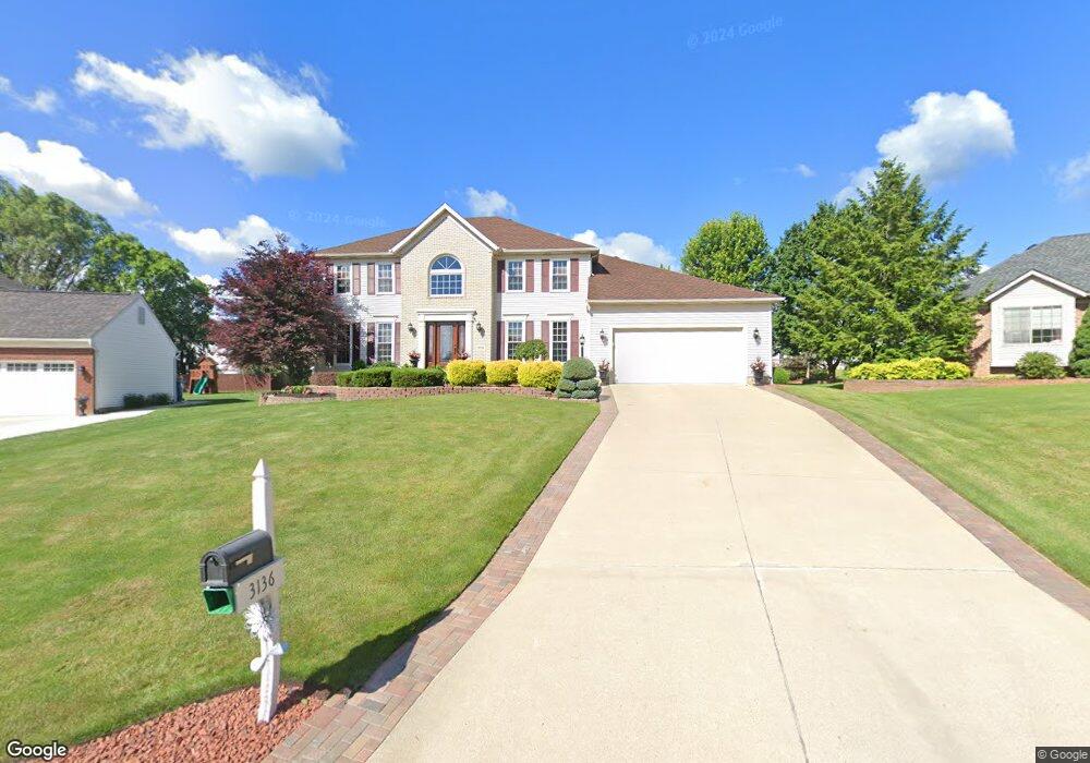
This home is located at 3136 Dunstone Ave, Akron, OH 44312 and is currently estimated at $486,948, approximately $163 per square foot. 3136 Dunstone Ave is a home located in Summit County with nearby schools including Greenwood Elementary School, Green Intermediate Elementary School, and Green Primary School.
Ownership History
Date
Name
Owned For
Owner Type
Purchase Details
Closed on
Jun 7, 1999
Sold by
Drees Co
Bought by
Luft Jan R and Luft Dana J
Current Estimated Value
Home Financials for this Owner
Home Financials are based on the most recent Mortgage that was taken out on this home.
Original Mortgage
$174,800
Interest Rate
7.29%
Create a Home Valuation Report for This Property
The Home Valuation Report is an in-depth analysis detailing your home's value as well as a comparison with similar homes in the area
Purchase History
| Date | Buyer | Sale Price | Title Company |
|---|---|---|---|
| Luft Jan R | $219,254 | Miller Examining Service Inc |
Source: Public Records
Mortgage History
| Date | Status | Borrower | Loan Amount |
|---|---|---|---|
| Previous Owner | Luft Jan R | $174,800 |
Source: Public Records
Tax History
| Year | Tax Paid | Tax Assessment Tax Assessment Total Assessment is a certain percentage of the fair market value that is determined by local assessors to be the total taxable value of land and additions on the property. | Land | Improvement |
|---|---|---|---|---|
| 2025 | $6,699 | $141,817 | $25,480 | $116,337 |
| 2024 | $6,699 | $141,817 | $25,480 | $116,337 |
| 2023 | $6,699 | $141,817 | $25,480 | $116,337 |
| 2022 | $5,342 | $101,427 | $18,200 | $83,227 |
| 2021 | $5,010 | $101,427 | $18,200 | $83,227 |
| 2020 | $4,914 | $101,430 | $18,200 | $83,230 |
| 2019 | $4,707 | $90,990 | $18,200 | $72,790 |
| 2018 | $4,811 | $90,990 | $18,200 | $72,790 |
| 2017 | $4,703 | $90,990 | $18,200 | $72,790 |
| 2016 | $4,680 | $83,500 | $18,200 | $65,300 |
| 2015 | $4,703 | $83,500 | $18,200 | $65,300 |
| 2014 | $4,672 | $83,500 | $18,200 | $65,300 |
| 2013 | $4,500 | $79,910 | $18,200 | $61,710 |
Source: Public Records
Map
Nearby Homes
- 2828 Steelwood Cir
- S/L 43 Park Ave
- 3108 Vermont Place
- 3218 Pickle Rd
- 1457 5th Ave
- 2872 Ironwood Dr
- 1134 E Turkeyfoot Lake Rd
- 2837 Stratford Cir
- 1086 Saint Andrew's Ct
- 0 Fortuna Dr Unit 5005346
- 3374 Buckeye Trail
- 3375 Buckeye Trail
- 1236 Selena Grove
- 3367 Ponderosa Trail
- 2729 Ariels Way
- 3397 Buckeye Trail
- 1254 Maxfli Dr
- 1238 Maxfli Dr
- 1362 Maple Grove Ln
- 3508 Bushwillow Dr
- 3144 Dunstone Ave
- 3128 Dunstone Ave
- 3137 Helston Ave
- 3165 Helston Ave
- 3149 Helston Ave
- 3129 Helston Ave
- 3171 Helston Ave
- 3120 Dunstone Ave
- 3129 Dunstone Ave
- 3121 Dunstone Ave
- 3121 Helston Ave
- 3137 Dunstone Ave
- 1243 Corsham Cir
- 3112 Dunstone Ave
- 1251 Corsham Cir
- 3113 Dunstone Ave
- 1235 Corsham Cir
- 3115 Helston Ave
- 1259 Corsham Cir
- 1220 Corsham Cir
Your Personal Tour Guide
Ask me questions while you tour the home.