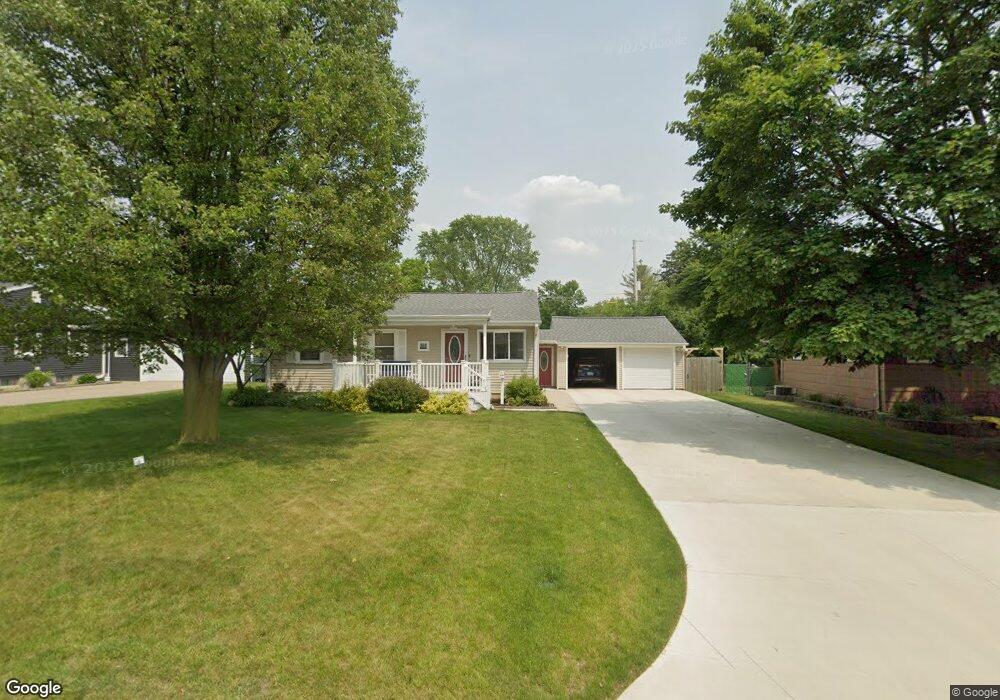
314 N Moorland Dr Battle Creek, MI 49015
Minges Brook Riverside NeighborhoodEstimated Value: $176,671 - $202,000
3
Beds
2
Baths
1,209
Sq Ft
$156/Sq Ft
Est. Value
About This Home
This home is located at 314 N Moorland Dr, Battle Creek, MI 49015 and is currently estimated at $188,918, approximately $156 per square foot. 314 N Moorland Dr is a home located in Calhoun County with nearby schools including Lakeview Middle School, Lakeview High School, and Arbor Academy.
Ownership History
Date
Name
Owned For
Owner Type
Purchase Details
Closed on
Apr 29, 2011
Sold by
Lake Charles G and Mynhier Mandy M
Bought by
Lake Robert and Lake Kathleen
Current Estimated Value
Purchase Details
Closed on
Aug 29, 2003
Sold by
Howley Dolores J
Bought by
Lake Charles and Lake Mynhier,Mandy M
Purchase Details
Closed on
Dec 7, 2000
Sold by
Howley Howley R R and Howley Dolores J
Bought by
Howley Dolores J
Purchase Details
Closed on
Aug 10, 1996
Sold by
Howley Dolores J
Bought by
Howley Howley R and Howley Dolores J
Purchase Details
Closed on
Aug 9, 1996
Bought by
Howley
Create a Home Valuation Report for This Property
The Home Valuation Report is an in-depth analysis detailing your home's value as well as a comparison with similar homes in the area
Home Values in the Area
Average Home Value in this Area
Purchase History
| Date | Buyer | Sale Price | Title Company |
|---|---|---|---|
| Lake Robert | $84,000 | Dba Ppr Title Agency | |
| Lake Charles | $96,800 | -- | |
| Howley Dolores J | -- | -- | |
| Howley Howley R | -- | -- | |
| Howley | $76,000 | -- |
Source: Public Records
Tax History Compared to Growth
Tax History
| Year | Tax Paid | Tax Assessment Tax Assessment Total Assessment is a certain percentage of the fair market value that is determined by local assessors to be the total taxable value of land and additions on the property. | Land | Improvement |
|---|---|---|---|---|
| 2025 | -- | $66,800 | $0 | $0 |
| 2024 | $1,849 | $62,134 | $0 | $0 |
| 2023 | $2,105 | $54,329 | $0 | $0 |
| 2022 | $1,670 | $47,789 | $0 | $0 |
| 2021 | $2,051 | $44,547 | $0 | $0 |
| 2020 | $2,029 | $46,495 | $0 | $0 |
| 2019 | $1,921 | $46,108 | $0 | $0 |
| 2018 | $1,921 | $45,976 | $3,421 | $42,555 |
| 2017 | $1,863 | $47,514 | $0 | $0 |
| 2016 | $1,860 | $43,406 | $0 | $0 |
| 2015 | $1,730 | $40,496 | $3,439 | $37,057 |
| 2014 | $1,730 | $38,685 | $3,439 | $35,246 |
Source: Public Records
Map
Nearby Homes
- V/L Riverside Dr
- 620 Meadow Dr
- 320 N Ridgeway Dr
- 214 Morningside Dr
- 175 S Ridgeway Dr
- 210 Briar Hill Dr
- 117 Meadow Dr
- 1227 Capital Ave SW
- 317 Country Club Terrace
- 170 Frances Dr E
- 239 Brewer Dr S
- 160 Lincoln Hill Dr
- 1116 Lakeside Dr S
- 32 Golden Ave
- 245 Columbia Ave E
- 1200 Lakeside Dr S
- 112 Darragh Dr
- 326 Goldenview Dr
- 415 Oakvale Ct
- 621 Golden Ave
- 308 N Moorland Dr
- 320 N Moorland Dr
- 720 Riverside Dr
- 722 Riverside Dr
- 716 Riverside Dr
- 326 N Moorland Dr
- 302 N Moorland Dr
- 821 Meadow Dr
- 315 N Moorland Dr
- 712 Riverside Dr
- 309 N Moorland Dr
- 321 N Moorland Dr
- 303 N Moorland Dr
- 332 N Moorland Dr
- 708 Riverside Dr
- 810 Meadow Dr
- 333 N Moorland Dr
- 338 N Moorland Dr
- 728 Riverside Dr
- 314 Clover Ln