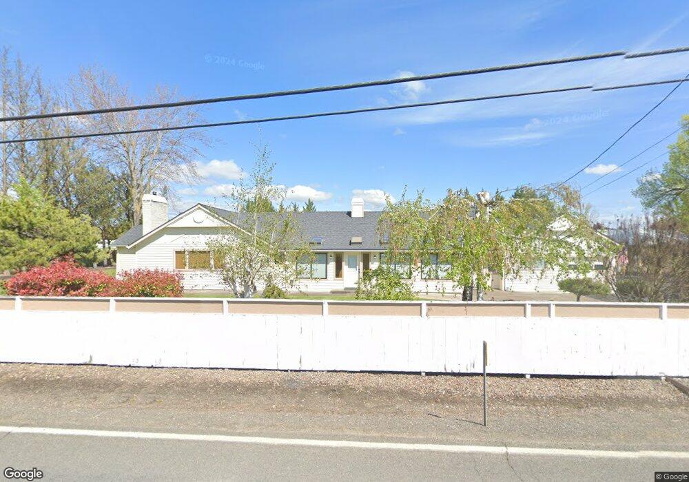
3148 Taylor Rd Central Point, OR 97502
Estimated Value: $606,622 - $778,000
4
Beds
2
Baths
2,434
Sq Ft
$283/Sq Ft
Est. Value
About This Home
This home is located at 3148 Taylor Rd, Central Point, OR 97502 and is currently estimated at $688,541, approximately $282 per square foot. 3148 Taylor Rd is a home located in Jackson County with nearby schools including Richardson Elementary School, Scenic Middle School, and Crater High School.
Ownership History
Date
Name
Owned For
Owner Type
Purchase Details
Closed on
Apr 21, 2006
Sold by
Inglis Craig and Inglis Julie
Bought by
Inglis Craig S and Inglis Julie A
Current Estimated Value
Home Financials for this Owner
Home Financials are based on the most recent Mortgage that was taken out on this home.
Original Mortgage
$107,000
Interest Rate
6.29%
Mortgage Type
Fannie Mae Freddie Mac
Create a Home Valuation Report for This Property
The Home Valuation Report is an in-depth analysis detailing your home's value as well as a comparison with similar homes in the area
Purchase History
| Date | Buyer | Sale Price | Title Company |
|---|---|---|---|
| Inglis Craig S | -- | First American Title |
Source: Public Records
Mortgage History
| Date | Status | Borrower | Loan Amount |
|---|---|---|---|
| Closed | Inglis Craig S | $107,000 |
Source: Public Records
Tax History
| Year | Tax Paid | Tax Assessment Tax Assessment Total Assessment is a certain percentage of the fair market value that is determined by local assessors to be the total taxable value of land and additions on the property. | Land | Improvement |
|---|---|---|---|---|
| 2026 | $4,390 | $359,590 | -- | -- |
| 2025 | $4,289 | $349,120 | $114,280 | $234,840 |
| 2024 | $4,289 | $338,960 | $123,840 | $215,120 |
| 2023 | $4,147 | $329,090 | $120,230 | $208,860 |
| 2022 | $4,058 | $329,090 | $120,230 | $208,860 |
| 2021 | $3,943 | $319,510 | $116,730 | $202,780 |
| 2020 | $3,828 | $310,210 | $113,330 | $196,880 |
| 2019 | $3,740 | $292,410 | $106,830 | $185,580 |
| 2018 | $3,624 | $283,900 | $103,720 | $180,180 |
| 2017 | $3,538 | $283,900 | $103,720 | $180,180 |
| 2016 | $3,435 | $267,620 | $97,780 | $169,840 |
| 2015 | $3,275 | $267,620 | $97,780 | $169,840 |
| 2014 | $3,196 | $252,270 | $92,160 | $160,110 |
Source: Public Records
Map
Nearby Homes
- 3371 Freeland Rd
- 1134 Steamboat Dr
- 3307 Freeland Rd
- 420 Mayberry Ln
- 3220 Freeland Rd
- 884 Mendolia Way
- 407 Silver Creek Dr
- 404 Silver Creek Dr
- 1407 Rustler Peak St
- 545 Bridge Creek Dr
- 650 Golden Peak Dr
- 626 Griffin Oaks Dr
- 3288 Grant Rd
- 0 Boulder Ridge St
- 166 Nadine Ln
- 4533 Old Stage Rd
- 356 Marian Ave Unit 40
- 349 W Pine St
- 209 Corcoran Ln
- 4626 N Pacific Hwy
- 3198 Taylor Rd
- 3080 Taylor Rd
- 3210 Taylor Rd
- 3235 Taylor Rd
- 3124 Taylor Rd
- 3250 Taylor Rd
- 3223 Taylor Rd
- 2982 Taylor Rd
- 3317 Taylor Rd
- 2946 Phillips Way
- 3330 Taylor Rd
- 3230 Taylor Rd
- 2934 Taylor Rd
- 2943 Phillips Way
- 200 Phillips Way
- 3320 Taylor Rd
- 3930 Old Stage Rd
- 3396 Taylor Rd
- 2947 Phillips Way
- 2940 Taylor Rd
Your Personal Tour Guide
Ask me questions while you tour the home.