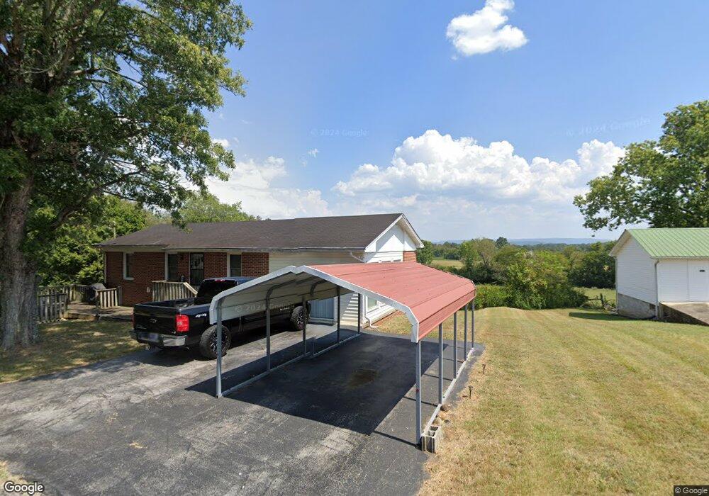
315 Alverson Rd Sparta, TN 38583
Estimated Value: $123,440 - $218,000
--
Bed
1
Bath
1,098
Sq Ft
$157/Sq Ft
Est. Value
About This Home
This home is located at 315 Alverson Rd, Sparta, TN 38583 and is currently estimated at $171,860, approximately $156 per square foot. 315 Alverson Rd is a home located in White County with nearby schools including Woodland Park Elementary School, White County Middle School, and White County High School.
Ownership History
Date
Name
Owned For
Owner Type
Purchase Details
Closed on
Sep 23, 2024
Sold by
Dedominicis Connie and Goff Douglas L
Bought by
Mcginniss Samuel A and Mcginniss Veronica L
Current Estimated Value
Home Financials for this Owner
Home Financials are based on the most recent Mortgage that was taken out on this home.
Original Mortgage
$168,686
Outstanding Balance
$166,462
Interest Rate
6.47%
Mortgage Type
Credit Line Revolving
Estimated Equity
$5,398
Purchase Details
Closed on
Mar 1, 2002
Sold by
Betty Goff and Betty Douglas
Bought by
Betty Goff
Purchase Details
Closed on
Sep 28, 1989
Bought by
Goff Betty
Purchase Details
Closed on
Mar 7, 1974
Bought by
Alverson Carl and Nora Benny
Create a Home Valuation Report for This Property
The Home Valuation Report is an in-depth analysis detailing your home's value as well as a comparison with similar homes in the area
Home Values in the Area
Average Home Value in this Area
Purchase History
| Date | Buyer | Sale Price | Title Company |
|---|---|---|---|
| Mcginniss Samuel A | $167,000 | None Listed On Document | |
| Mcginniss Samuel A | $167,000 | None Listed On Document | |
| Betty Goff | $20,000 | -- | |
| Goff Betty | $20,000 | -- | |
| Alverson Carl | -- | -- |
Source: Public Records
Mortgage History
| Date | Status | Borrower | Loan Amount |
|---|---|---|---|
| Open | Mcginniss Samuel A | $168,686 | |
| Closed | Mcginniss Samuel A | $168,686 |
Source: Public Records
Tax History Compared to Growth
Tax History
| Year | Tax Paid | Tax Assessment Tax Assessment Total Assessment is a certain percentage of the fair market value that is determined by local assessors to be the total taxable value of land and additions on the property. | Land | Improvement |
|---|---|---|---|---|
| 2025 | $427 | $40,800 | $0 | $0 |
| 2024 | $427 | $20,825 | $1,500 | $19,325 |
| 2023 | $427 | $20,825 | $1,500 | $19,325 |
| 2022 | $427 | $20,825 | $1,500 | $19,325 |
| 2021 | $427 | $20,825 | $1,500 | $19,325 |
| 2020 | $427 | $20,825 | $1,500 | $19,325 |
| 2019 | $340 | $16,575 | $1,375 | $15,200 |
| 2018 | $340 | $16,575 | $1,375 | $15,200 |
| 2017 | $340 | $16,575 | $1,375 | $15,200 |
| 2016 | $340 | $16,575 | $1,375 | $15,200 |
| 2015 | $307 | $16,575 | $1,375 | $15,200 |
| 2014 | -- | $16,575 | $1,375 | $15,200 |
| 2013 | -- | $17,350 | $1,375 | $15,975 |
Source: Public Records
Map
Nearby Homes
- 217 Oaklawn Cemetery Rd
- 154 Jersey Pike
- 226 Blackberry Ln
- 999 Gum Springs Mountain Rd
- 2 Smithville Hwy
- 1 Smithville Hwy
- 611 Imperial Dr
- 1644 Walker Cove Rd
- 1165 Sullivan Knowles Rd
- 419 Adams St
- 0 Millers Point Rd
- 1255 Washington St
- 25 Mayberry St
- 731 Howell St
- 147 Mayberry St
- 196 Dairy Barn
- 673 Charles Golden Rd
- 320 Alverson Rd
- 339 Alverson Rd
- 274 Alverson Rd
- 283 Hidden Ln
- 231 Alverson Rd
- 392 Alverson Rd
- 2136 Jerry Parker Rd
- 2048 Jerry Parker Rd
- 2090 Jerry Parker Rd
- 176 Alverson Rd
- 2120 Jerry Parker Rd
- 2079 Jerry Parker Rd
- 2142 Jerry Parker Rd
- 1934 Jerry Parker Rd
- 1870 Jerry Parker Rd
- 2017 Jerry Parker Rd
- 1933 Jerry Parker Rd
- 2007 Smithville Hwy
- 124 Alverson Rd Unit 150
- 2258 Jerry Parker Rd