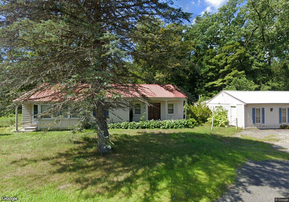
315 Ashfield Rd Conway, MA 01341
Estimated Value: $395,000 - $565,498
2
Beds
2
Baths
2,048
Sq Ft
$241/Sq Ft
Est. Value
About This Home
This home is located at 315 Ashfield Rd, Conway, MA 01341 and is currently estimated at $493,875, approximately $241 per square foot. 315 Ashfield Rd is a home with nearby schools including Frontier Regional School.
Ownership History
Date
Name
Owned For
Owner Type
Purchase Details
Closed on
Jul 7, 2004
Sold by
Ouimette Richard E and Ouimette Gladys I
Bought by
Wilson John S and Smith Cheryl D
Current Estimated Value
Home Financials for this Owner
Home Financials are based on the most recent Mortgage that was taken out on this home.
Original Mortgage
$170,000
Outstanding Balance
$85,484
Interest Rate
6.32%
Mortgage Type
Purchase Money Mortgage
Estimated Equity
$408,391
Create a Home Valuation Report for This Property
The Home Valuation Report is an in-depth analysis detailing your home's value as well as a comparison with similar homes in the area
Home Values in the Area
Average Home Value in this Area
Purchase History
| Date | Buyer | Sale Price | Title Company |
|---|---|---|---|
| Wilson John S | $212,500 | -- |
Source: Public Records
Mortgage History
| Date | Status | Borrower | Loan Amount |
|---|---|---|---|
| Open | Wilson John S | $170,000 |
Source: Public Records
Tax History
| Year | Tax Paid | Tax Assessment Tax Assessment Total Assessment is a certain percentage of the fair market value that is determined by local assessors to be the total taxable value of land and additions on the property. | Land | Improvement |
|---|---|---|---|---|
| 2025 | $7,047 | $488,000 | $76,900 | $411,100 |
| 2024 | $5,953 | $363,000 | $70,000 | $293,000 |
| 2023 | $6,225 | $363,000 | $70,000 | $293,000 |
| 2022 | $6,033 | $336,100 | $64,800 | $271,300 |
| 2021 | $5,932 | $316,700 | $61,700 | $255,000 |
| 2020 | $5,799 | $309,100 | $61,700 | $247,400 |
| 2019 | $5,765 | $309,100 | $61,700 | $247,400 |
| 2018 | $5,718 | $309,100 | $61,700 | $247,400 |
| 2017 | $5,487 | $309,100 | $61,700 | $247,400 |
| 2016 | $5,094 | $305,400 | $53,900 | $251,500 |
| 2015 | $4,938 | $305,400 | $53,900 | $251,500 |
Source: Public Records
Map
Nearby Homes
- 71 Mathews Rd
- 240 Beldingville Rd
- 0 N Bear River Rd Unit 73485981
- 2930 Shelburne Falls Rd
- 527 Main St
- 15 Stillwater Rd
- 41 Upper Rd
- 40 Suburban Dr
- 90 Whately Rd
- 345 Greenfield Rd
- 0 Sears Rd Unit 73373850
- 208 Greenfield Rd
- 24 Elm St
- 220 Hawley Rd
- 0 Greenfield Rd Unit 73472322
- 26 S Main St
- 13 Bray Rd
- 0 North St Unit 73407299
- 10 Deerfield Ave Unit 2
- 15 Crestview Dr
- 283 Ashfield Rd
- 356 Ashfield Rd
- 269 Ashfield Rd
- 397 Ashfield Rd
- 120 Main Poland Rd
- 94 Main Poland Rd
- 204 Ashfield Rd
- 134 Main Poland Rd
- 46 Main Poland Rd
- 230 Ashfield Rd
- 468 Ashfield Rd
- 10 Manning Rd
- 34 Eldridge Rd
- 12 Main Poland Rd
- 177 Delabarre Ave
- 30 Manning Rd
- 40 Eldridge Rd
- 40 Manning Rd
- 166 Orchard St
- 144 Delabarre Ave
Your Personal Tour Guide
Ask me questions while you tour the home.